Pleasant Day Before Storm Chances Return Into Friday
Oklahoma Weather Forecast: Bookmark this page and refresh it often for the latest forecast and daily updates.Tuesday, May 14th 2024, 9:57 am
TULSA, Okla. -
The main upper-level trough responsible for scattered showers and storms across the area Monday is now positioned across southern Missouri and continues to move slowly east.
A few scattered showers will remain possible on the backside of the system Tuesday, mostly across far eastern Oklahoma and into northwestern Arkansas, before quickly moving out of the region.
What will the weather be like in Oklahoma on Tuesday, May 14?
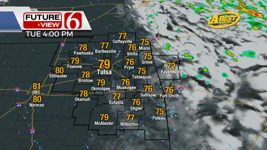
We'll be in the short holding pattern Tuesday. Some clouds will be near and east of the area this morning but will continue thinning and moving east with the migrating upper trough.

We should see some sunshine and highs reaching the upper 70s and lower 80s. The upper air flow will bring fast but small wave into the area later tonight into early Wednesday morning.
What are the storm chances in Oklahoma on Wednesday, May 15?
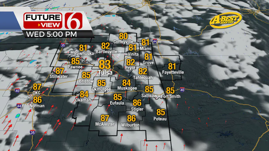
There will be a chance for a few showers with this disturbance as it moves from southwestern Kansas into northern OK early Wednesday morning. Most of this wave will quickly move out of the region early Wednesday morning, but a few showers can't be ruled out. Temps Wednesday morning start in the lower 60s and finish with highs in the lower 80s.

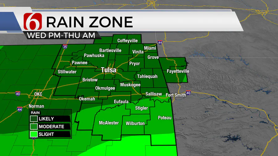
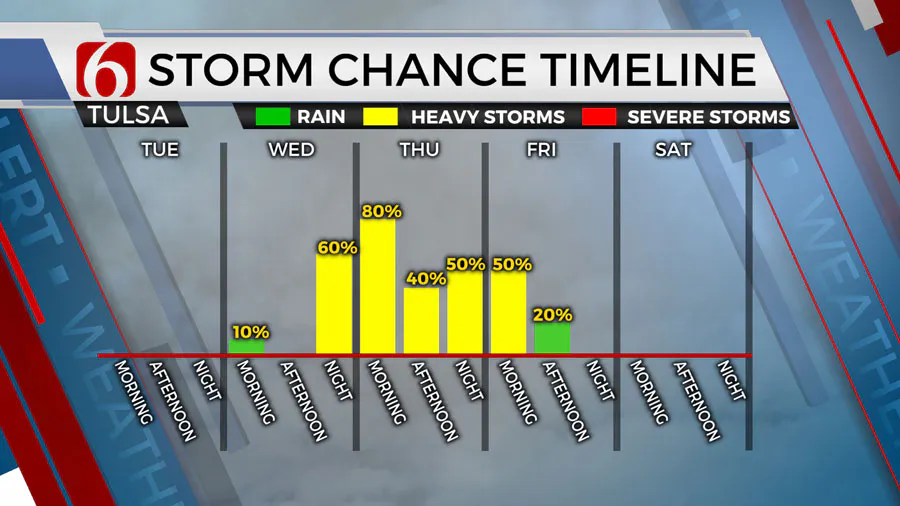
The period from Wednesday evening into Friday morning brings unsettled weather, including mentions for occasional rain and thunder, some of which may be strong to severe.
Is severe weather expected in Oklahoma on Thursday, May 16?
A stronger and more pronounced wave nears the area Wednesday with increasing rain and thunder chances from late Wednesday night through Thursday morning to midday. A few of these storms may become strong and severe with hail and wind the primary threats.

Some additional rain and thunder may persist for part of Thursday afternoon and evening before exiting the area early Friday morning as another surface front crosses the area.

What will the weather be like this weekend in Oklahoma?
By this weekend, some temporary ridging nudges northward from Texas while stronger upper air flow remains north across the central plains. This means temps and humidity will increase with afternoon highs in the mid-80s Saturday and into the upper 80s Sunday.
There remains a small signal for a few showers or storms to take a run at southern Kanss and extreme northern Oklahoma late Saturday evening into early Sunday morning, but confidence in this solution remains low.
A much stronger upper-level trough is likely to impact the southern and central plains early next week increasing severe weather threats over a larger area based on the pattern.
Outages Across Oklahoma:
Northeast Oklahoma has various power companies and electric co-operatives, many with overlapping areas of coverage. Below is a link to various outage maps.
Indian Electric Cooperative (IEC) Outage Map
Oklahoma Association of Electric Cooperatives Outage Map - (Note Several Smaller Co-ops Included)
The Alan Crone morning weather podcast link from Spotify:
https://open.spotify.com/episode/5j0ovActG8BZCOTqZQzrfU
The Alan Crone morning weather podcast link from Apple:
https://podcasts.apple.com/us/podcast/weather-out-the-door/id1499556141?i=1000646589555
Follow the News On 6 Meteorologists on Facebook!

More Like This
May 14th, 2024
May 14th, 2024
May 14th, 2024
Top Headlines
May 14th, 2024
May 14th, 2024


