Another Ozone Alert Day, Morning Showers Across Eastern Oklahoma
<p>A weakening complex of thunderstorms will move across southern Kansas and part of northern Oklahoma this morning before exiting the region by approximately 10 a.m. </p>Thursday, May 10th 2018, 4:07 am
A weakening complex of thunderstorms will move across southern Kansas and part of northern Oklahoma this morning before exiting the region by approximately 10 a.m. Locations near and north of the metro will continue with a chance for some of this activity while locations across southern Oklahoma will remain dry. Our chances in the metro aren’t exactly high but we’ll need to keep a mention for the morning hours.
Today is also an Ozone Alert Day for Tulsa area.
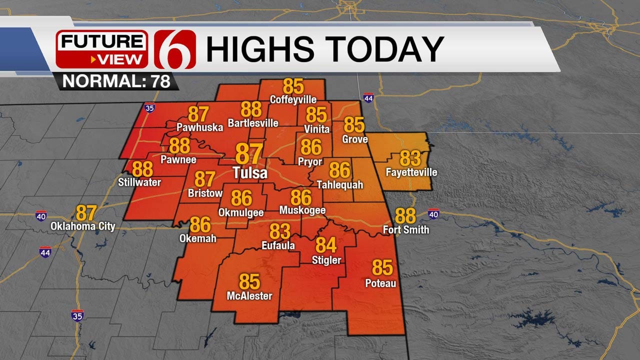
A small convectively induced area of vorticity may spread some additional developing storms scooting across the northern third of the region but severe weather is highly unlikely. Strong south to southeast winds should develop again this afternoon with highs in the mid to upper 80s along with warm and muggy weather.
Our early summer preview will continue through the weekend with morning lows in the upper 60s and lower 70s in the metro along with highs in the upper 80s or lower 90s. Earlier this week a boundary was positioned in the data to move into northern Oklahoma by Sunday morning to midday. But in the last few days, the data has converged on a solution that will keep the front north of the state for most of next week while south winds will keep us warm and muggy. The upper air flow will become more favorable for some storm activity to reach part of our area next week.
The pattern this morning remains from the west and slightly northwest. This is allowing the tail end of the Kansas MCS to brush our area this morning. A mid-level ridge of high pressure will begin developing and become stronger across the Mexican Plateau into Texas and part of the Arkansas-Louisiana-Texas region early this weekend. A small signal for some Friday morning showers continues to show in some of the data yet the forcing for this is rather nebulous. I currently don’t have any pops for early Friday but may have to punt on 3rd down tomorrow morning.
A trough will be loading across the western U.S. soon with the upper air flow transitioning to a southwest flow for most of next week. This flow would typically bring us active weather including the threats of severe storms across the state. But the location of the ridge may keep eastern Oklahoma on the very edge of the ridge while the western part of the state would be in a more favorable location for some storms along the dry line. What does this mean for our area?
Sunday into Monday the highs should continue to be in the upper 80s and lower 90s with a few low storm chances for the eastern part of the state, while western Oklahoma would have higher chances. Tuesday through the end of the week, the ridge should flatten and allow a better chance for a few storms to move into the area.
Once again, due to the expected environmental conditions, an Ozone Alert will be posted for the Tulsa metro Thursday. Wind speeds may help to ease the production slightly later today.
The following is information regarding the Ozone Alert, as posted by our friends at the National Weather Service.
While ozone in the upper levels of the atmosphere is beneficial in screening the suns radiation, it is harmful near the ground. Ozone can bother those with respiratory problems and can damage vegetation. A few simple measures can be taken to help keep the ozone levels from becoming unhealthy.
During ozone alert days:
Postpone any unnecessary driving and car pool if possible.
If you do drive to work,turn The air conditioner in your car off during your morning commute. You can also cut down on extra driving by bringing your lunch to work. If you must refuel your vehicle, do it in the evening after the sun goes down or postpone your fueling to another day.
Postpone running the lawn mower and gas trimmer, the exhaust from these small engines contributes a significant amount of pollution to the air. Industrial facilities should reduce pollution emissions as much as possible on ozone alert days.
These preventative measures, performed throughout the Tulsa metro area, can have a tremendous effect in reducing the pollutants that contribute to ozone problems.
For further information, contact The Oklahoma Department of Environmental Quality at (918) 293-1600 or the Indian Nations Council of Governments at (918) 584-7526. Additional information can also be found at www.ozonealert.com...including current ozone levels around the Tulsa area.
Thanks for reading the Thursday morning weather discussion and blog.
More Like This
January 2nd, 2025
September 29th, 2024
September 17th, 2024
Top Headlines
January 2nd, 2025
January 2nd, 2025
January 2nd, 2025
January 2nd, 2025


