Near Normal Temps Return
The intense summer heat has moved out of the area, but warm temperatures stick around on Wednesday.Wednesday, August 24th 2022, 6:13 am
TULSA, Okla. -
The intense summer heat has moved out of the area, but warm temperatures stick around on Wednesday.
Here are the details from News On 6 Meteorologist Alan Crone:

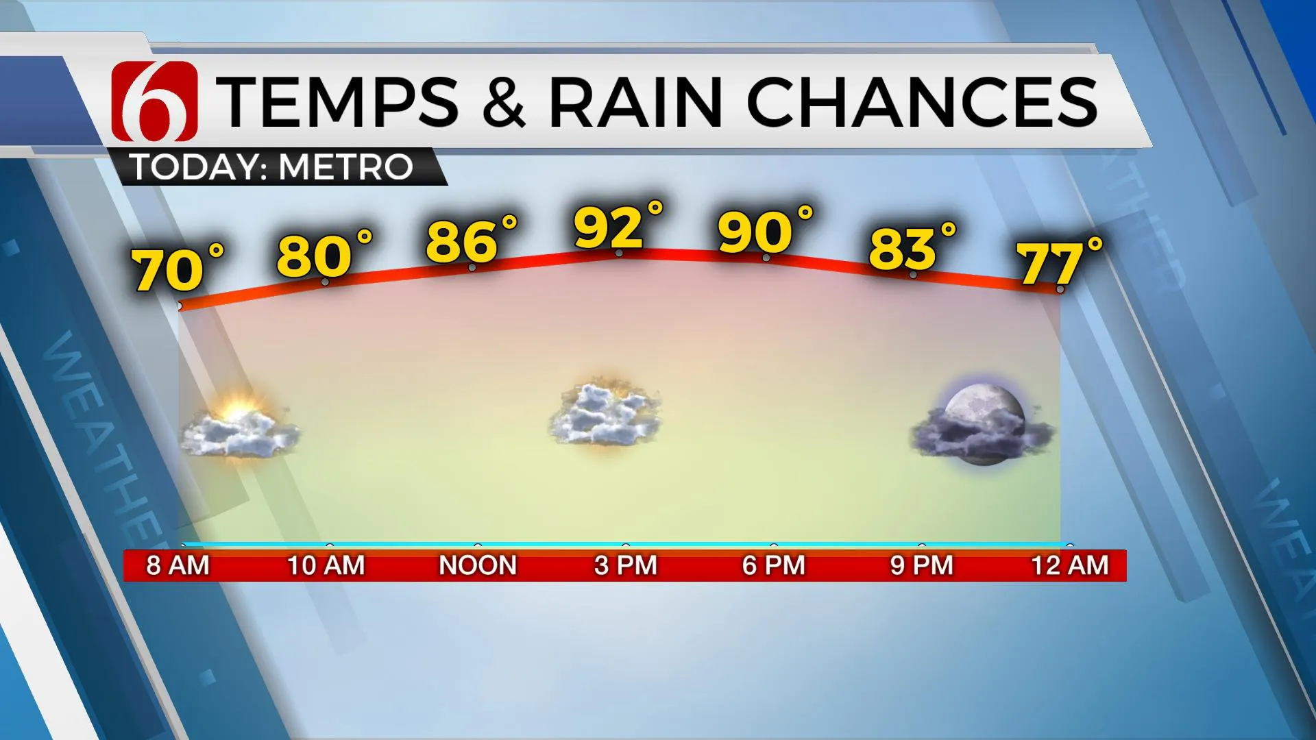
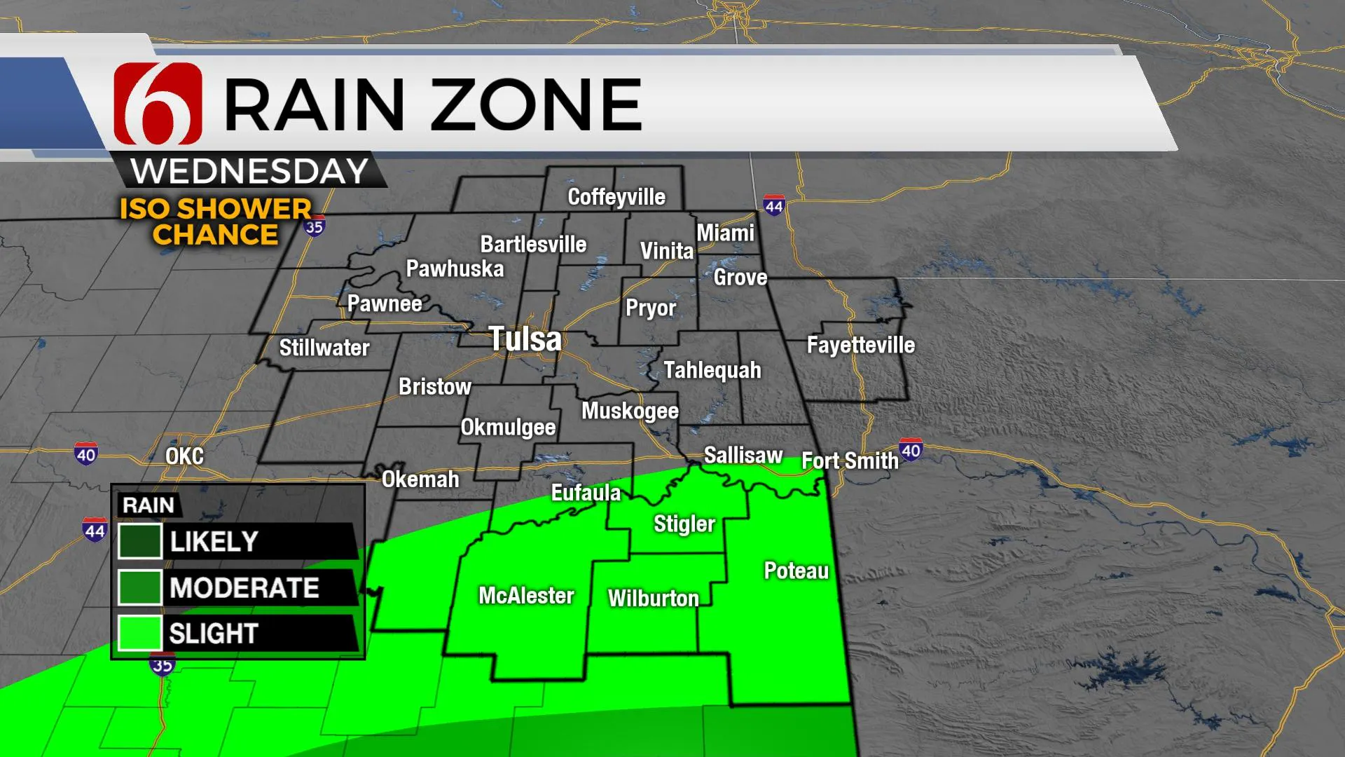
A sunshine and cloud mix returns today with afternoon highs in the lower 90s for the Tulsa metro. Upper 80s will remain for other locations south and east of Tulsa. While a stray shower or two remains possible across southern section’s today and tomorrow, our next stronger system nears the state for part of the weekend. The low-pressure area remains across the far eastern areas of the ArkLaTex region this morning and may still be able to produce a few additional showers later today across part of southeastern OK. These should be fewer than yesterday, but we’ll keep a mention today and tomorrow for a few locations across the southern third of the area. Highs will be very similar to yesterday with upper 80s and lower 90s area-wide. Some mid-80s will remain across far southeastern OK where more clouds should remain compared to the north.

Friday into the weekend the low-pressure area keeps moving east while the next storm system begins influencing the state from the Rockies with a few scattered storm chances.

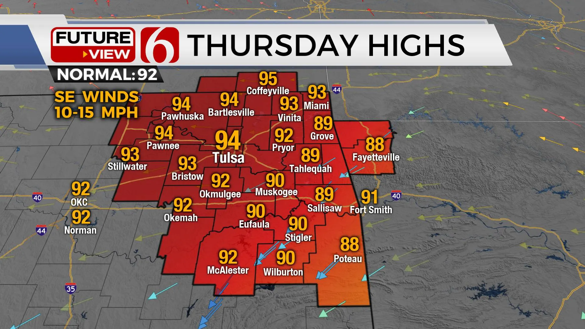
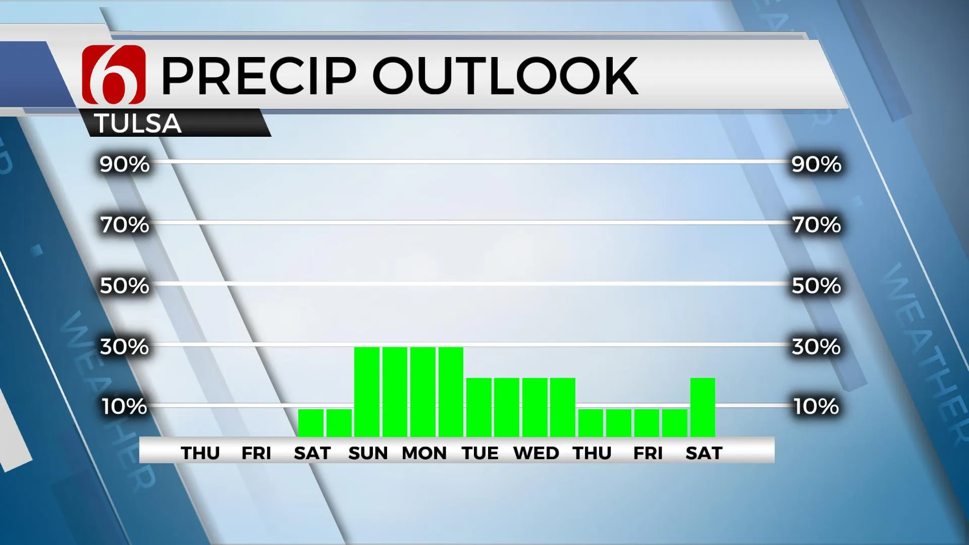
A lead wave will eject from the front range of the Rockies into the central plains Saturday with a stronger disturbance nearing the state Sunday into Monday. This brings a few scattered shower or storm chances this weekend near our area. A few scattered showers will be possible Saturday across far eastern OK and western Arkansas, but slightly higher chances arrive Sunday evening into Monday morning. A surface cold front is expected to move across the area sometime Tuesday or Wednesday with another decent chance of showers and storms followed by another notable reduction in temps for a few days next week. Until then, we’re expecting gradually increasing afternoon highs through the end of the week with temps reaching the mid-90s Friday. The return of southeasterly winds later tonight through the weekend will also increase the heat index values a few degrees above the projected highs. While not a major issue, you’ll feel slightly more humidity Friday through the weekend.

Thanks for reading the Wednesday morning weather discussion and blog.
Have a super great day!
Alan Crone
KOTV
If you’re into podcasts, check out my daily weather update. Search for NewsOn6 and ‘Weather Out The Door’ on most podcast providers, including Spotify, Stitcher and Tune-In, or Click Here to listen on Apple Podcasts.
More Like This
August 24th, 2022
June 21st, 2023
June 19th, 2023
June 13th, 2023
Top Headlines
December 13th, 2024
December 13th, 2024
December 13th, 2024
December 13th, 2024


