Temps In The 80s Friday, Hurricane Helene Makes Landfall In Florida
Oklahoma Weather Forecast: Bookmark this page and refresh it often for the latest forecast and daily updates.Thursday, September 26th 2024, 10:42 pm
OKLAHOMA CITY -
Hurricane Helene made landfall in Florida Thursday night.
The remainder of this week is warm and quiet across Oklahoma, with sunny skies and a cool breeze.
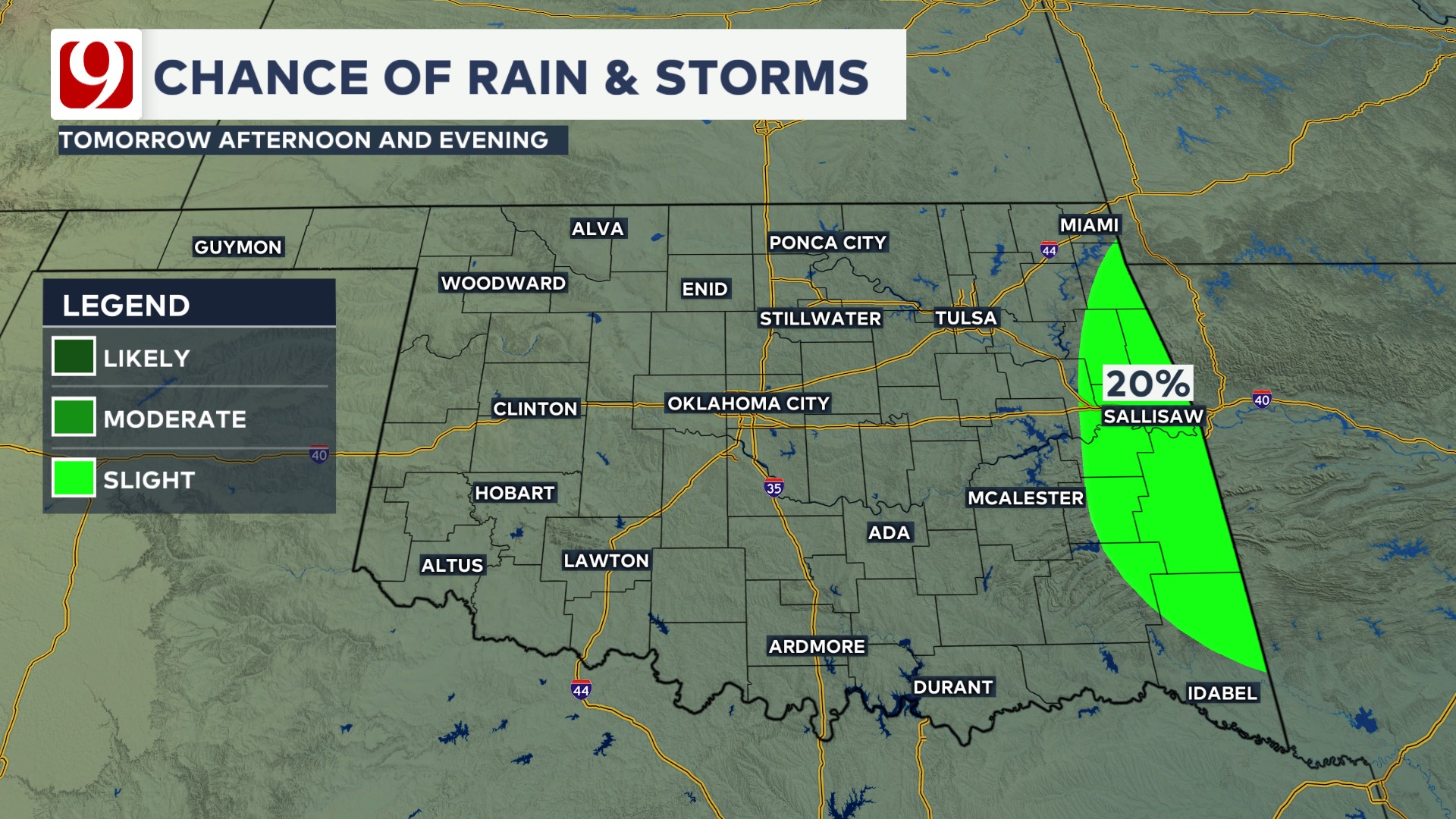
Oklahoma's only impact will be on our far eastern counties. This region could see showers Friday into early Saturday.
What is the weather like for Thursday?
Light north winds & sunshine continue on our Friday with highs in the 80s.

What is the weather like for the rest of the week?
We continue with cool nights & warm afternoons over the weekend with lots of sunshine.

HURRICANE HELENE
Meanwhile, Florida is already getting hammered by Hurricane Helene.

Helene is currently a Cat 3 with winds over 150 mph.

The storm surge along the coast near landfall is expected to be as high as 20 feet!
Landfall will occur this evening around 8 p.m. just southeast of Tallahassee. Flooding rain and tornadoes will impact not only Florida but also many states in the South and even the Midwest.

EMSA HEAT SAFETY TIPS
-HYDRATION is key in preventing heat-related illness. Drink plenty of water or electrolyte replacement drinks several hours before and during long exposure to the summer heat.
Wear light-colored, loose fitting clothing and a wide-brimmed hat if working outdoors, and take plenty of shade breaks.
No alcohol or caffeine.
If you do not have air conditioning, find a cooling station or public space (such as libraries or malls) during the day.
Don’t limit your use of air conditioning.
Use the buddy system if working outdoors and check on elderly neighbors.
Keep a cellphone on you at all times when outdoors, including walking, running daily errands, yard work or sports and physical activity.
Follow our meteorologists!

Get The Daily Update!
Be among the first to get breaking news, weather, and general news updates from News on 6 delivered right to your inbox!
More Like This

September 26th, 2024

September 26th, 2024

September 26th, 2024

September 26th, 2024
Top Headlines
September 26th, 2024
September 26th, 2024

September 26th, 2024

September 26th, 2024