Severe Storms, High Winds Reported In Eastern Oklahoma
The rain continues Tuesday morning with a slow-moving storm system moving through eastern Oklahoma. Monday saw record-setting rainfall.Monday, March 19th 2012, 8:19 am
The rain continues Tuesday morning with a slow-moving storm system moving through eastern Oklahoma. Monday saw record-setting rainfall.
Flood warnings are in effect for much of eastern Oklahoma with moderate flooding forecast. The National Weather Service in Tulsa is watching creek levels near Sperry, Skiatook and Turley.
See all flood watches and warnings
As the leading edge moved through the Tulsa area, poles were reported down near 44th and 129th East Avenue in Broken Arrow.
PSO reported 947 customers without power at the noon hour. Power was restored to almost all the customers by 2:45 p.m.
"Rivers and streams will almost certainly flood, some at major flood stage, if the forecast amounts verify," said News On 6 meteorologist Crone said. "This would result in river flooding of the Illinois, Poteau, and Kiamichi Rivers. Other smaller streams and rivers will also flood.
"Please remain aware of low water crossings and flood-prone areas during the next 60 hours and make efforts to move to high ground."
Read Alan Crone's Weather Blog
The possibility for tornadoes appears strongest in southeastern Oklahoma and a large portion of north Texas, Crone said in his weather blog.
"All residents of eastern Oklahoma should remain aware of this weather situation and seek appropriate shelter if warnings are issued for your area," he said.
3/20/2012 Related Story: Record Rainfall, Potholes Causing Hazards For Tulsa Drivers
Get severe weather text alerts
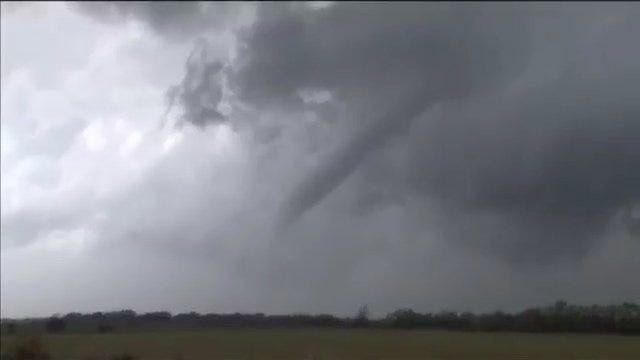
The system brought tornadoes to the western side of the state with storm chasers capturing video of funnel clouds in Beckham and Greer Counties Monday.
News On 6 viewers can share their severe weather and flooding photos by sending them to pics@newson6.net.
More Like This
March 19th, 2012
January 2nd, 2025
September 29th, 2024
September 17th, 2024
Top Headlines
March 24th, 2025


