Mild, Breezy Tuesday In Oklahoma; Winter Weather Outlook For Weekend
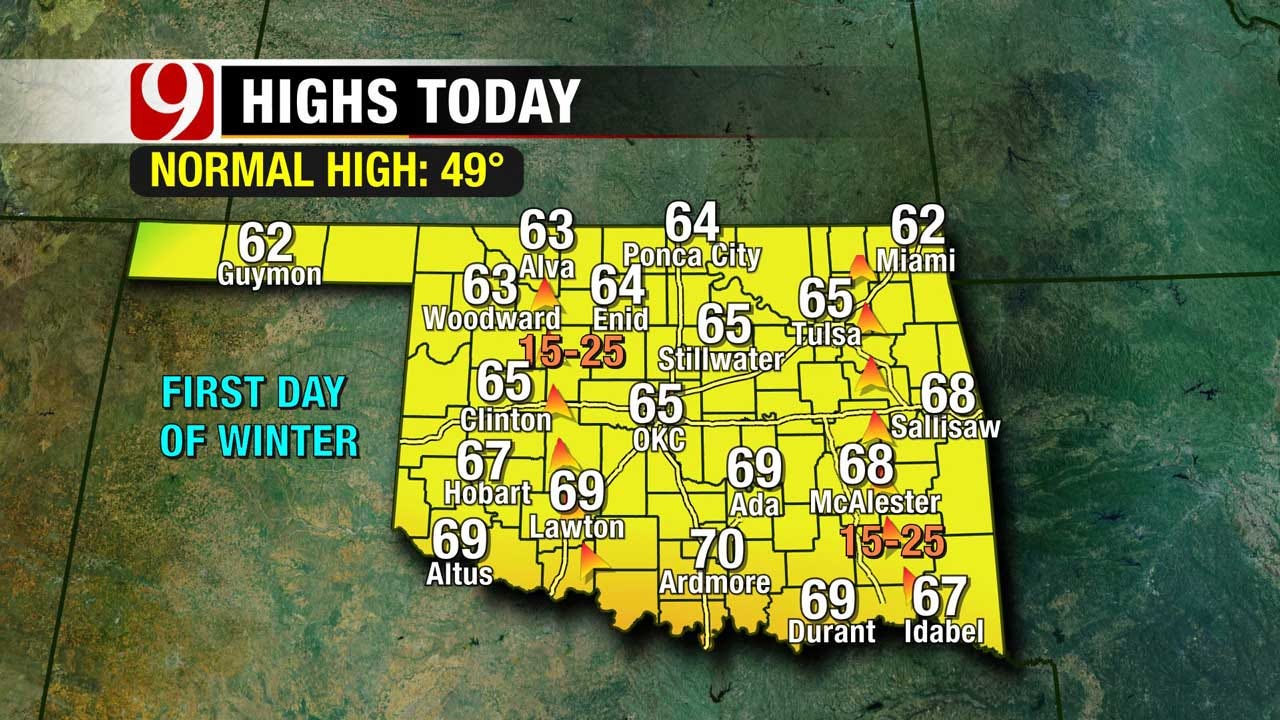
<p>Today is the first full day of winter, but it won't feel like it this afternoon. Highs today will climb into the 60s and even low 70s. </p>Tuesday, December 22nd 2015, 9:47 am
Today is the first full day of winter, but it won't feel like it this afternoon. Highs today will climb into the 60s and even low 70s. A breezy afternoon is in the forecast with south winds gusting to 30 mph.
No big changes to the weekend forecast. Here's what we know: This will be a slow moving powerful low pressure system. It will meander around the Southern Plains for three days. The moisture available will be through the roof, and could lead to significant precip totals. The winds will really ramp up as well, leading to blowing precip.
Still up in the air...literally: Exact track of the low and exact timing. This will impact the placement of the cold air, and the depth of the cold air, leading to questions in precip type and placement.
What you need to know: This forecast continues to evolve so you need to stay tuned.Totals will change. We have the potential for flooding rain along and east of I-35, a winter mix along and west of I-35, and heavy snow in the panhandle. Accumulating snow is possible in far NW OK as well. Due to strong winds, blowing snow is possible, and could near blizzard conditions in the TX/OK panhandles. Weekend travel issues a big concern out west.
Stay with News9, we'll keep you advised.
More Like This
December 22nd, 2015
January 2nd, 2025
September 29th, 2024
September 17th, 2024
Top Headlines
January 19th, 2025
January 19th, 2025
January 19th, 2025


