Weather Blog: Summer Returns Before A Late Weekend Front Brings Relief Early Next Week
Oklahoma Weather Forecast: Bookmark this page and refresh it often for the latest forecast and daily updates.Wednesday, September 18th 2024, 7:18 am
TULSA, Okla. -
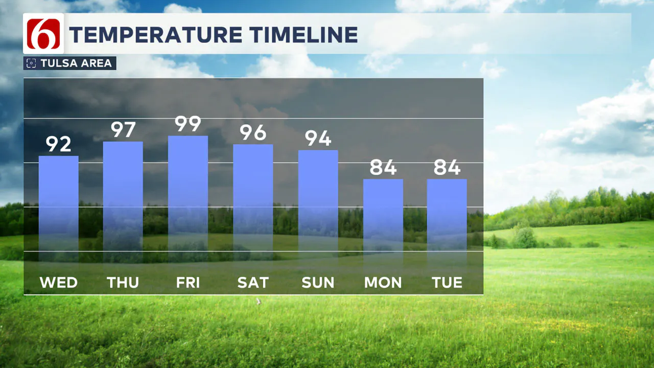
A summer weather pattern will intensify over the next few days with afternoon highs reaching the mid to upper 90s on both Thursday and Friday.
Local dew point temperatures in the upper 60s to lower 70s will result in heat index values between 100 and 107, particularly on Friday.
A midlevel ridge of high pressure will dominate our weather, while a series of troughs in the upper southwestern airflow may lead to a few showers and storms as the weekend approaches.
What will the weather be like today?
Early this morning, a system is moving from northwestern OK into central Kansas producing a few isolated showers west of I-35 early this morning. This activity is not expected to reach our immediate vicinity.
Later today and tonight, northwestern Oklahoma could see a few scattered showers and storms.
What is the forecast for the rest of the week?
By early Thursday morning, some of these residual showers or storms may move into extreme northern Oklahoma and southern Kansas, although the likelihood remains low.
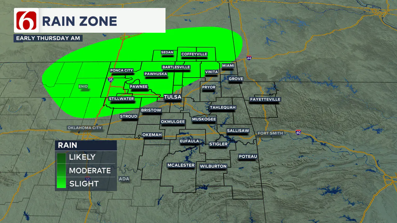
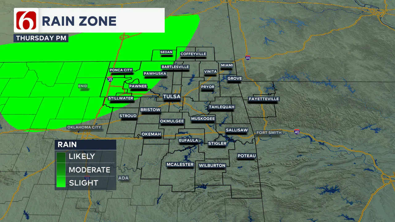
Additional storms are likely to develop Thursday afternoon and early evening across south central Kansas into part of north-central OK. A few of these could move into areas along and northwest of the I-44 corridor before weakening late Thursday evening. Severe threats will include the mention of damaging downbursts of wind.
A stronger upper air trough is forecast to move across the Intermountain region into the Central Plains states on Saturday and Sunday. A surface cold front is anticipated to form and move southward Sunday into Monday.
Most projections indicate that this front will reach our area by Sunday afternoon or evening, progressing slowly southward into early Monday morning to midday. Before this front arrives, scattered showers and storms are possible on Saturday, primarily across southern Kansas Saturday evening.
Late Saturday night and early Sunday morning a few showers or storms could extend into northern Oklahoma. The front is expected to move slowly southward Sunday bringing temperatures back to near-normal averages by early next week.
Most of our region will be south of the boundary this weekend and we expect temperatures to remain in the mid-90s Saturday and lower to mid-90s on Sunday. This part of the forecast may continue to evolve as the timing of the front becomes more certain. By Monday and Tuesday, afternoon highs should drop into the lower 80s with Monday morning lows in the lower to mid-60s and Tuesday morning lows in the upper 50s and lower 60s.
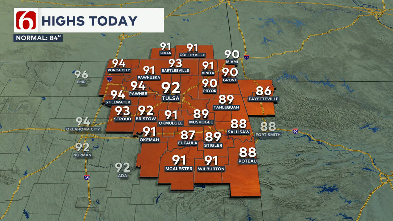
This afternoon, temperatures are expected to reach the lower 90s with heat index values in the mid-90s. Winds are anticipated to be around 10 to 15 mph, with some gusts near 20 mph along the I-35 corridor.
Thursday morning lows will range from the upper 60s to lower 70s, followed by daytime highs in the mid-90s.
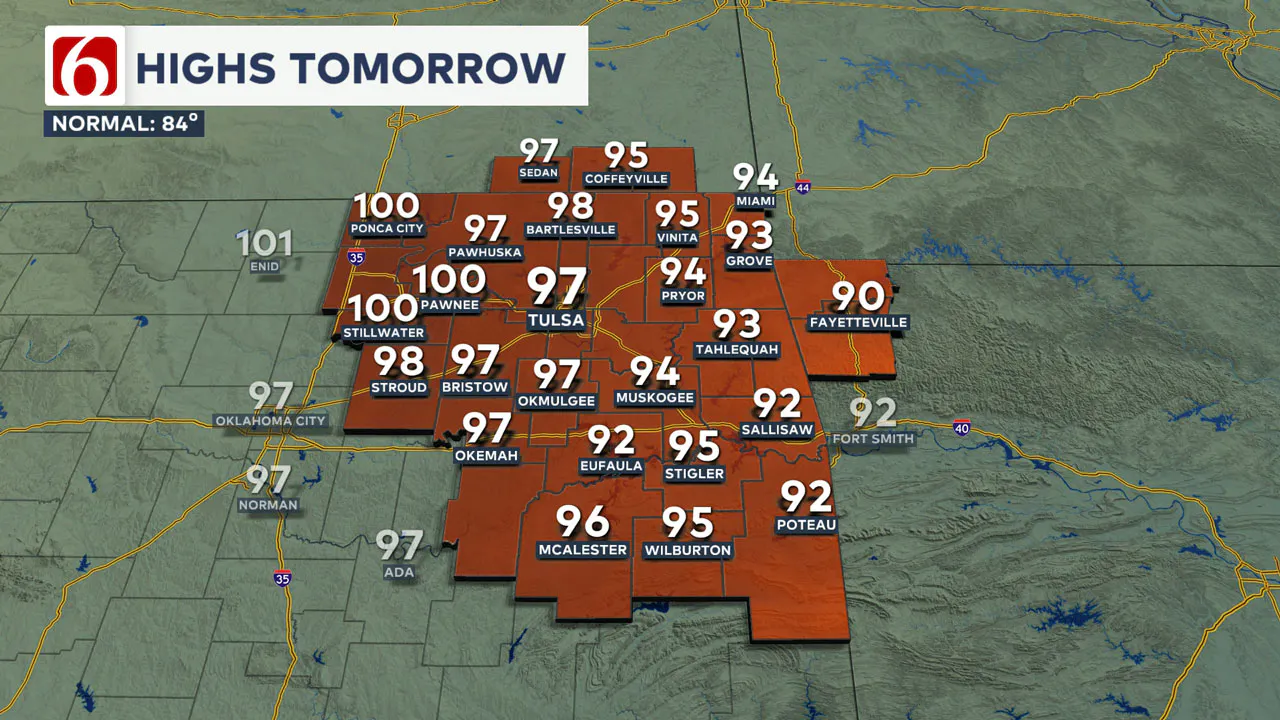
Friday morning lows will begin in the lower 70s, leading to afternoon highs in the mid to upper 90s. A few locations west of the Tulsa metro area may approach 100 by Friday afternoon.
Friday night high school football Games will kick off with temperatures in the lower 90s and finish in the lower 80s.
The OSU Cowboys and Utah football game on Saturday afternoon will see temperatures in the mid-90s in Stillwater at kickoff.
The Sooners began Southeastern Conference play against the Tennessee Volunteers on Saturday evening. Temperatures are expected to be in the lower 90s at game time and will gradually fall into the 80s by halftime.
In this forecast update, we will keep a low-end chance for a shower or storm for the latter half of the game, but higher chances should remain along the OK-Kansas state line region Saturday evening.
Emergency Info: Outages Across Oklahoma:
Northeast Oklahoma has various power companies and electric cooperatives, many of which have overlapping areas of coverage. Below is a link to various outage maps.
Indian Electric Cooperative (IEC) Outage Map
Oklahoma Association of Electric Cooperatives Outage Map - (Note Several Smaller Co-ops Included)
The Alan Crone morning weather podcast link from Spotify:
https://open.spotify.com/episode/1MfnOPMdQddgVysuppn1Gw
The Alan Crone morning weather podcast link from Apple:
https://podcasts.apple.com/us/podcast/weather-out-the-door/id1499556141?i=1000669913553
Follow the News On 6 Meteorologists on Facebook!

More Like This
September 18th, 2024
September 18th, 2024
 Flavor Of Oklahoma: Maple Ridge Grocery And Bishop Quigley Bringing Local Eats To Tulsa Neighborhood
September 18th, 2024
September 18th, 2024
Top Headlines
 Flavor Of Oklahoma: Maple Ridge Grocery And Bishop Quigley Bringing Local Eats To Tulsa Neighborhood
September 18th, 2024
September 18th, 2024
September 18th, 2024
September 18th, 2024


