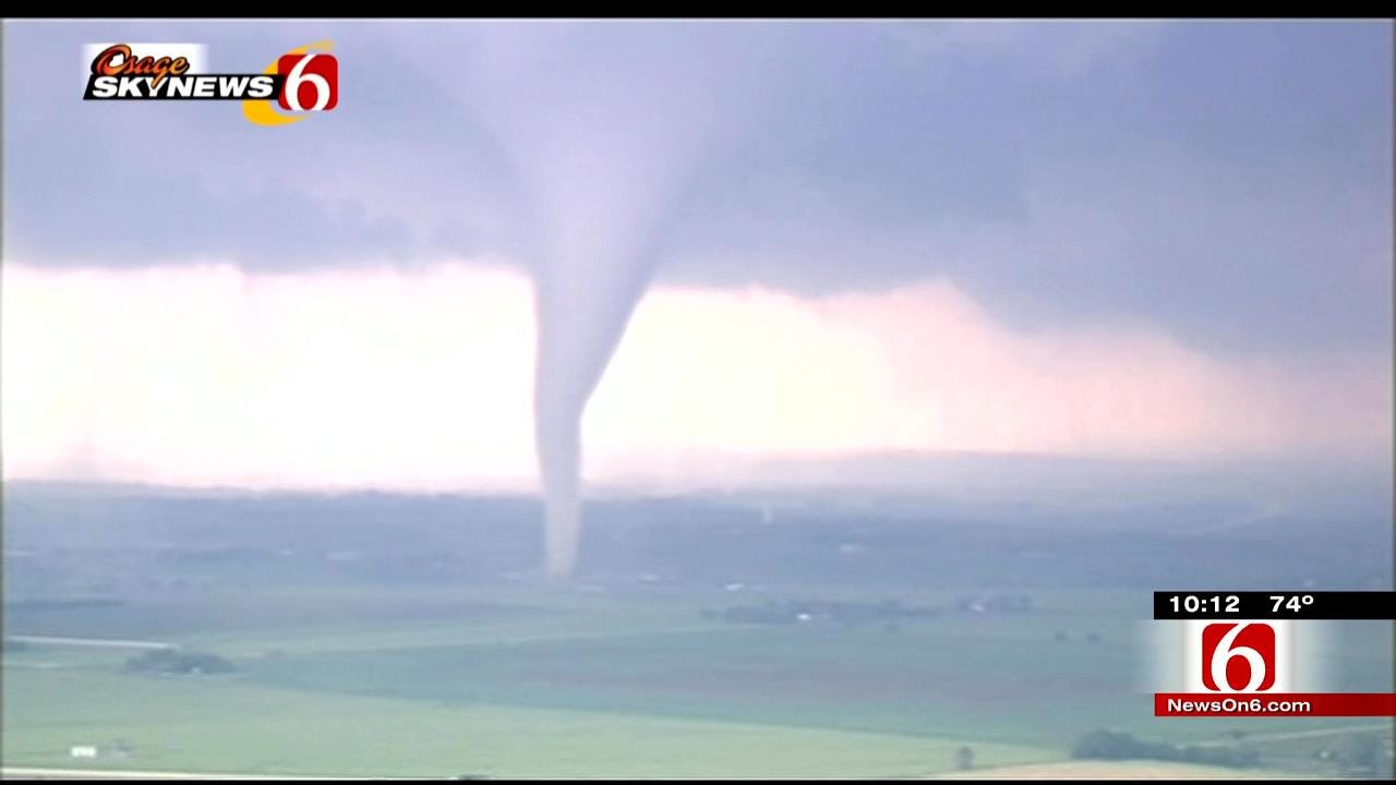
Center Of 'Tornado Alley' Shifting To Green Country, Research Shows
New models show severe weather patterns are changing and that could put Green Country in line for even worse tornado outbreaks.Thursday, May 7th 2015, 11:29 pm
Scientists are pouring over new models pointing to more extreme weather in Oklahoma's future, including an increase in tornado outbreaks.
Chief Meteorologist Travis Meyer has the new information and explains why Green Country is becoming the center of Tornado Alley.
On March 25th the roar of tornadoes, damaging high winds, softball sized hail and dangerous lightning rattled nerves and even shattered lives.
Severe weather patterns are changing according to a noted scientist with the National Severe Storms Lab in Norman, and it could put Green Country in line for even worse tornado outbreaks.
In fact, some of the most violent storms that typically start west of Oklahoma City could start firing up immediately west of Tulsa.
Dr. Harold Brooks said alarming evidence shows a semi-permanent drought developing over the high plains is pushing tornado alley east, putting Green County closer to the bull's-eye
"Many of the climate models project that drying will move east, and, as a result, that'll have a huge impact on where we see storms, because storms essentially happen where it rains," he said.
That's because moisture is the lifeblood of thunderstorm and tornadoes.
"Does the dry part in western Oklahoma move east? And the most likely answer is probably ‘yes.' And at that point, if we move the average position of the dry line from the middle of the Texas Panhandle to central Oklahoma, which, as far as the earth is concerned isn't a big difference, then storms will move east along with that," Brooks explained.
He said Tornado Alley has shifted about 50 miles east since the 1950s, and now the shift could be accelerating; and that's not the only change he's finding in our weather patterns, there's an alarming trend on when tornadoes are happening.
"The big days have gotten bigger, and so we're distributing tornadoes in different ways. It's like we're having more outbreaks, but fewer days in which tornadoes occur," Brooks said.
More days with dozens of tornadoes mean wider-spread damage, and that adds up to a bigger strain on resources for homeowners and emergency management.
The differences are also greater year-to-year.
In just the past five years, we've set the record for the most number of tornadoes and a record for the least number of tornadoes in a 12-month stretch.
It's not clear why, but Brooks said the likely culprit is global warming; and the rising temperatures are also changing the start of severe weather season.
"The season may be happening as much as two or three weeks earlier than it did 30 or 40 years ago," Brooks said.
That's because warmer winter months leading into spring tend to produce severe weather sooner.
And here's the other issue researchers are warning about, the drought expanding eastward.
"That's, in some senses, the single biggest and scariest question, is if we move the dry part of the United State east by, say, 250 miles, that has huge impacts on what we can do with agriculture," Brooks said.
The impact on central and western Oklahoma could be crippling.
"It affects what we can do with our land, and we can't run near the number of cattle that we'd like to if there's a long-term drought out here," said Charlie Coblentz with Coblentz Farms.
Some of our driest years in the past decade have only produced between five and ten inches of rainfall to parts of western Oklahoma.
"If you're not even getting five inches rainfall total a year, there's no water to water the stock, there's no water to grow the grass, and the wells are drying up so there's no water for irrigation if it continues like this," Coblentz said.
It's important to keep in mind that we've always had bursts of extreme weather like major dry spells, tornado outbreaks and flooding rains, but the bottom line, according to Brooks, is that with earth's weather patterns changing, extreme events like a 100-year flood or drought will now likely happen every ten years.
More Like This
January 2nd, 2025
September 29th, 2024
September 17th, 2024
Top Headlines
March 12th, 2025
March 12th, 2025
March 12th, 2025
March 12th, 2025


