Mild Weather Forecast For Northeast Oklahoma
<p>Our main weather issue continues to focus upon the eventual outcome of Harvey and what, if any impacts will occur across part of eastern and southern Oklahoma. We're basically in a holding pattern for the next few days with pleasant conditions. </p>Tuesday, August 29th 2017, 3:43 am
Our main weather issue continues to focus upon the eventual outcome of Harvey and what, if any impacts will occur across part of eastern and southern Oklahoma. We're basically in a holding pattern for the next few days with pleasant conditions.
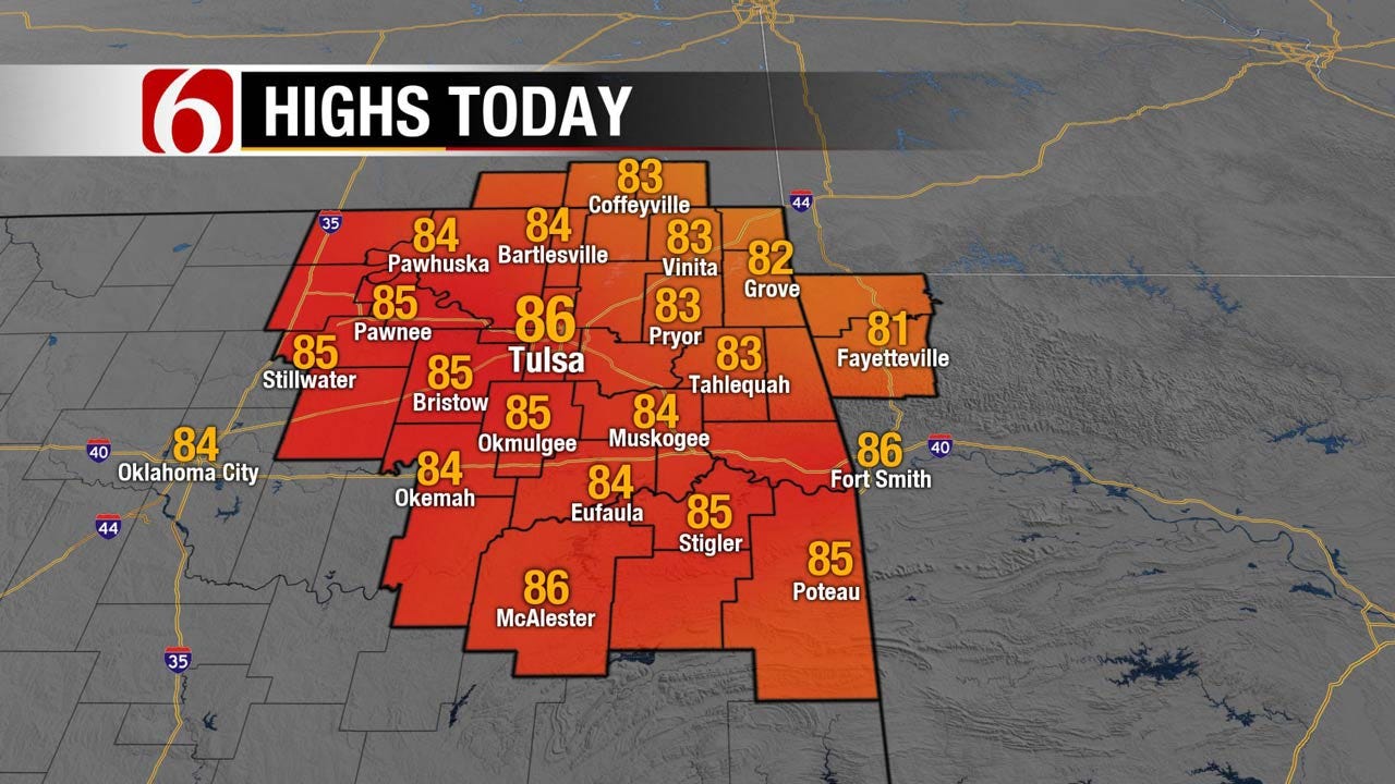
Temps this morning will start in the upper 50s and lower 60s with highs back into the lower to mid-80s along with another mostly sunny day and northeast winds around 10 to 15 mph. Very nice weather by late August standards for Oklahoma.
The tropical storm has moved back into the Gulf this morning and will slowly move eastward and then northeast back on-shore later tonight into Wednesday morning. It's not expected to intensify significantly but it will bring more heavy rainfall into flood ravaged areas of southeast Texas and southern Louisiana over the next 36 to 48 hours. This may bring some additional 10 to 20 inches to the region creating storm totals from 40 to near 50 inches in some locations. Additionally, tornadoes will also be possible on the northeast quadrant of the storm across part of southeast Texas and western Louisiana.
Most data slowly take the tropical low northeast into southeast Texas and eventually northwest or western Louisiana Wednesday before lifting out into south-central or southern Arkansas Thursday evening. Friday and Saturday the remnant low pressure area should be far enough north to be influenced by stronger winds aloft and the storm will finally pick-up speed and move quickly away from the southern Plains. The past few days some data had been taking the storm more to the west before moving NE. This would bring much higher rain chances into the state. We have continued to discount this solution. Our forecast continues to keep only very low impacts from the storm with a few outer-bands of precipitation a possibility Wednesday and Thursday across southern or southeastern Oklahoma. The proximity of the system will increase our surface wind speeds Thursday from 15 to near 25 mph from the northeast. Again, a few bands may brush the outer regions of our state but higher odds will remain away from our immediate area. We'll be on the back-side or subsidence side with an area of dry air near or northwest of the low. This typically keeps the clouds remaining to the east and can bring the temps up a few degrees from computer suggestions. This means our temp forecast for the weekend will be slightly above the model suggestions with readings nearing 90 to 93 Sunday into Monday. The Labor Day holiday looks good with dry and warm conditions. The next front will arrive around the middle of next week with some rain and storm chances followed by a significant reduction in temp and moisture. Next week may bring the first fall front of the season.
Thanks for reading the Tuesday morning weather discussion and blog.
More Like This
August 29th, 2017
January 2nd, 2025
September 29th, 2024
September 17th, 2024
Top Headlines
January 20th, 2025
January 20th, 2025
January 19th, 2025


