Warmer Weather Returns To Northeastern Oklahoma
One this system exits, improving weather is likely through the weekend and into at least Monday before another strong arctic front moves into the state bringing cold weather and a chance for some precipitation.Friday, January 31st 2020, 5:25 am
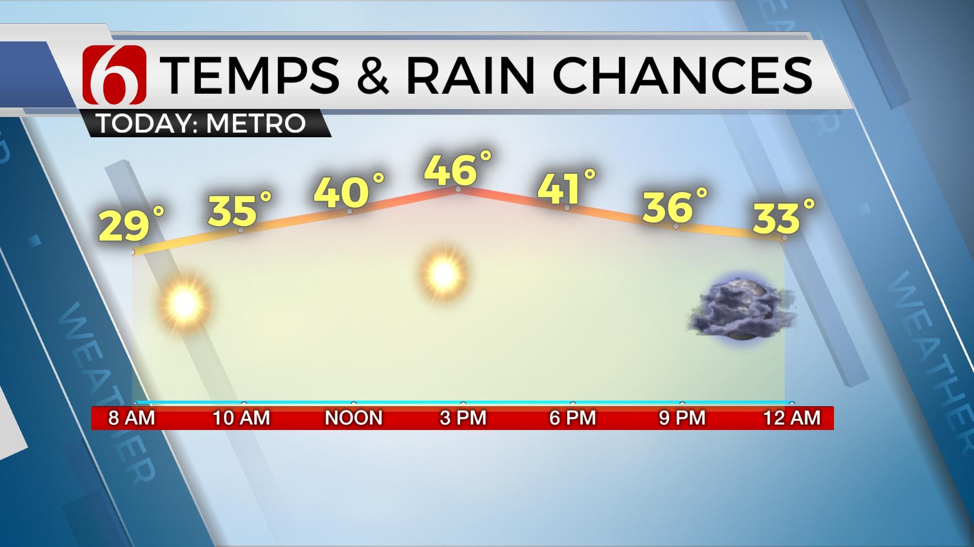
A strong mid to upper deck trough will dive down the plains today and cross northeastern OK through the overnight periods. One this system exits, improving weather is likely through the weekend and into at least Monday before another strong arctic front moves into the state bringing cold weather and a chance for some precipitation. Highs today should reach the upper 40s to lower 50s with a sunshine to cloud mix along with a slight mention for a few showers or sprinkle this evening and a few snow flurries overnight across extreme northeastern OK and southeastern Kansas. Winds will be from the south this morning and the northwest later tonight as the above mention trough exits the area.

This weekend, a mid level ridge of high pressure quickly establishes across much of Texas and Oklahoma bringing unseasonably warm weather into the plains. We’ll start Saturday morning in the upper 20s but should quickly climb into the 40s by morning and reach the upper 50s and lower 60s through the afternoon with abundant sunshine and west winds near 10 to 20 mph. Sunday, slightly stronger winds are possible by midday to afternoon from the southwest at 15 to 25 mph with more sunshine. Lows will start in the upper 40s and highs should reach the lower 70s with mostly sunny conditions along with a few high clouds.

Monday the next series of events will begin setting the stage for more cold weather. A strong western U.S trough will move across the pacific northwest and dig southward into the desert southwest by Monday night. Southwest winds from 20 to 30 mph will be likely Monday along with high clouds and filtered sunshine with another mostly mild temperature day. Morning lows may start in the 50s with afternoon highs either in the upper 60s or lower 70s. Sometime Monday evening or Tuesday morning a strong shallow arctic front will move across the northern OK region bringing falling temps and gusty north winds. The chance for a few pre-frontal showers will remain a low mention across southeastern or extreme eastern OK but only spotty activity and low amounts would be expected. As the front moves southward, temps should fall from the 40s into the 30s by afternoon. A southwest upper flow slightly removed to our west may bring some moisture up and over the boundary with snow showers likely across central Kansas Tuesday. This probably remains too far north for any impacts across our areas of concern.

Wednesday the boundary will be stalled across the Arbuckles into southeastern OK as another southwestern impulse nears the Red River Valley. Scattered showers should form on the cold side of the boundary, with the chance of some wintry weather Wednesday possibly across far southern OK. This zone may migrate northward in the data over the next few days and we will include the potential in our forecast for Wednesday morning.

The extended “pattern” suggests at least two, possibly three more weeks of occasional arctic intrusions across the nation, including some leading-edge cold fronts for Oklahoma. As posted yesterday, our climatology indicates this is the favored period for southwestern impulses to travel up and over colder air at the surface.
In summary, help is on the way for those wanting sunshine and warmer weather.
Thanks for reading the Friday morning weather discussion and blog.
Have a super great day!
Alan Crone
More Like This
January 31st, 2020
November 30th, 2022
November 1st, 2022
August 26th, 2022
Top Headlines
January 2nd, 2025
January 2nd, 2025
January 2nd, 2025


