Late Week Severe Storm Chances
A pleasant fall day is expected on Tuesday, but the chance for showers and storms returns this week.Tuesday, November 1st 2022, 5:47 am
TULSA, Okla. -
If you’re into podcasts or in a rush, check out my daily weather update. Search for NewsOn6 and ‘Weather Out The Door’ on most podcast providers, including Spotify, Stitcher and Tune-In, or Click Here to listen on Apple Podcasts.
TULSA, Okla. - A pleasant fall day is expected on Tuesday, but the chance for showers and storms returns this week.
Here are the details from News On 6 Meteorologist Alan Crone:

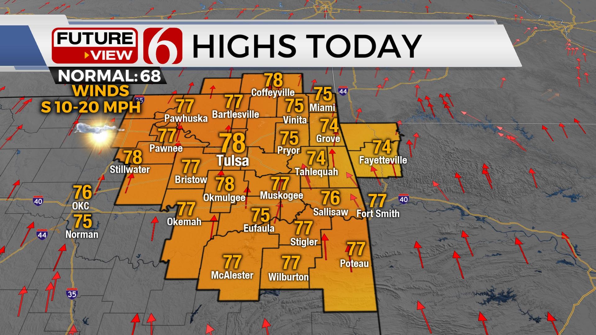
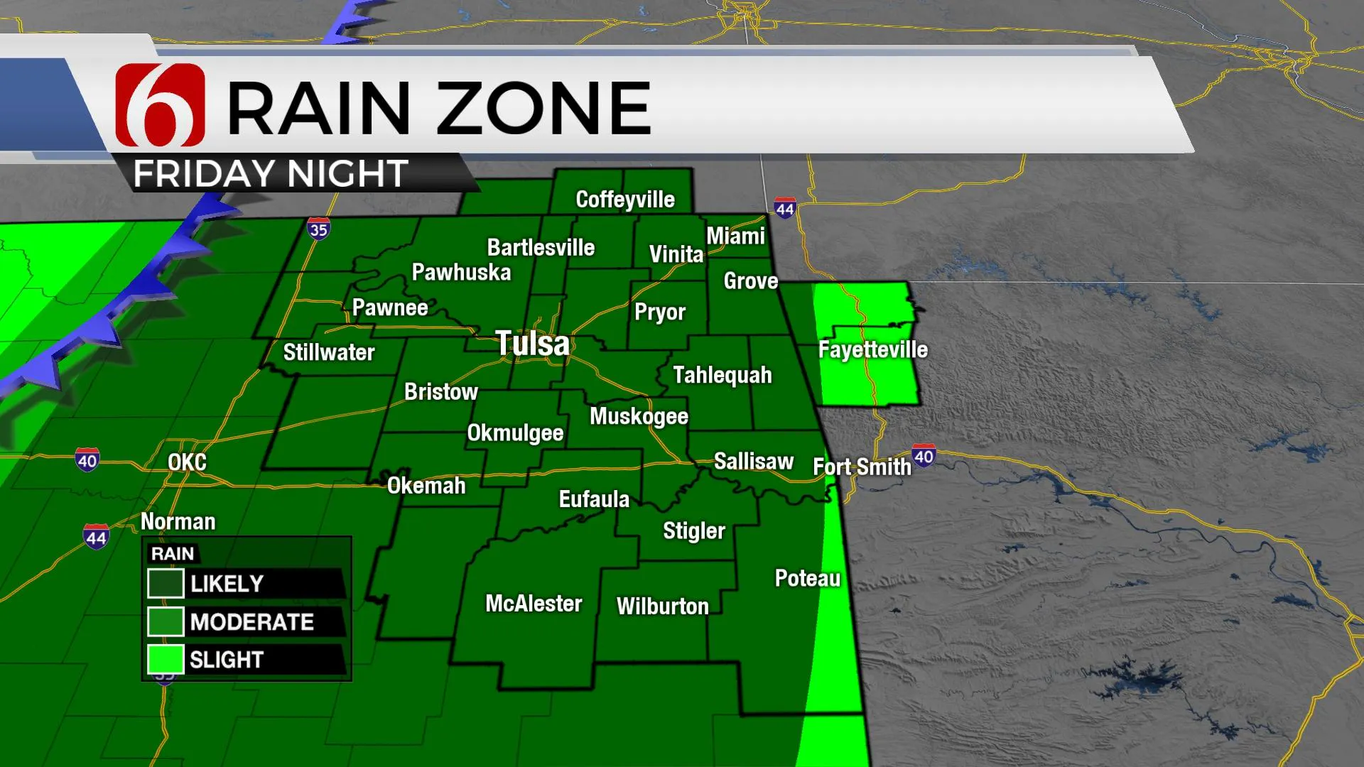
A powerful upper-level system arrives at the end of the week providing high probabilities for thunderstorms, including possibilities for locally heavy rainfall and severe weather. As this system exits the area late Friday night into early Saturday morning, cooler weather prevails for a few days before our next strong cold front arrives next Tuesday. Highs for Tuesday afternoon and for the remainder of the week will remain above seasonal averages with max temps in the mid-70s. Gusty south winds arrive Wednesday and continue until the system nears the state Friday.
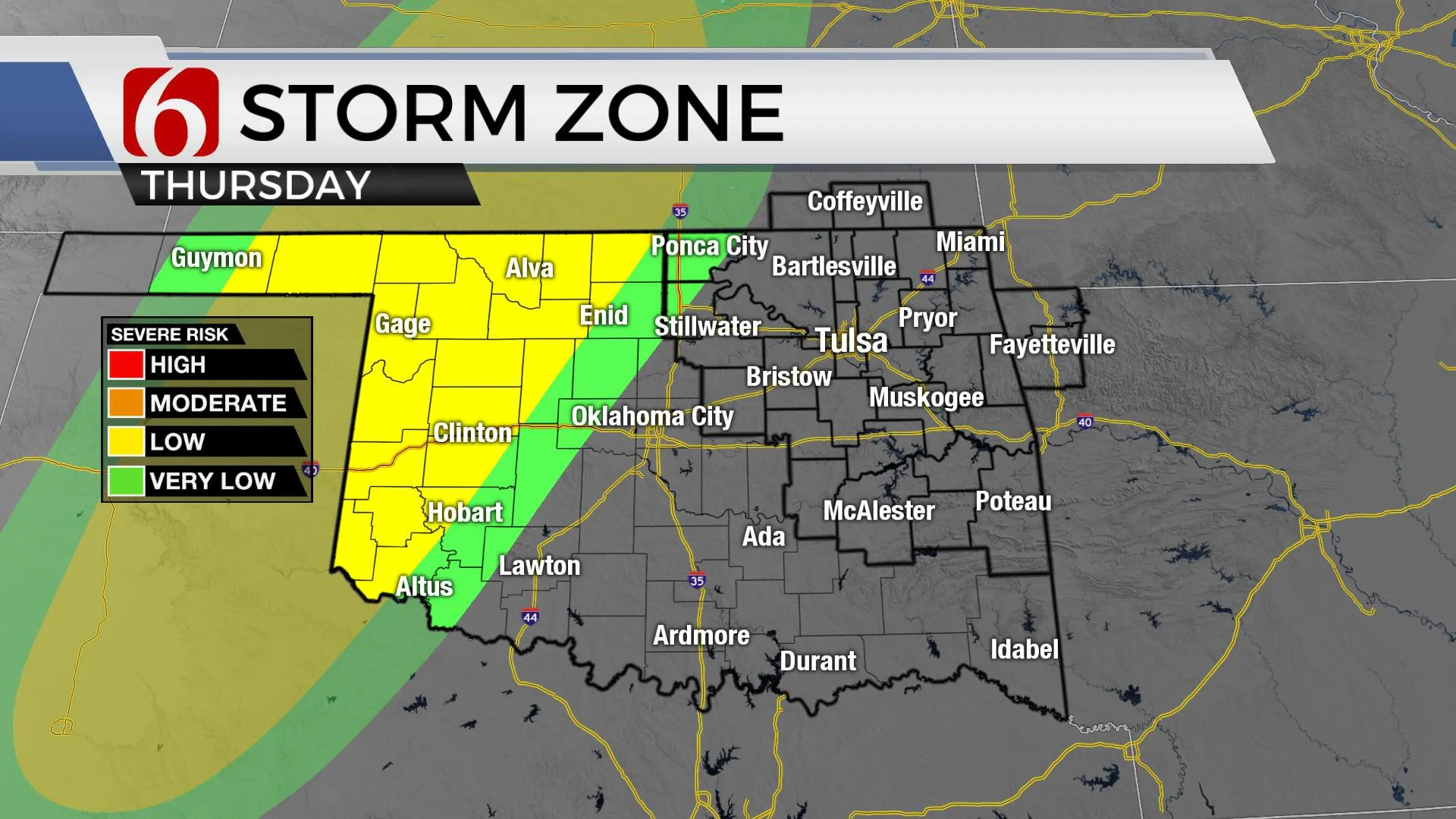
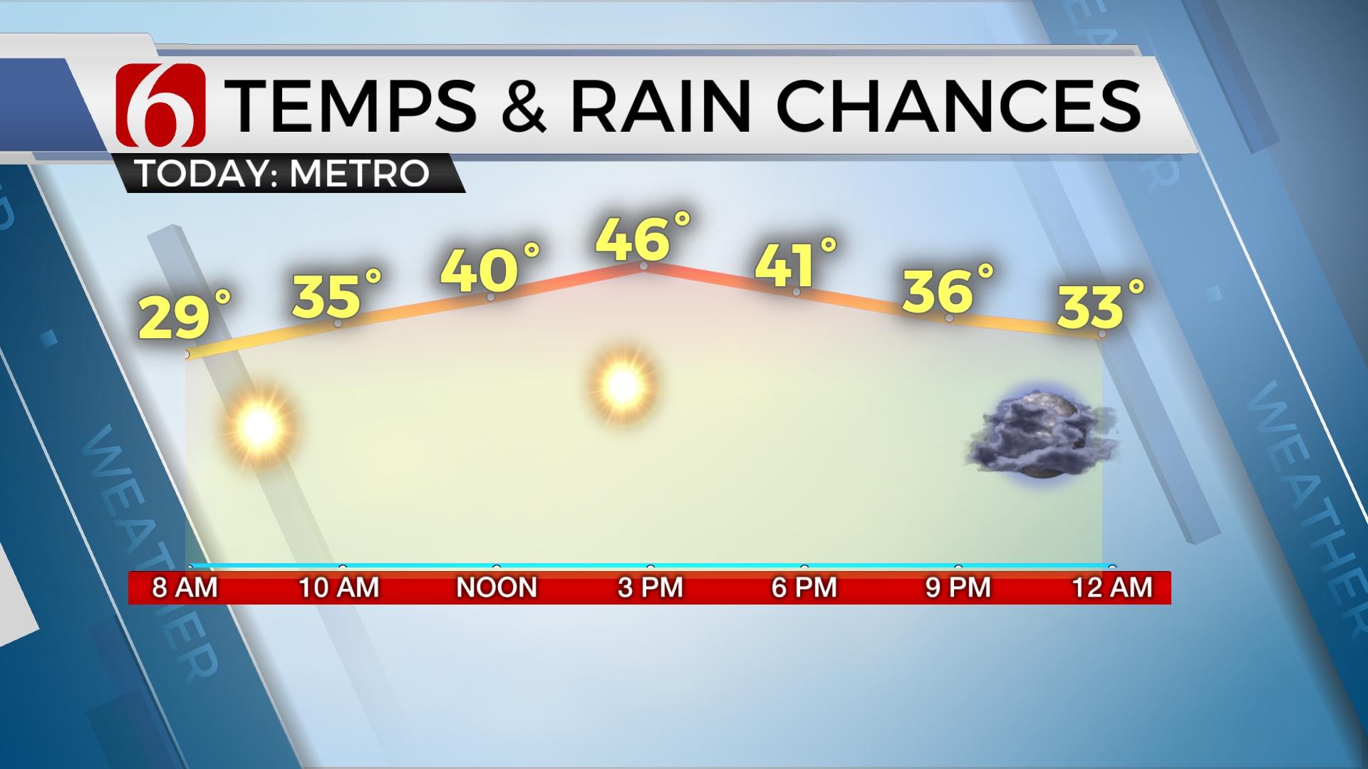
Conditions on Tuesday morning through the afternoon will be pleasant. Some patchy fog is possible in a few locations Tuesday morning but should not be as problematic as Monday morning. Lows in the mid to upper 40s will rise with afternoon highs reaching the mid to upper 70s with mostly sunny conditions. A weak southern stream wave positioned across southern to central Texas will eject northeast tonight into early Wednesday morning and may bring a few clouds near the region. Any showers should remain south of our immediate area. Wednesday and Thursday will feature gusty south winds and afternoon highs in the mid-70s. As the trough nears the state later this week, shower and storm chances will arrive across far western Oklahoma Thursday evening and move eastward with time Friday. Our main window for strong to severe storms across the eastern third of the state should occur Friday, including the potential for the evening hours. All modes of severe weather will remain possible based on the upper air pattern. More specific timeline and threat information will be posted on Wednesday. The initial look at most data supports rainfall amounts from 1 to 3 inches possible.
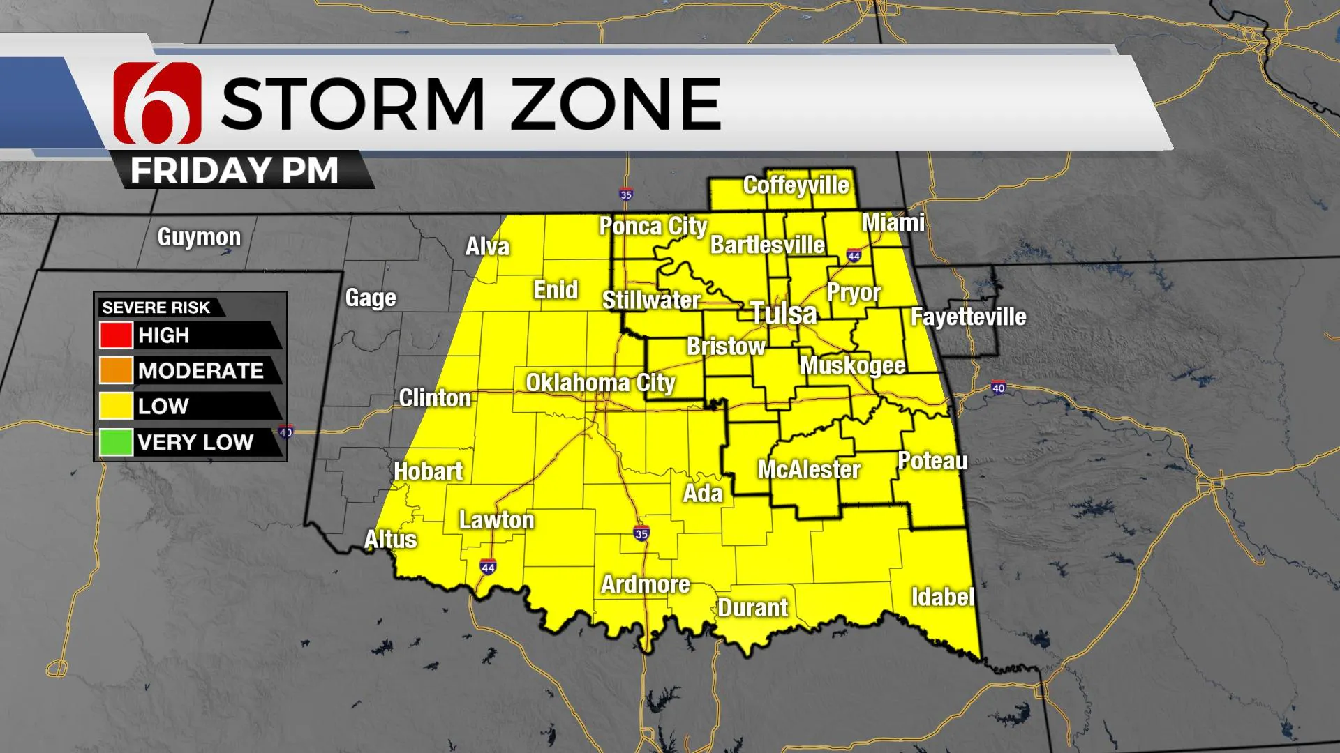
As the main upper-level trough nears the state, a closed low may attempt to develop at the base Friday evening and eject across the state Saturday morning to midday. While the threat for strong to severe storms across the eastern third of the state currently appears highest Friday based on Tuesday's data, some showers may linger early Saturday morning before quickly exiting as the low ejects quickly out of the state. Afternoon highs Saturday should remain in the 60s with gusty southwest winds from 15 to 30 mph. Sunday highs will be nearing the upper 60s to lower 70s with mostly sunny and dry weather. The next strong system arrives Tuesday, but the current pattern suggests greater upper air energy should remain across the central to northern plains. This should bring a mention for a few storms and a notable cool-down following the Tuesday cold front.
Thanks for reading the Tuesday morning weather discussion and blog.
Have a super great day!
Alan Crone


Alan Crone
An integral part of the News On 6 Weather Team since 2006, Alan Crone keeps Oklahomans safe and informed about morning weather each weekday on Six in the Morning. He’s always keeping an eye on the sky for both severe weather and just weather that’s going to make your day a bit more interesting.
More Like This
November 1st, 2022
November 30th, 2022
August 26th, 2022
July 21st, 2021
Top Headlines
May 31st, 2025


