Additional Tropical Downpours Remain
Off and on scattered rain is expected and a few storms are possible on this mostly cloudy and warm Monday.Monday, June 28th 2021, 8:07 am
TULSA, Oklahoma -
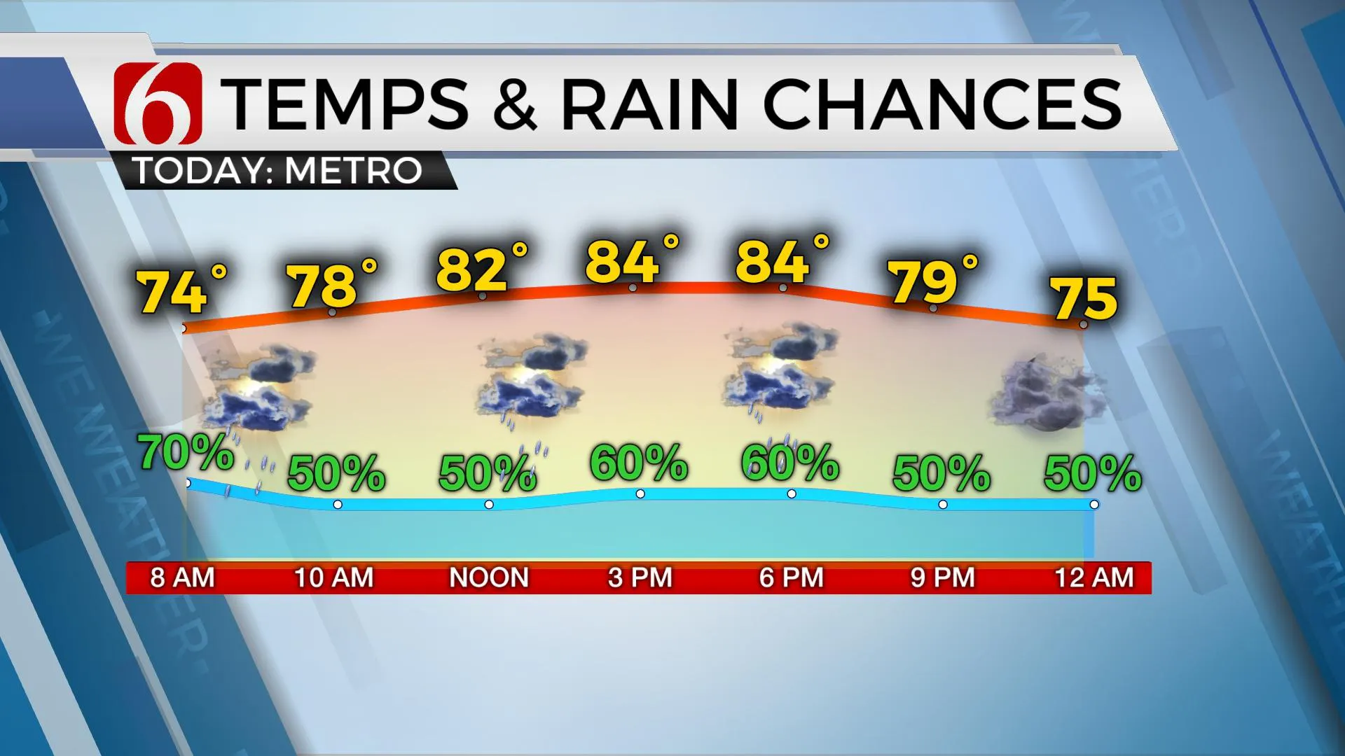
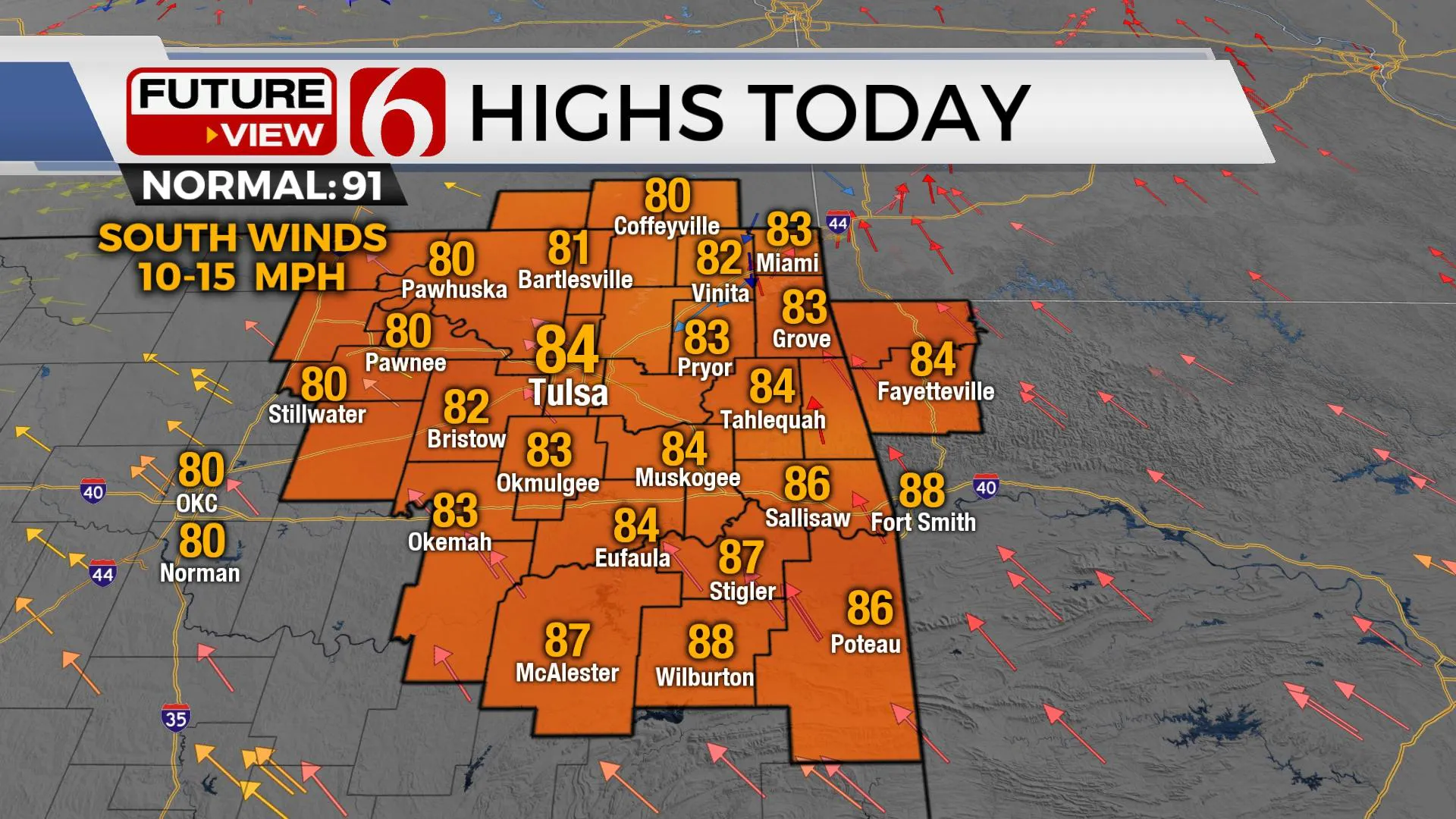
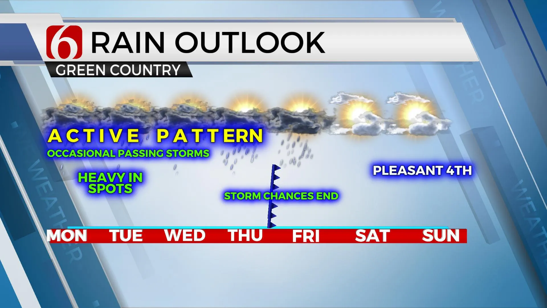
The overall pattern will not change much for the next few days. This means scattered showers and storms will be possible at times, including the possibility of heavy downpours resulting in localized flooding issues. The upper air pattern remains unchanged for the short term but will bring changes by the end of the week taking most of the showers and storms south of the region for the holiday weekend. Temps will stay in the lower 70s this morning before reaching the lower or even mid-80s later today with mostly-to-partly cloudy sky and south winds at 10 to 15 mph. The sporadic and somewhat disorganized nature of most of the convective activity will allow some locations to remain dry but the probability must remain between 50 to 70% for most of eastern Oklahoma for the day. Severe weather threats are very low for the day, but one or two cells later today may still produce gusty winds and small hail.

A weak boundary remains northwest of the metro and will eventually be a focus for some additional scattered storms later today. Additional storms that do develop later today across eastern Oklahoma will also support localized outflow boundaries that may aid in scattered development through the afternoon. Most of the showers and storms will decrease with the loss of daytime heating but additional flare-ups will be likely later tonight into pre-dawn Tuesday morning as the process repeats through at least Thursday.

Later this week a strong upper-level trough develops over the Great Lakes and moves south while helping to shove a cold front southward through the state Thursday afternoon or evening. This will fire up additional storms near this front as it moves southward into early Friday. Most of Friday should be rain-free across the northern sections of the state with some activity across southeastern OK into the Red River Valley region yet drier air with north winds will not arrive until late Friday night into Saturday morning. This should bring improving conditions for the weekend with morning lows in the 60s and highs in the 80s. The outlook for Sunday, July 4th brings morning lows in the mid-60s and afternoon highs in the mid-80s with sunshine and pleasant conditions.

Thanks for reading the Monday morning weather discussion and blog.
Have a super great day!
Alan Crone
KOTV
If you’re into podcasts, check out my daily weather update below. Search for NewsOn6 and ‘Weather Out The Door’ on most podcast providers, including Apple, Stitcher, Tune-In and down below on Spotify.

More Like This
June 28th, 2021
June 21st, 2023
June 19th, 2023
June 13th, 2023
Top Headlines
January 23rd, 2025
January 23rd, 2025
January 23rd, 2025
January 23rd, 2025


