Strong Winds, Hail Sweep Across Eastern Oklahoma; Causing Some Damage
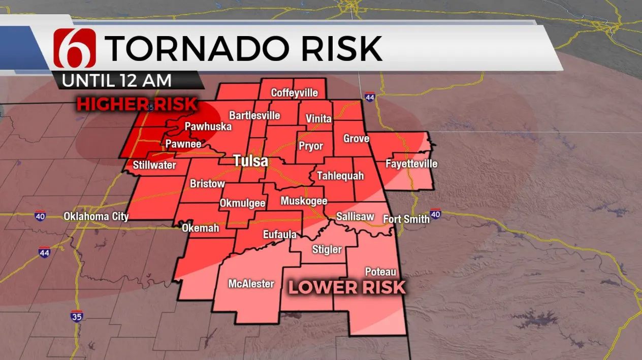
Tornado Watch for Cherokee, Craig, Creek, Delaware, Hughes, Kay, Lincoln, McIntosh, Mayes, Muskogee, Noble, Nowata, Okfuskee, Okmulgee, Osage, Ottawa, Pawnee, Payne, Pittsburg, Rogers, Tulsa, Wagoner and Washington County in OK until 10:00pm.Monday, May 2nd 2022, 11:05 pm
TULSA, Oklahoma -
Severe Weather Recap:
Strong winds, large hail, and isolated tornados swept across Oklahoma on Monday.
The National Weather Service (NWS) said the storm line moved east at 50 to 60 mph. Several areas saw power outages and reports of hail damage. Osage SkyNews 6 Pilot Dustin Stone spotted some damage from the storms in Chickasha and crews expect to find more damage after sunrise.
All tornado watches expired just before 10 pm Monday but a Tornado Watch remains in effect for Adair, Haskell, Latimer, Le Flore, and Sequoyah County until 1:00 am. At least 4 tornados were reported around Oklahoma on Monday but the NWS is still investigating those reports.
News 9 Chief Meteorologist David Payne and Bob Mills SkyNews 9 pilot Jim Gardner tracked a rope tornado near the town of Omega.
VIDEO: Tornado Near Omega, Okla. (May 2)

Here are the details from News On 6 Meteorologist Alan Crone:

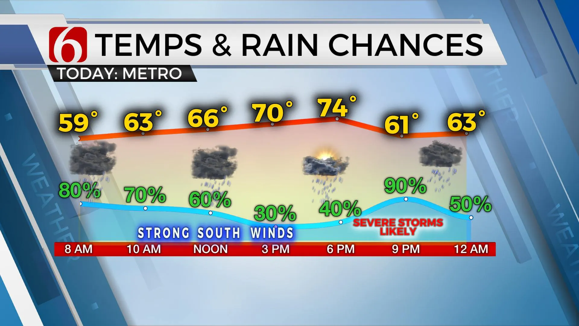
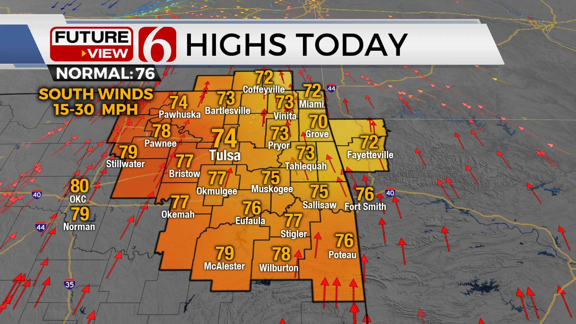
Morning storms will thin-out some by midday with afternoon highs reaching the mid-70s along with gusty south winds and mostly to partly cloudy sky. A threat of severe weather arrives later Monday afternoon and night as another strong storm system impacts the region. All modes of severe weather will be possible, including supercell storms during the early hours of development followed by a complex or line of storms moving southeast this evening.

Storms that developed yesterday across west Tx continue moving eastward this morning impacting portions of Eastern OK. Instability is marginal this morning, but low-level moisture continues streaming northward as this precipitation populates our area. A few strong storms will remain possible with the main threat of nickel hail and gusty winds in the stronger storms. This activity should continue moving east this morning bringing an eventual break by midday to early afternoon. This period later today is crucial to severe thunderstorm development this afternoon and early evening. If enough solar insolation occurs later this afternoon, surface instability is expected to increase with more than adequate recovery time from this morning's storms. A strong upper-level system, currently across the Rockies, will eject into the central plains tonight. A surface dry line will once again be established near or slightly west of I-35 with a cold front developing across central Kansas. While a massive CAP kept storms from developing last Friday evening, the CAP this afternoon and early evening is not expected to be as strong. A few supercells will be possible across the I-35 corridor of north central OK early evening supporting mentions of large hail, damaging winds, and tornadoes. Once again, as the cold front nears the area by early evening, storms are more likely to develop along the boundary and quickly spread southeast with straight-line damaging winds threats for a few hours before weakening as they exit far southeastern OK around 1 a.m. Tuesday features a pleasant day with afternoon highs in the upper 60s and lower 70s before this same scenario once again returns Wednesday to the region with yet another strong storm system quickly arriving with additional severe weather threats. As this system exits early Thursday morning, we should experience a few days of pleasant weather, including most of the weekend.
Thanks for reading the Monday morning weather discussion and blog.
Have a super great day!
Alan Crone
KOTV
If you’re into podcasts, check out my daily weather update. Search for NewsOn6 and ‘Weather Out The Door’ on most podcast providers, including Spotify, Stitcher and Tune-In, or Click Here to listen on Apple Podcasts.
More Like This
June 21st, 2023
June 19th, 2023
June 13th, 2023
Top Headlines
December 23rd, 2024
December 23rd, 2024
December 23rd, 2024


