Excessive Heat Warnings Before Minor Weekend Relief
Heat advisories and excessive heat warnings are in effect as the hot and humid weather continues across Green Country.Thursday, July 7th 2022, 6:07 am
TULSA, Oklahoma -
Heat advisories and excessive heat warnings are in effect as the hot and humid weather continues across Green Country.
Here are the details from News On 6 Meteorologist Alan Crone:

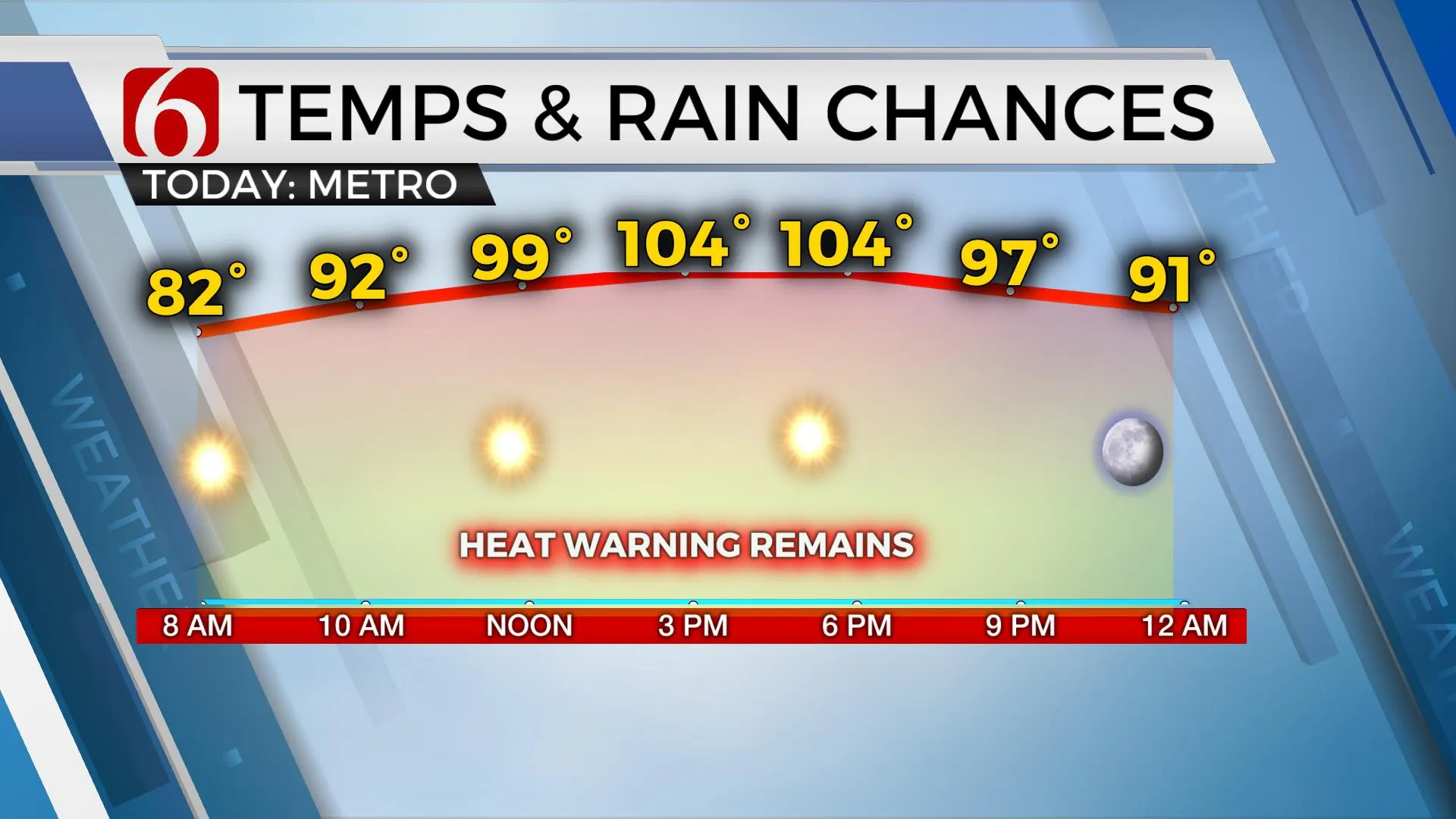
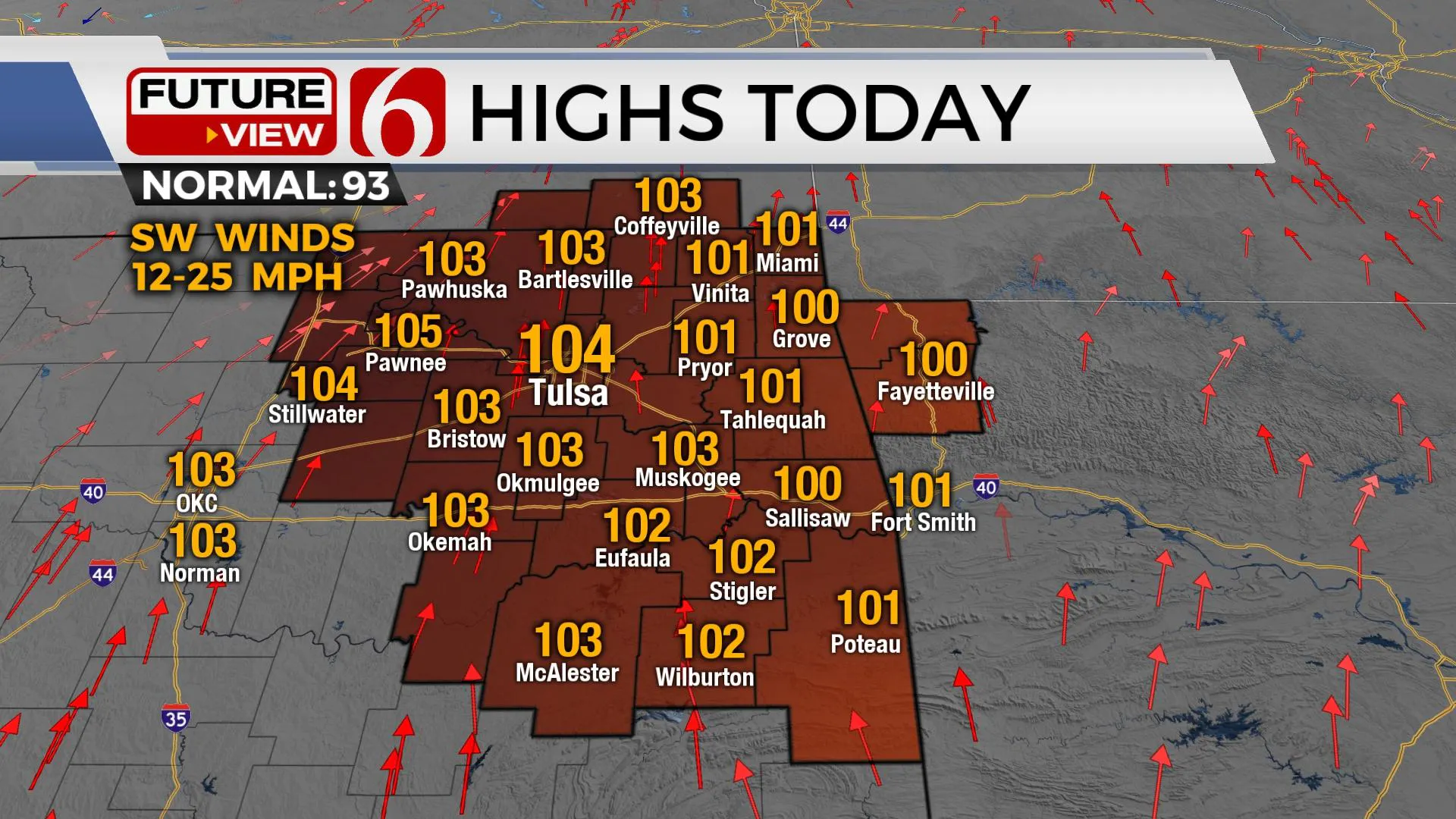
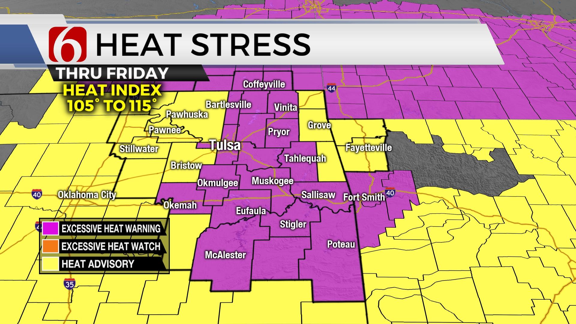
The ridge continues to compress with afternoon highs expected to reach the 100 to 104 range across most of the area. Another heat advisory and excessive heat warnings remain with heat index values nearing 105 to 115 this afternoon. Very little cooling is expected tonight, with the Tulsa metro heat island effect keeping temps well into the mid-90s at 9pm and the lower 90s at midnight. The pattern may change enough to bring a weak front into part of the area tonight and Friday giving us a slight chance for a few isolated storms late tonight into Friday morning for part of northeastern OK. This boundary may also bring a slight reduction in temps for the weekend with northern OK staying just below triple digits. Most data also support the mid-level ridge retrograding westward next week. This will help to develop a more favorable upper air pattern for a few more scattered storms by the middle next week. This should also bring a more noticeable reduction in heat and humidity with as stronger front Tuesday evening into Wednesday.

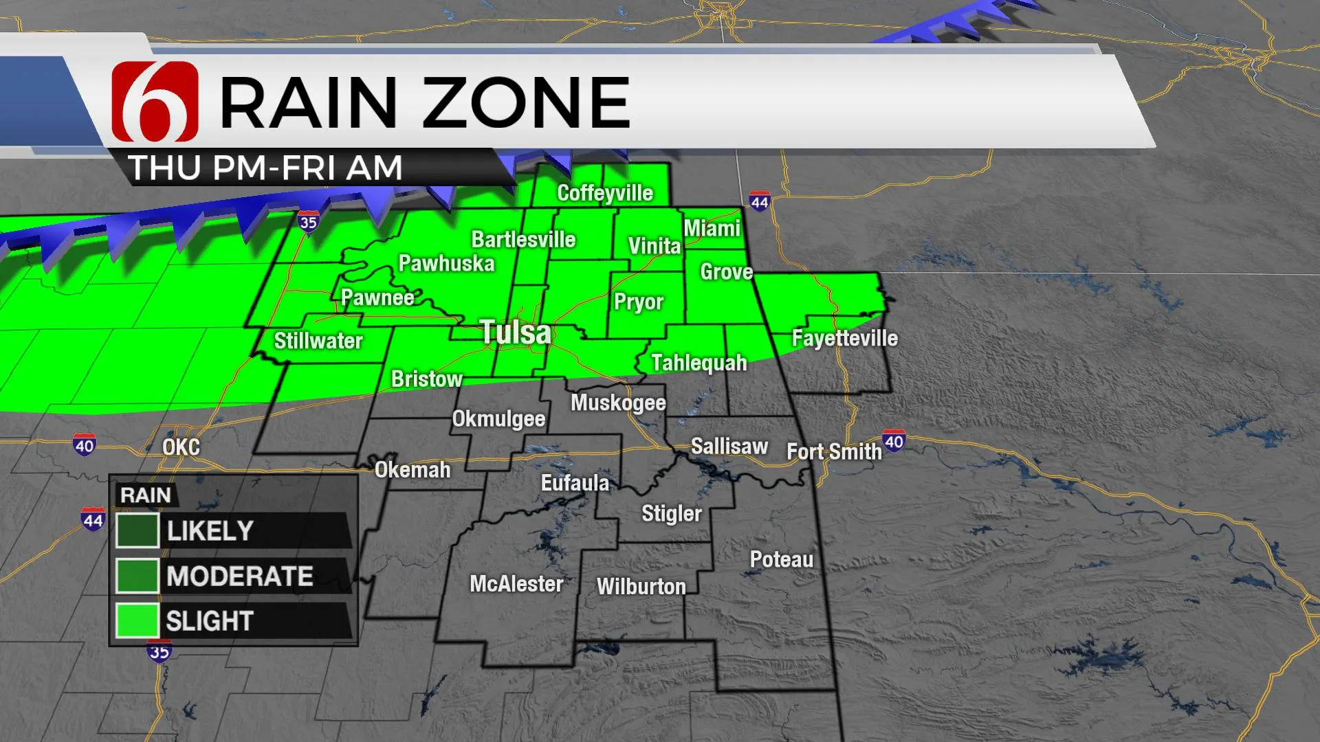
Later this evening, a weak front will slide southward, and spark-off a few scattered storms along the boundary across northwestern OK and southern Kansas. Most of this activity should remain north of the metro, but a few isolated storms can’t be ruled out along the OK-Kansas state line region. Friday, as the front slides slowly southeast, a few additional isolated storms will be possible, including the Tulsa metro early Friday morning. Friday afternoon the focus will more than likely shift to the I-40 region. By Saturday morning, the boundary should be southeast of the metro before stalling across the I-40 corridor. A few scattered storms will be possible Saturday near and east of the metro, with a few isolated storms possible across southeastern OK by evening. All these above-mentioned probabilities will remain near 20% for these periods. Please remember, that any mature storm during the summer months can produce fast downbursts of wind.

Thanks for reading the Thursday morning weather discussion and blog.
Have a super great day!
Alan Crone
KOTV
If you’re into podcasts, check out my daily weather update. Search for NewsOn6 and ‘Weather Out The Door’ on most podcast providers, including Spotify, Stitcher and Tune-In, or Click Here to listen on Apple Podcasts.
More Like This
July 7th, 2022
June 21st, 2023
June 19th, 2023
June 13th, 2023
Top Headlines
January 12th, 2025
January 12th, 2025
January 12th, 2025


