Sunny, Cool Day With Abundant Sunshine
A sunny and cool fall day is underway across green County.Wednesday, October 26th 2022, 10:35 am
TULSA, Okla. -
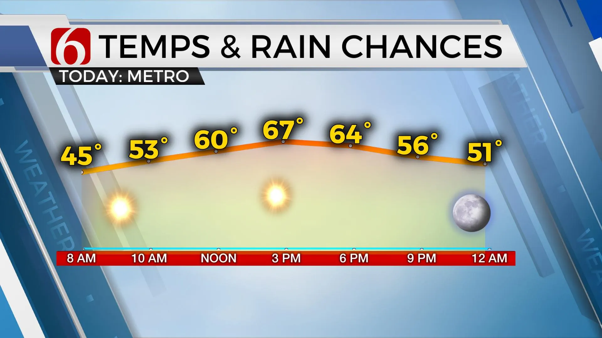
A sunny and cool fall day is underway across green County.
Here are the details from News On 6 Meteorologist Alan Crone:

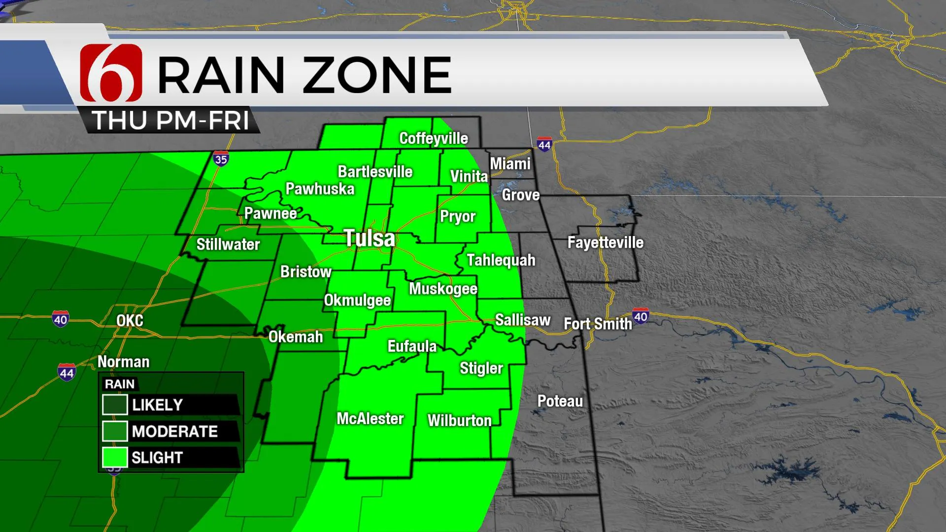
The next upper air system will drop from the pacific northwest across the Rockies and into the southern plains Thursday evening before slowly moving across north Texas Friday and exiting to our east Saturday evening into early Sunday. This system should take a more southern route compared to the last system. Most of the strong and severe storm threats should remain well to our west and south Thursday late and early Friday morning. But additional showers and some thunder will remain in the forecast during this period. As the bowling ball of energy slowly advances east Friday night into Saturday morning across north Texas, some residual showers will be possible across at least southeastern OK, and possibly as far north of the Tulsa metro. Rain chances will remain Thursday evening into Friday morning, but a small probability will remain for Saturday across the northern third of the state with higher chances along the Red River Valley.

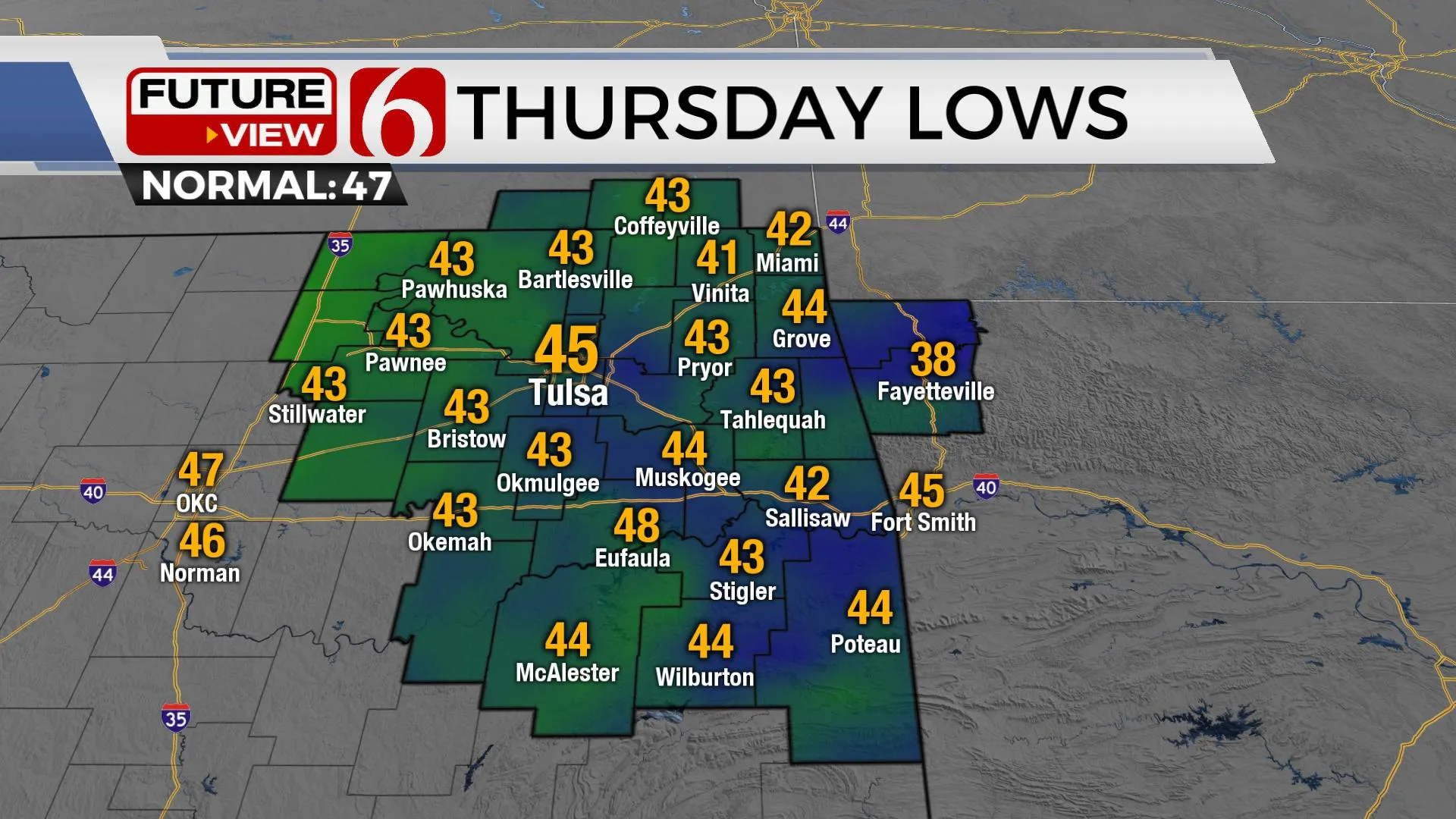
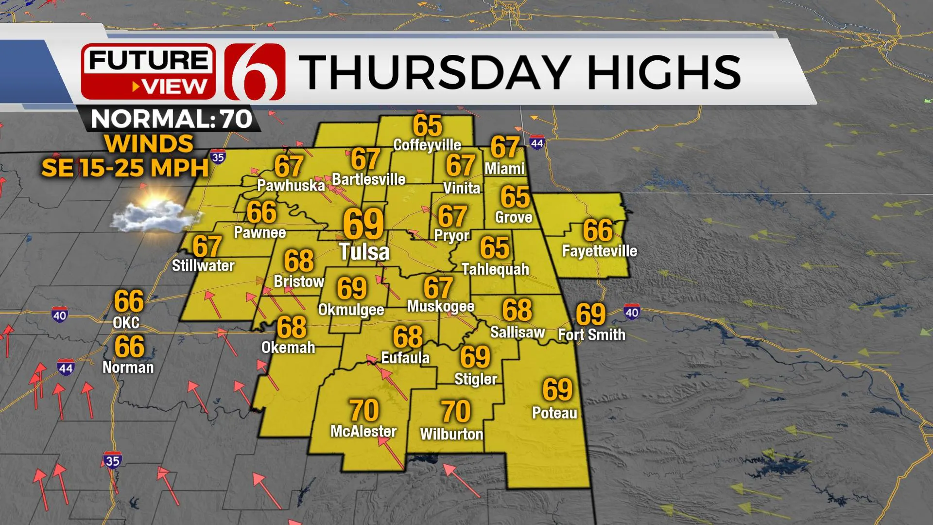
Temperatures Thursday will top-out in the upper 60s north and low 70s south along with southeast winds from 15 to 25 mph. Winds will back from the northeast early Friday morning as the surface low drops from the panhandle into the Red River Valley of north Texas. Gusty northwest winds return from 15 to 25 mph Friday with morning lows in the 50s and daytime high in the 60s.

The first opportunity for showers near the metro arrive Thursday evening into early Friday morning. The focus then should be across the southern sections Friday midday to afternoon. Late Friday evening into early Saturday, showers will be likely along the Red River Valley region with lower chances northward near the metro. Morning lows in the 50s will advance only into the upper 50s and lower 60s Saturday afternoon with decreasing clouds and north winds from 15 to 25 mph. Sunday should be another transition day with a few clouds exiting and sunshine arriving with highs in the upper 60s. Mostly sunny and pleasant weather returns early next week with afternoon highs in the 70s. Another strong front may approach the area by the latter half of next week with a few showers and a significant cool-down.

Thanks for reading the Wednesday morning weather discussion and blog.
Have a super great day!
Alan Crone
KOTV
If you’re into podcasts, check out my daily weather update. Search for NewsOn6 and ‘Weather Out The Door’ on most podcast providers, including Spotify, Stitcher and Tune-In, or Click Here to listen on Apple Podcasts.


Alan Crone
An integral part of the News On 6 Weather Team since 2006, Alan Crone keeps Oklahomans safe and informed about morning weather each weekday on Six in the Morning. He’s always keeping an eye on the sky for both severe weather and just weather that’s going to make your day a bit more interesting.
More Like This
October 26th, 2022
June 11th, 2025
June 11th, 2025
June 11th, 2025
Top Headlines
June 11th, 2025
June 11th, 2025


