Cold Weather Remains This Week
Below normal temperatures remain for the rest of the week with a series of cold fronts enforcing the cold and mostly dry air.Tuesday, November 15th 2022, 8:18 am
TULSA, Okla. -
Below normal temperatures remain for the rest of the week with a series of cold fronts enforcing the cold and mostly dry air. A system nears Thursday evening into Friday that may bring a few snow flurries along with another temperature drop with highs remaining only in the 30s Friday afternoon. The early outlook for Thanksgiving supports the potential for a storm system nearing the southern plains.
The system that brought some rain and slushy snow across eastern Oklahoma yesterday has exited our area this morning. Most locations across northeastern OK had minimal impacts from the system with a rain to snow mix. Southern sections along the Highway 270 corridor recorded enough slushy snow to cover the ground with one to two inches reported. The highest totals across the state remained in the winter storm warning areas of west central Oklahoma where four to six inches of snow occurred.
We’re seeing some patchy fog developing this morning across the region. Visibilities may briefly drop during your morning commute. Use caution while driving. Most of the roadways in eastern Oklahoma are in good shape, but a few slick spots will be possible, especially in southeastern and far east central OK. Roads have more snow issues across the west-central portion of the state.
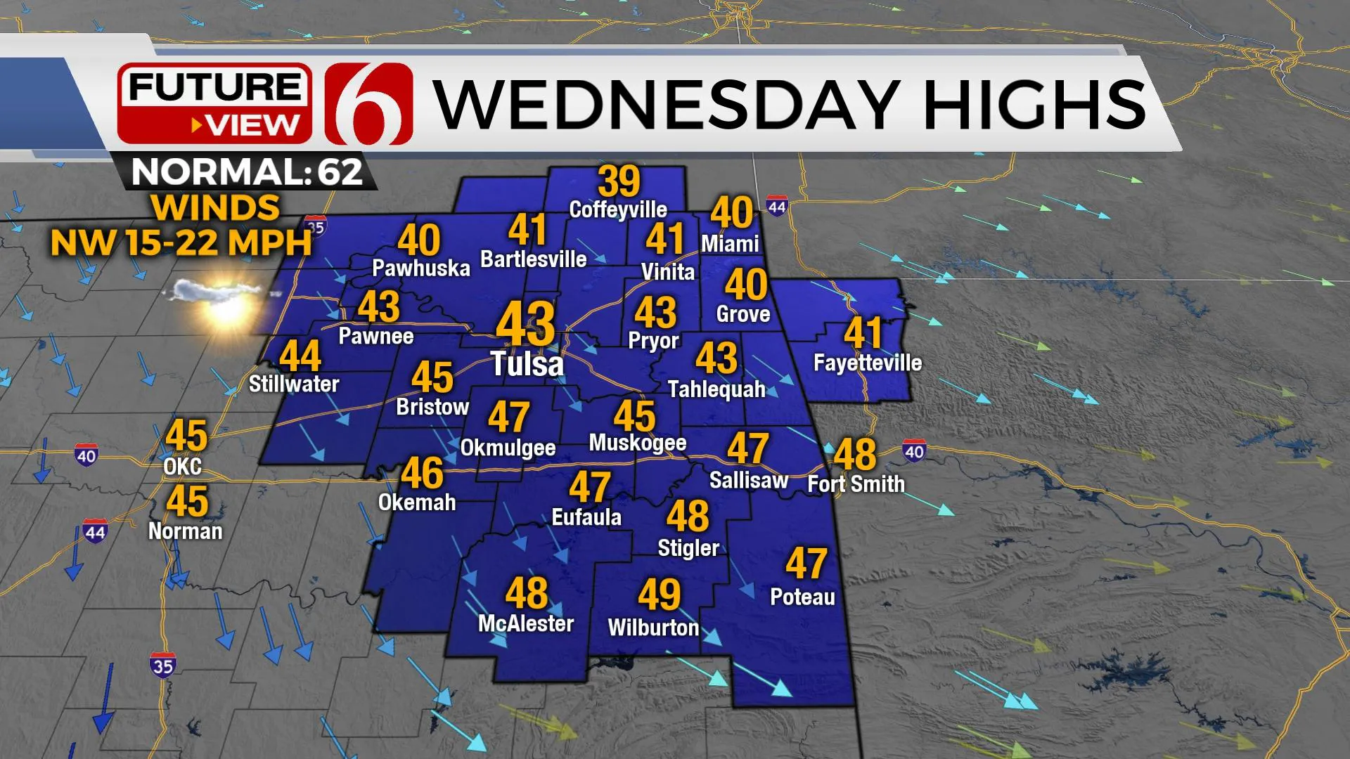
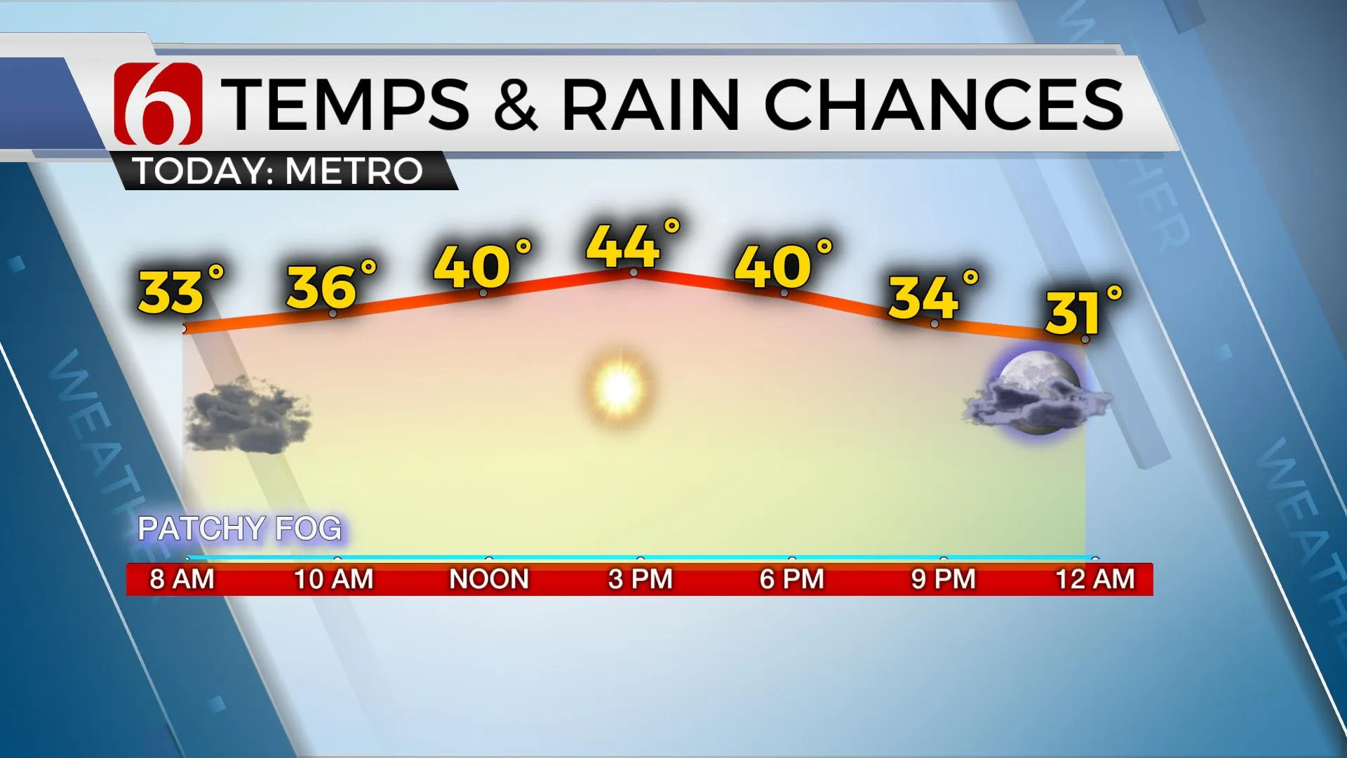
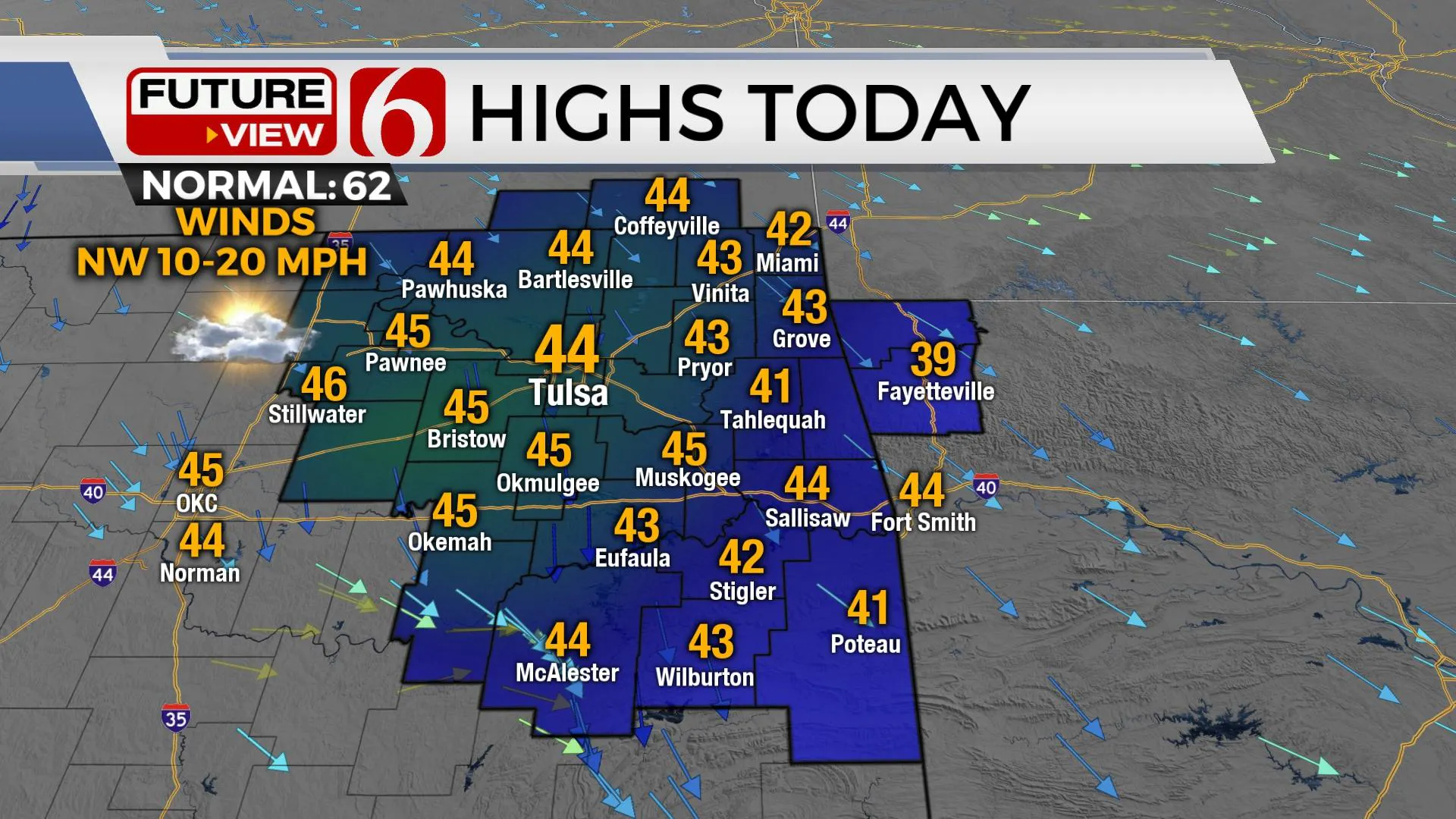
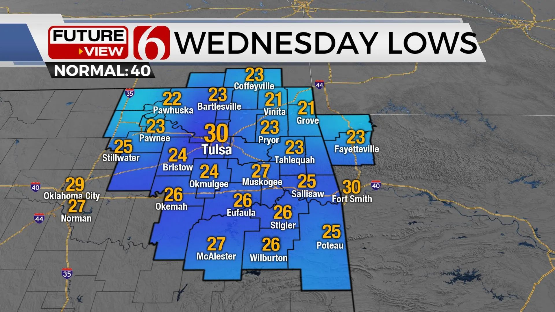
Clouds will also decrease from the west to east early this morning allowing for a mostly sunny and chilly afternoon with highs in the mid-40s. Northwest winds from 10 to 20 mph will be likely. Clear sky, light winds, and dry air will allow Wednesday morning lows in the lower to mid-20s with afternoon highs also in the mid-40s as another boundary moves across the area with gusty northwest winds from 15 to 25 mph. Low humidity Wednesday afternoon will support an elevated fire danger spread rate.
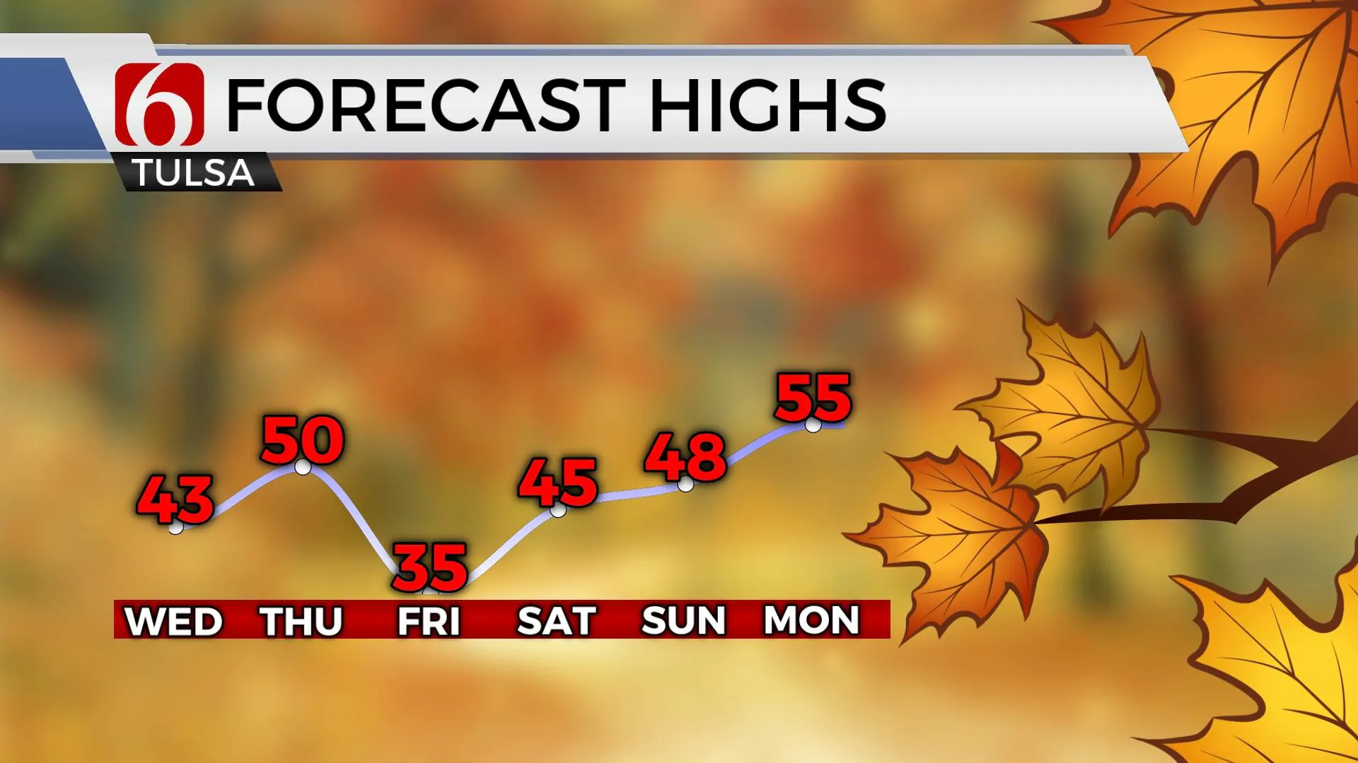
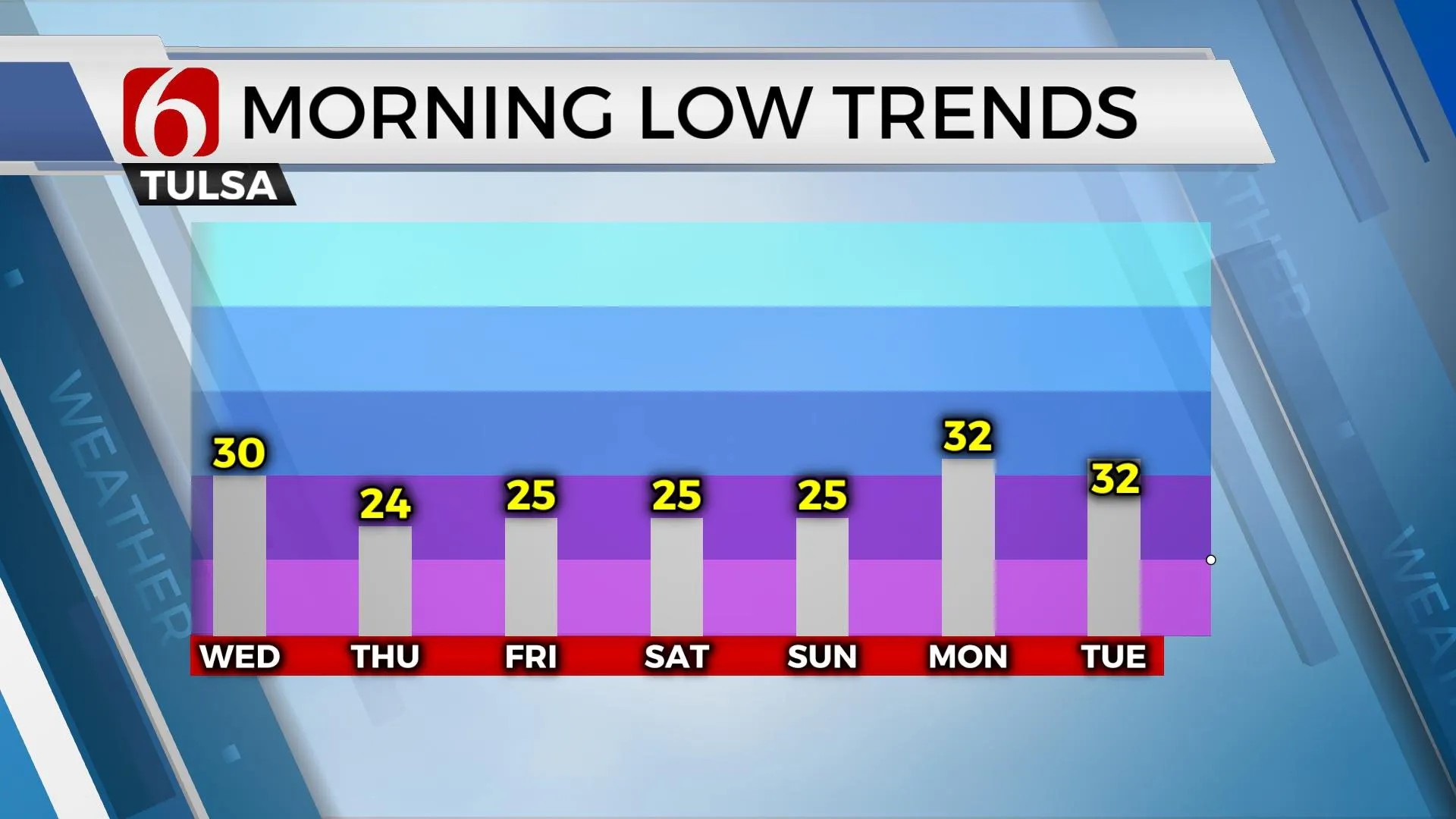
A stronger front enters the area Thursday evening bringing a few clouds Friday and the potential for snow flurries in some locations. Friday will be the coldest day of the week with lows in the 20s and highs remaining in the mid-30s. The weekend appears cold yet dry. A minor warming trend should commence early next week with afternoon highs reaching the mid to upper 50s before a storm system nears the state around Thanksgiving bringing additional precip chances and colder weather.
More Like This
November 15th, 2022
October 22nd, 2023
October 21st, 2023
August 3rd, 2023
Top Headlines
November 16th, 2024
November 16th, 2024
November 16th, 2024
November 16th, 2024


