Severe Storms Move Out Of Green Country
Heavy rain, wind, and hail moved out of Green Country Monday night after many watches and warnings were issued.Monday, January 2nd 2023, 6:54 pm
TULSA, Okla. -
Heavy rain, wind, and hail moved out of Green Country Monday night after many watches and warnings were issued.
Some of the storms were severe and even caused a few tornado warnings, while all of north eastern Oklahoma was under a tornado watch until 10 p.m.
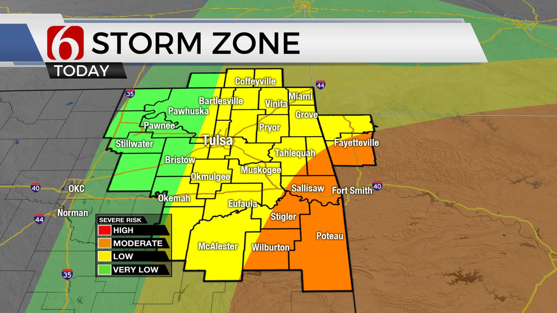
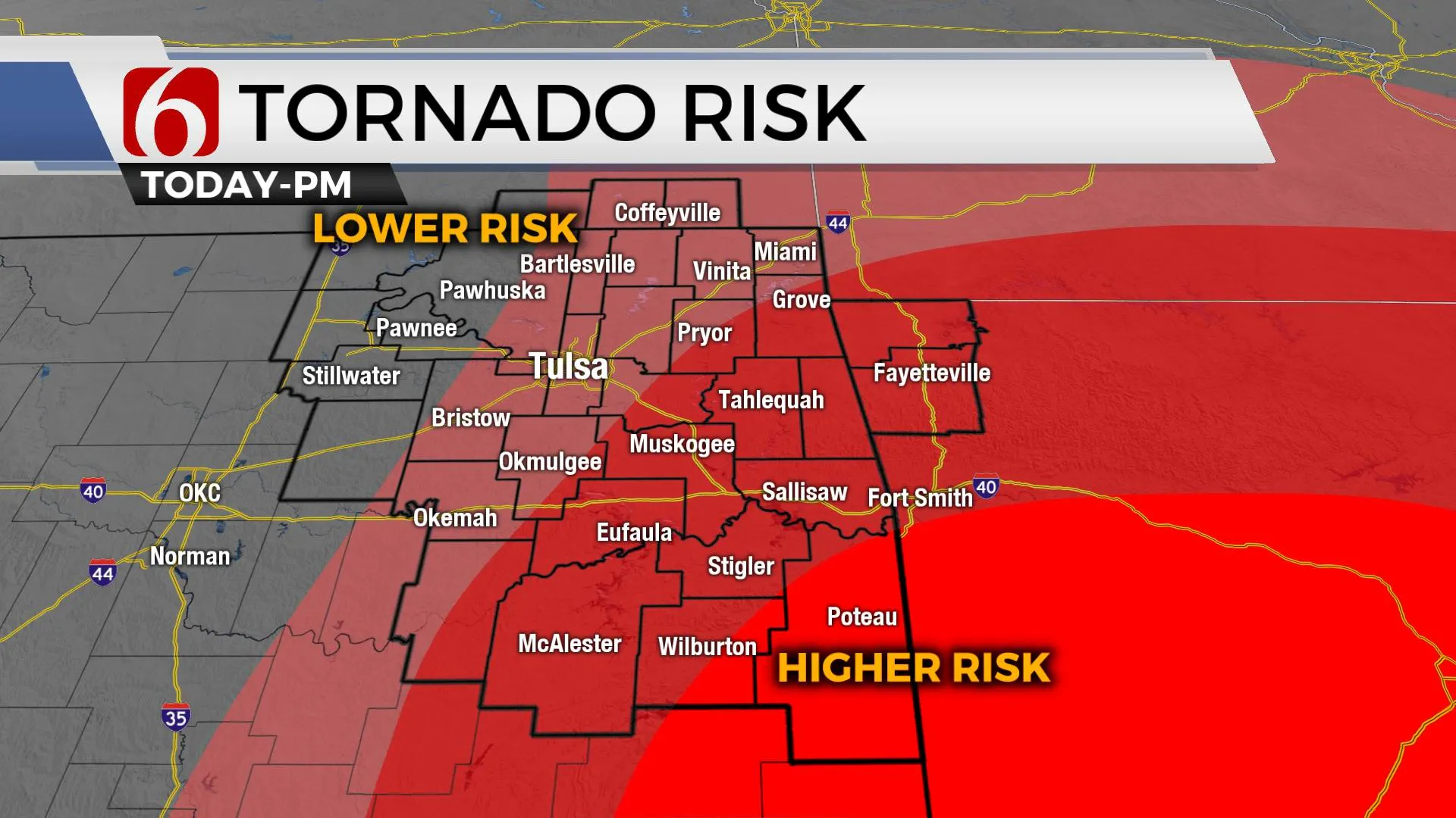
A powerful storm system will quickly move across the state today with the chance for some strong to severe thunderstorm development across the eastern third of the area. Higher probabilities for strong and severe weather will be mostly confined to locations along and east of highway 69. All modes of severe weather will be possible, including the chance for a few tornadoes. As this system exits the area later tonight, cooler weather arrives Tuesday and will remain for a few days before another system nears the state next weekend.
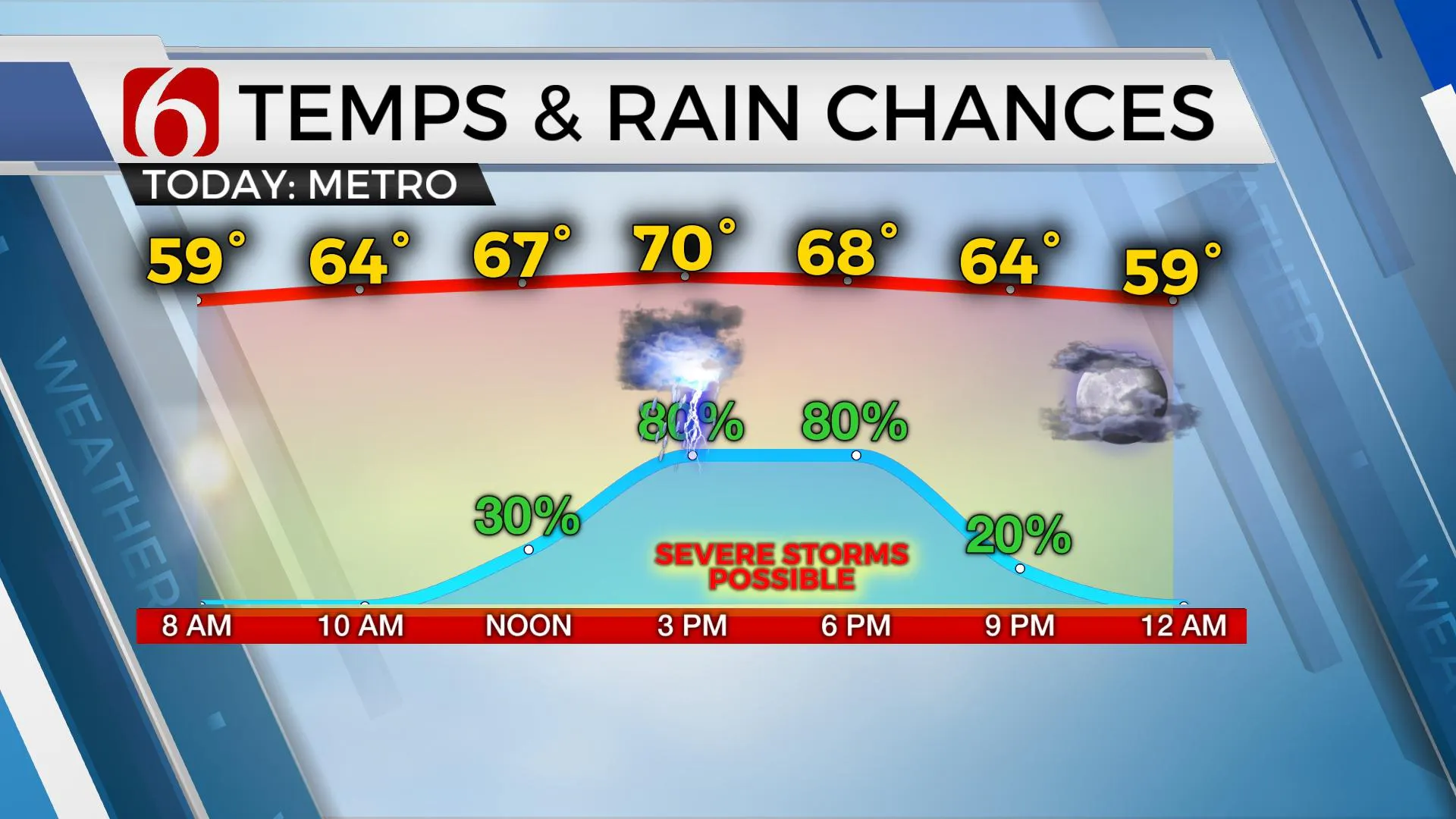
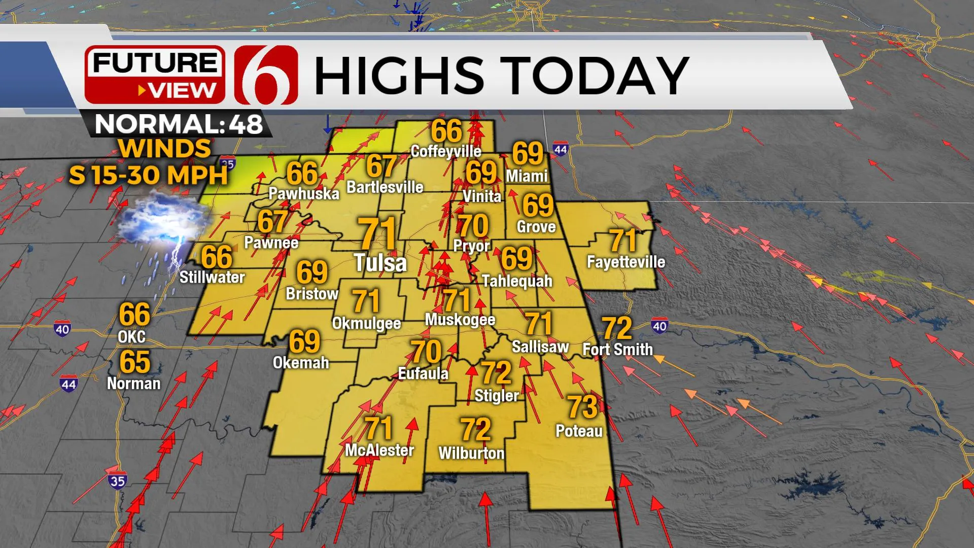
Highs today will range into the upper 60s to lower 70s. Tuesday morning lows begin in the mid-40s with highs in the mid-50s. Chilly weather arrives Wednesday with morning lows in the 20s and daytime highs only in the mid-40s.
A strong upper-level system is located west of the area this morning and will move eastward by afternoon and evening. Strong southeast winds will bring low level moisture north, with dew point temps nearing lower 60s as far north as I-40. The expected cloud cover may keep daytime highs in the mid to upper 60s, but any suns breaks yield convective and potential energy sufficient for strong updrafts. Deep layer wind shear will provide more than efficient lift for rotating updrafts with thunderstorms by afternoon. The lack of higher surface instability may be overcome by the strong shear and severe storm formation will be possible, even likely across part of the area. The system seems to be slightly slower in the data this morning and could bring severe threats more northward. Regardless, remain aware of your weather surroundings later today and early evening.
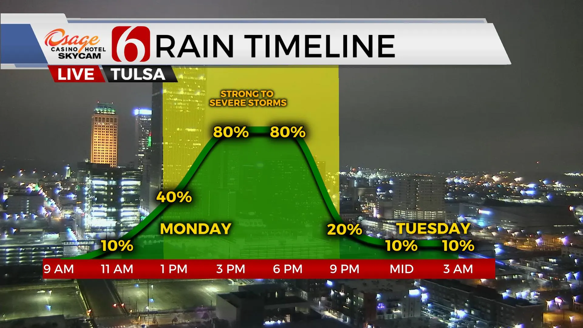
Timing in cool season events can be tricky, but most data support a window from 1pm until 10pm tonight with the main metro window from 3pm to 7pm. A few discrete supercells may develop later this morning across northeast Texas and southeastern OK and quickly spread northeast. A pacific front nearing I-35 by afternoon will sweep across the area early this evening producing some linear configuration of storms. As the front exits the area tonight, the threat for severe weather will end.
Thanks for reading the Monday morning weather discussion and blog.
Have a super great day!
More Like This
January 2nd, 2023
November 27th, 2024
November 27th, 2024
November 27th, 2024
Top Headlines
November 27th, 2024
November 27th, 2024
November 27th, 2024
November 27th, 2024


