Chilly Weather Takes Hold As 2025 Begins
Oklahoma Weather Forecast: Bookmark this page and refresh it often for the latest forecast and daily updates.Wednesday, January 1st 2025, 5:33 pm
TULSA, Okla. -
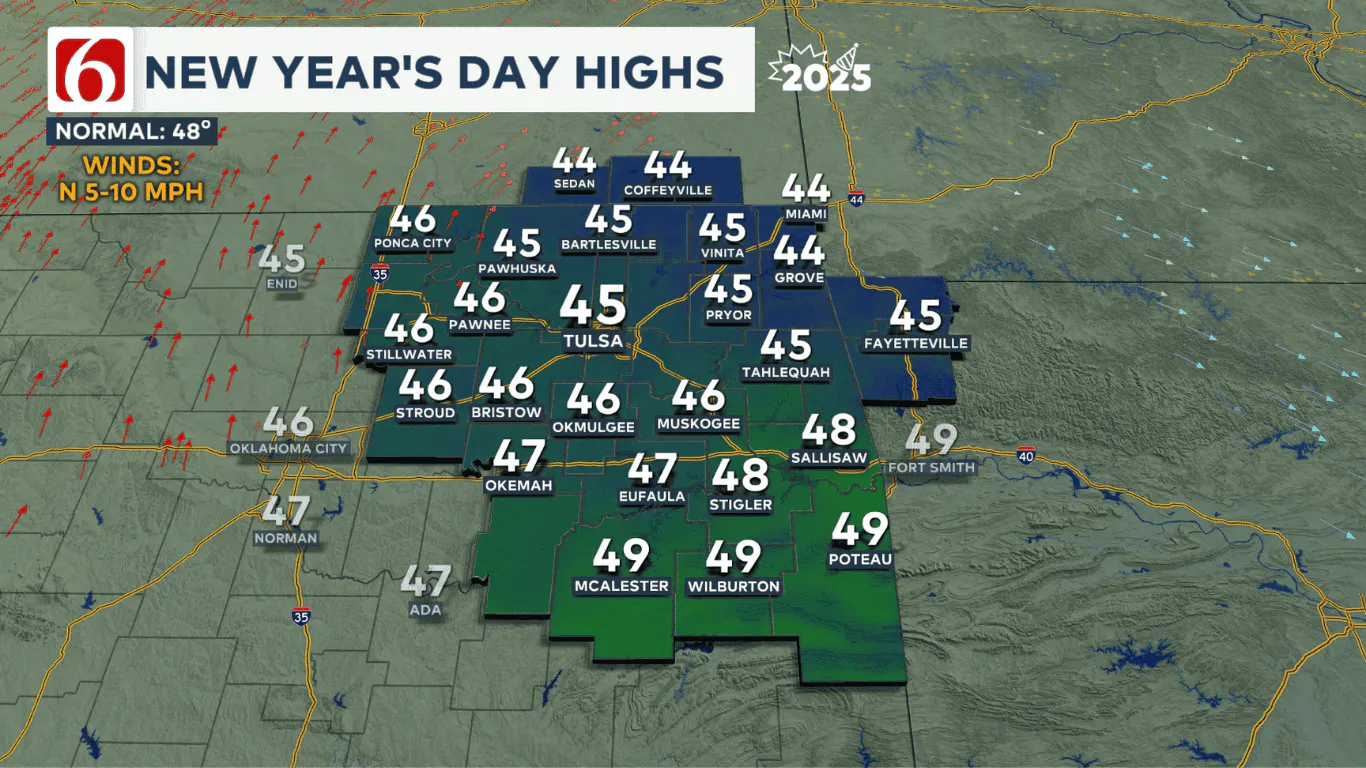
Happy New Year, everyone! Our first day of 2025 will be a chilly but calm day across Green Country.
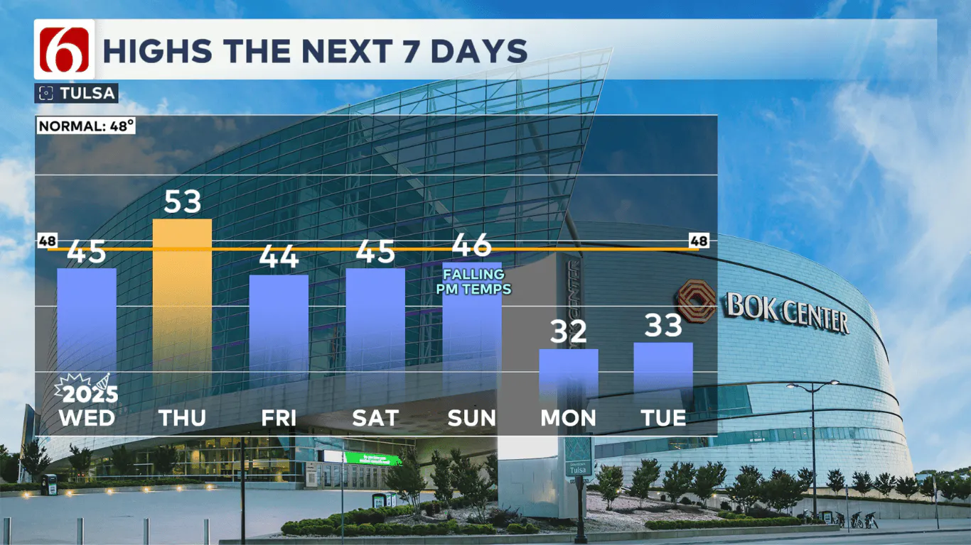
High pressure will slide across our area today, leading to much lighter winds. We’ll have a nice-looking New Year’s afternoon with mostly sunny skies returning and seasonable high temperatures in the mid-40s.

Thursday will bring a brief return to south winds and a bit of a temperature rebound. Highs look to reach the lower to mid-50s Thursday afternoon ahead of another cold front that pushes into Green Country late Thursday night. Friday’s temperatures will take a tumble behind that cold front, with highs falling back into the lower to mid-40s.

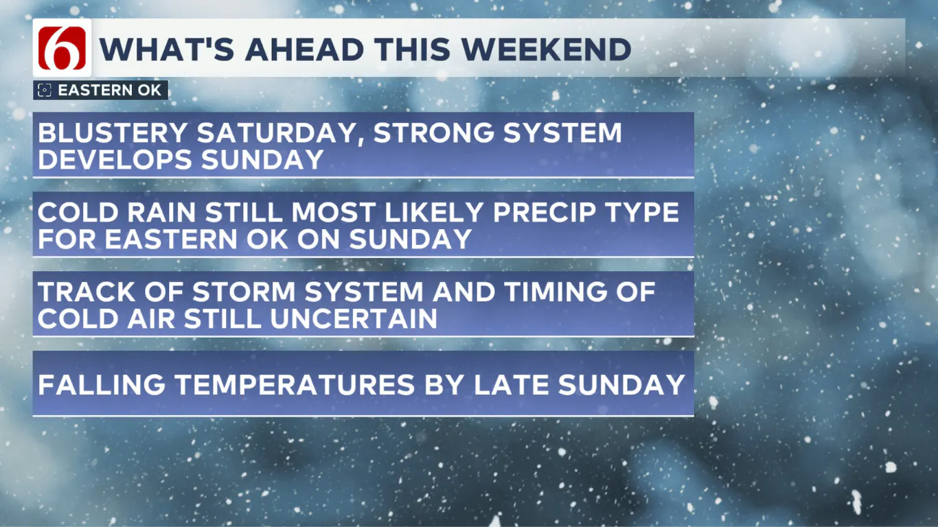
The forecast for the upcoming weekend remains quite unsettled, with many moving pieces that still need to be sorted out. As Arctic air begins to move into the northern United States, an upper-level trough in the Pacific Northwest will quickly strengthen and drop southeast towards Oklahoma by Sunday. With this system, a large amount of lift in the atmosphere will bring precipitation chances back into Oklahoma on Sunday, but the question for the past few days has been: What type (or types) of precipitation?
As precipitation develops on Sunday, the leading edge of a much colder airmass will be lined up just to our north across Kansas. The track of the center of the upper-level low will be crucial in determining how quickly that cold air arrives in Oklahoma and if it can produce wintry precipitation on Sunday.

As things stand right now, the most likely scenario will be for cold rain and possibly some storms across eastern Oklahoma on Sunday as the center of that upper-level low looks to track just to our north. If that forecast track holds, any meaningful changeover to wintry precipitation during the day Sunday would more likely be confined to northwestern Oklahoma and south-central Kansas. As the system exits late Sunday night into early Monday morning, there could be a brief window for some light wintry precipitation near the Oklahoma-Kansas state line.
With several days still to go between now and the weekend, this forecast could still change quite a bit! A southward shift in the storm track would potentially bring wintry weather chances back up for parts of northeastern Oklahoma and southeastern Kansas late Sunday if that occurs. We’ll be monitoring the trends closely and keeping you updated!
Emergency Info: Outages Across Oklahoma:
Northeast Oklahoma has various power companies and electric cooperatives, many of which have overlapping areas of coverage. Below is a link to various outage maps.
Indian Electric Cooperative (IEC) Outage Map
Oklahoma Association of Electric Cooperatives Outage Map — (Note Several Smaller Co-ops Included)
The Alan Crone morning weather podcast link from Spotify:
https://open.spotify.com/show/0dCHRWMFjs4fEPKLqTLjvy
The Alan Crone morning weather podcast link from Apple:
Follow the News On 6 Meteorologists on Facebook!

More Like This
January 1st, 2025
January 1st, 2025
January 1st, 2025
January 1st, 2025
Top Headlines
January 1st, 2025
January 1st, 2025
January 1st, 2025
January 1st, 2025


