Weather Blog: A Series Of Storm Systems This Week
Oklahoma Weather Forecast: Bookmark this page and refresh it often for the latest forecast and daily updates.Monday, December 23rd 2024, 6:15 am
TULSA, Okla. -
Rain Returning Tonight
A series of storm systems will influence our weather this week, starting with one later tonight. Another system arrives right after Christmas, and a third may affect extreme eastern Oklahoma late Friday night.
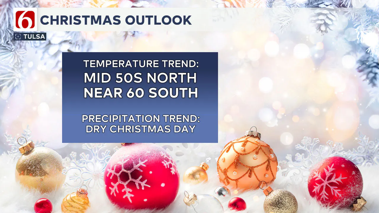
A few showers may linger early Christmas Eve morning, but most of Christmas Day will be dry with daytime highs in the mid-50s. This above-normal weather pattern will continue for the next seven days, with colder weather likely returning as the new year arrives.
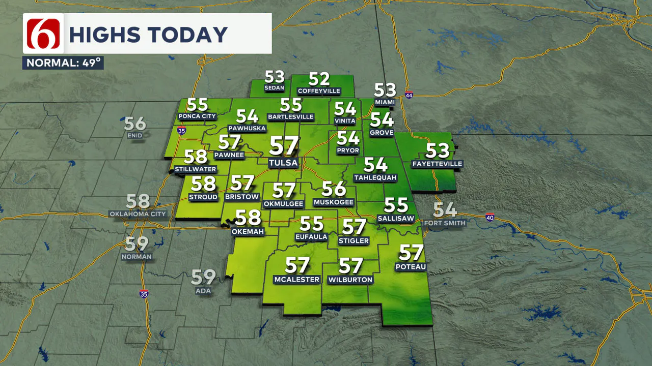
This afternoon, highs in the Tulsa metro area are expected to be in the mid to upper 50s with mostly cloudy conditions and south winds at 10 to 15 mph.

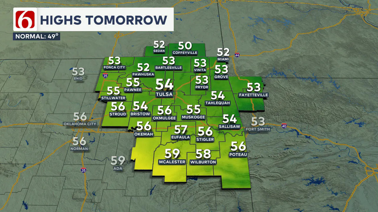
A few spotty showers may develop midday into early afternoon, but the higher likelihood of rain arrives later tonight through early Tuesday morning. Christmas Eve morning will start with some nearby showers and a low in the mid-40s. The afternoon will be mostly cloudy and dry with highs in the mid-50s and north winds at 10 to 15 mph.

🎄Christmas Day will start with a low in the lower 40s and highs in the mid-50s. Mostly cloudy conditions are expected along with northeast winds at 7 to 12 mph.

Tracking Severe Upper-Level Systems
The first upper-level wave will brush the area later tonight and early tomorrow morning. Higher instability and convective potential energy will be focused south of our immediate area. Severe weather is not anticipated in our immediate area of concern.
A few rumbles of thunder will be possible, mostly in southeastern Oklahoma late tonight and early tomorrow morning. If this system does not slow down, most of Christmas Eve should be dry after the early morning hours.

What Happens After Christmas Day?
A second, stronger upper-level system will approach our area late Wednesday night into early Thursday morning. Deeper atmospheric moisture will support pockets of moderate to heavy rainfall with this system.
However, higher instability and convective potential energy should be focused along the Red River into parts of Texas. Although a few strong storms will be possible on Thursday, severe weather threats should remain south of our area.
Weekend Weather Pattern
The final and strongest wave in this series will approach the area with a lead wave arriving in eastern Oklahoma Friday night. This main trough will not exit our area until late Saturday night, but the influence for showers and storms will be mostly Friday night into pre-dawn Saturday along and east of Highways 69 and 75.
This system appears to be a possible severe weather maker, especially across parts of East Texas, the Arklatex region, and locations to the east. A few strong to severe storms will be possible late Friday night, mostly in extreme southeastern Oklahoma into western Arkansas. The actual probability of showers and storms will remain very low Friday night for most of our immediate area except the far eastern sections of the state.
Please remain aware that if this system slows down, the probability of thunderstorms will increase.
Even though the main upper-level trough will not clear the area until Saturday night, this should provide a pleasant weekend. Saturday morning temperatures will start in the lower 40s, with daytime highs near 60.
Sunday morning will start in the upper 30s with highs in the lower 60s. A few clouds are still possible on Saturday, but mostly sunny conditions are expected on Sunday.
The Extended Outlook
The extended outlook continues with mild temperatures early next week, but the pattern should bring much colder weather as the new year approaches.
Emergency Info: Outages Across Oklahoma:
Northeast Oklahoma has various power companies and electric cooperatives, many of which have overlapping areas of coverage. Below is a link to various outage maps.
Indian Electric Cooperative (IEC) Outage Map
Oklahoma Association of Electric Cooperatives Outage Map — (Note Several Smaller Co-ops Included)
The Alan Crone morning weather podcast link from Spotify:
https://open.spotify.com/episode/3rrYhq4ptHhrsS1rj5Ab7k
The Alan Crone morning weather podcast link from Apple:
Follow the News On 6 Meteorologists on Facebook!

More Like This
December 23rd, 2024
December 23rd, 2024
December 23rd, 2024
Top Headlines
December 23rd, 2024
December 23rd, 2024
December 23rd, 2024
December 23rd, 2024


