Weather Blog: Warm & Dry Monday With Cold Front Sweeping In Later
Oklahoma Weather Forecast: Bookmark this page and refresh it often for the latest forecast and daily updates.Monday, September 30th 2024, 1:10 pm
TULSA, Okla. -
The pattern keeps us warm and dry for the foreseeable future across Oklahoma, with no major storm systems for the next 7 to 10 days.
What is the weather like on Monday?
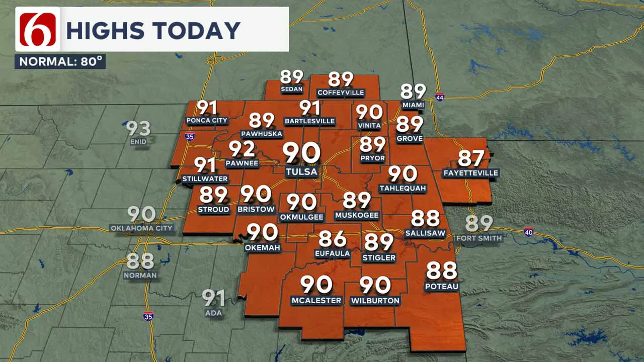
Afternoon highs in the metro area are expected to reach the upper 80s near 90 with a very light north wind.
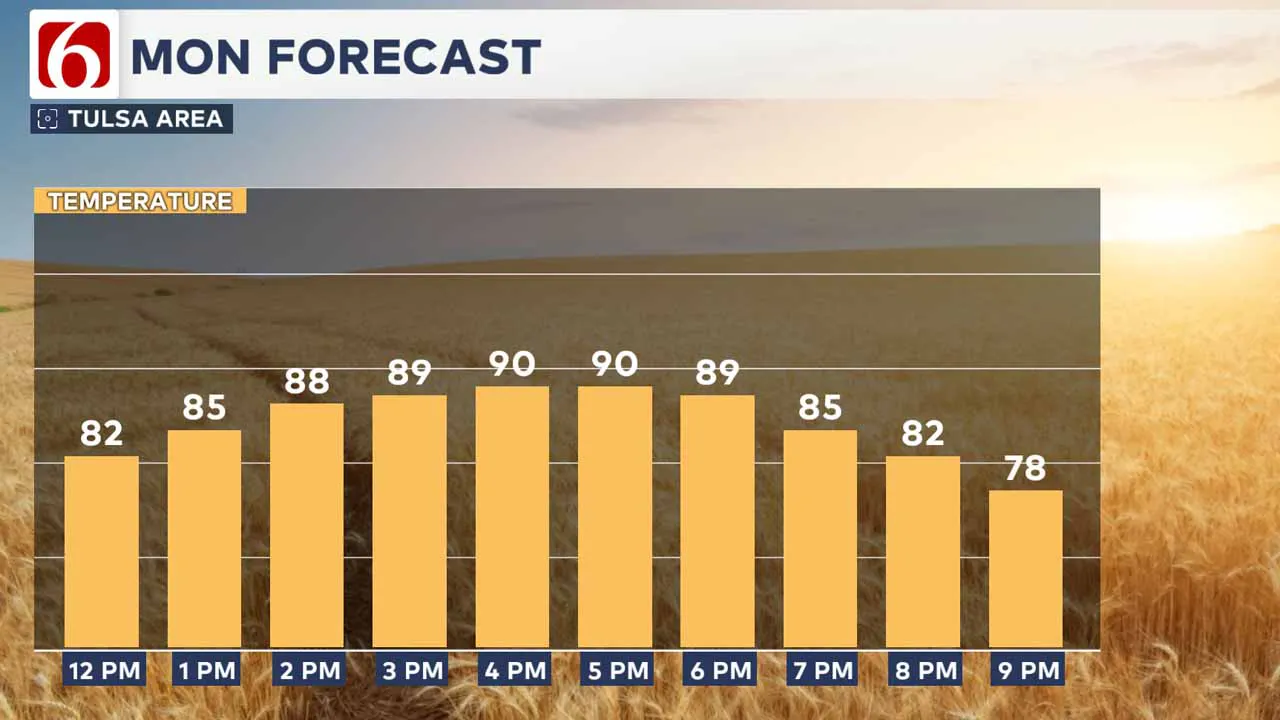
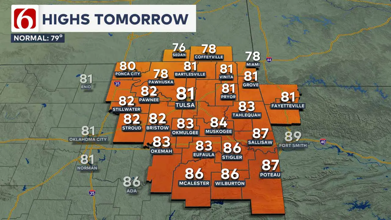
An incoming cold front is set to approach the area late Monday night and early Tuesday morning. As the front moves through early Tuesday, gusty north winds at 20 to 30 mph will follow with daytime highs reaching the upper 70s and lower 80s.
What is the weather like for the rest of the week?
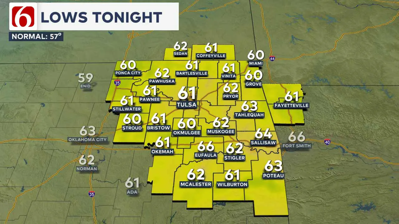
Tuesday will start with lows in the upper 50s to lower 60s along with sunny skies and highs in the upper 70s to lower 80s.
Gusty north winds of 20 to 30 mph are anticipated on Tuesday as the front moves across the area from north to south.
Unfortunately, no precipitation is anticipated. The dry conditions to the northwest of I-44 will likely lead to increased fire spread rates Tuesday afternoon.
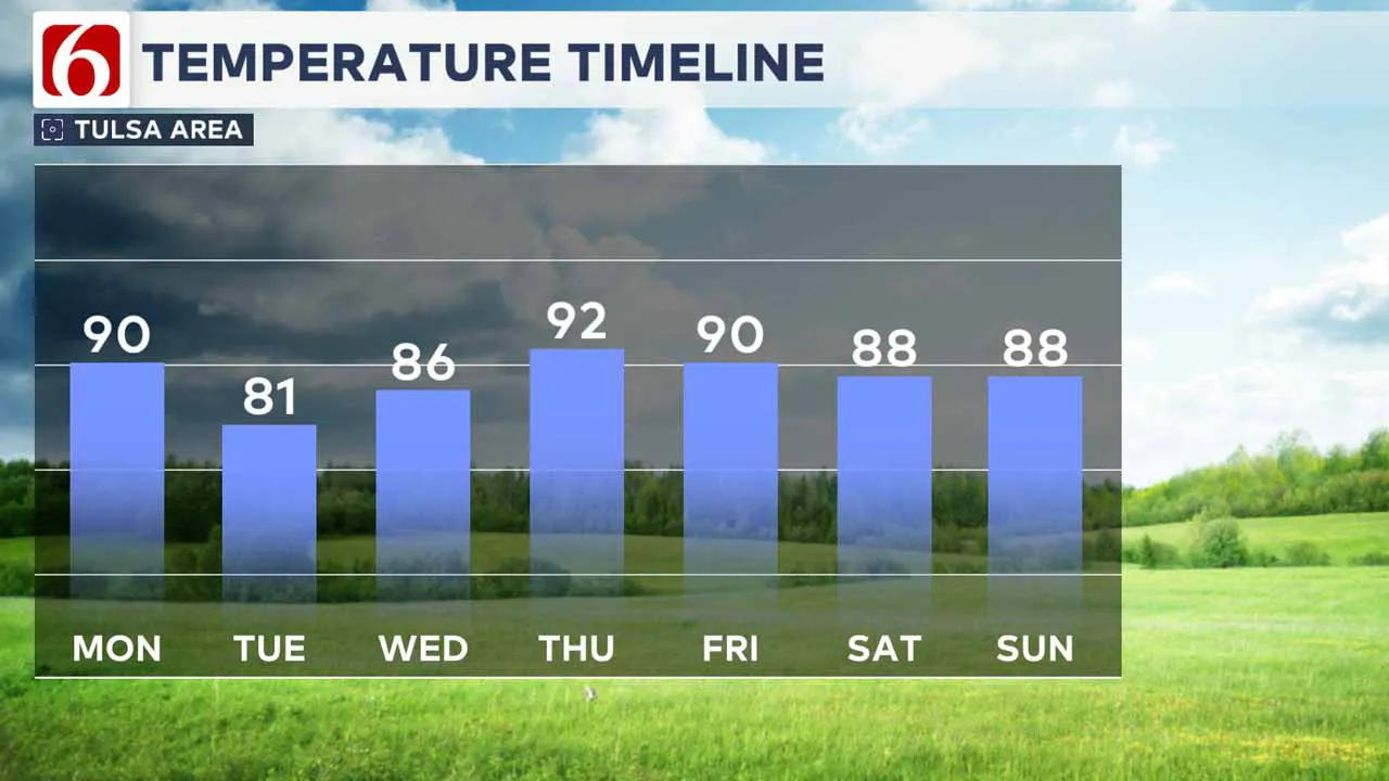
The main frontal impact will be felt on Wednesday morning with lows in the lower to mid-50s. Daytime highs on Wednesday will hit the mid-80s with south winds returning at 7 to 12 ph.
The front's effects will be brief, with south winds resuming on Wednesday and high temperatures approaching 90 degrees.
Daytime highs on Wednesday will hit the mid-80s with south winds returning at 7 to 12 mph.
Thursday's lows will begin in the mid-60s, with highs nearing 90. Expect morning lows in the 60s and daytime highs in the upper 80s to lower 90s for Friday and Saturday.
Another front should cross the area early next week but with only minor impacts.
In the meantime, several systems are currently active in the tropical Atlantic.
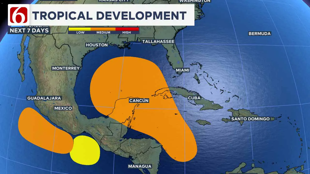
Tropical Storm Joyce and Tropical Storm Isaac are operational and expected to have minimal impacts. Tropical Depression 12 is projected to intensify into a major hurricane, but it will likely remain within the open waters of the Atlantic.
A broad low-pressure area over the Caribbean Sea is moving into a region favorable for development the next few days.
This system is expected to slowly move northwestward into the southern Gulf of Mexico later in the week and could develop into a named system, possibly a hurricane, within the next five to seven days.
Interests along the U.S. Gulf Coast region should monitor the progress of this evolving system.
Emergency Info: Outages Across Oklahoma:
Northeast Oklahoma has various power companies and electric cooperatives, many of which have overlapping areas of coverage. Below is a link to various outage maps.
Indian Electric Cooperative (IEC) Outage Map
Oklahoma Association of Electric Cooperatives Outage Map — (Note Several Smaller Co-ops Included)
The Alan Crone morning weather podcast link from Spotify:
https://open.spotify.com/episode/5yrCLrZVJ77OdHWEas7GHC
The Alan Crone morning weather podcast link from Apple:
https://podcasts.apple.com/us/podcast/weather-out-the-door/id1499556141?i=1000670919209
Follow the News On 6 Meteorologists on Facebook!

More Like This
September 30th, 2024
September 30th, 2024
September 30th, 2024
September 30th, 2024
Top Headlines
September 30th, 2024
September 30th, 2024
September 30th, 2024
September 30th, 2024


