Sunny And Chilly New Year's Day Ahead Of Weekend Arctic Front
Oklahoma Weather Forecast: Bookmark this page and refresh it often for the latest forecast and daily updates.Tuesday, December 31st 2024, 9:27 pm
OKLAHOMA CITY -
Happy New Year! Lots of sunshine to start 2025!
What is the weather like on Wednesday?
Lows in the morning will be in the 20s, with light winds with highs in the 40s by afternoon! This quiet weather continues ahead of the arrival of arctic air this weekend!
What does the rest of the week look like?
The rest of the week is quiet, with lows and highs close to normal.
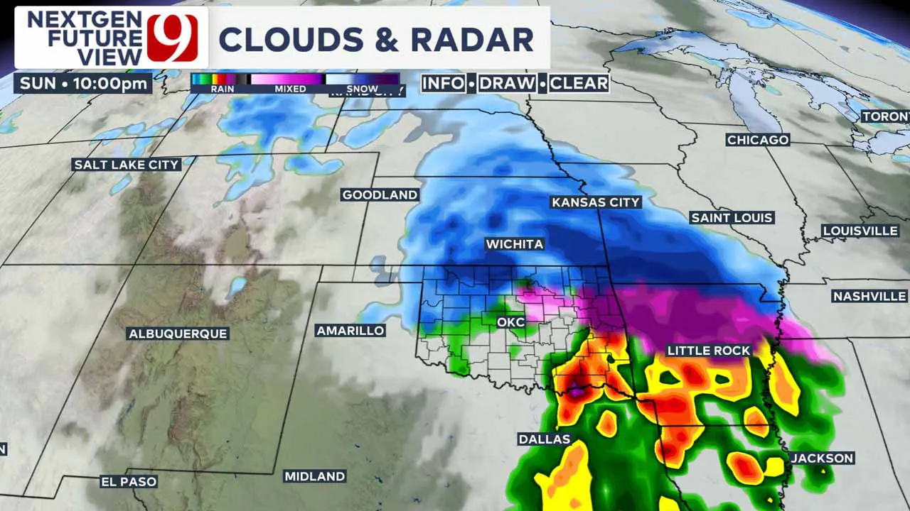
The arctic blast is still on track for Sunday! It will be timed with an upper-level storm coming in from the west.
This will spark rain and storms to the south and blowing snow to the north. The exact track of the low will determine who sees what impacts.

As of this morning, the track of the low is a little farther south. This brings more winter precipitation into Oklahoma.
Especially into northern Oklahoma with accumulating snow possible. The cut-off for winter precip will be around I-40.
That means the OKC metro may see rain change over to ice to sleet to eventually some light snow by Monday night.
As of now, the worst travel conditions look to be in Kansas and Missouri with slick spots possible in northern Oklahoma by Monday morning.
Of course, the totals and the precip zones will still change. This storm is 4,000 miles and 5 days away. Stay tuned.
2024 Weather Recap
This year brought Oklahoma a mix of highs and lows in weather trends:
- Snowfall: Oklahoma City recorded just 3.4 inches of snow this year, well below the average of 7.6 inches. We had small amounts in January, February, and March but nothing major.
- Rainfall: On the flip side, it was a wetter-than-average year with 37.11 inches of rain—three-quarters of an inch above normal. November stood out as the wettest month of the year, with a historic rainfall total, while August also brought significant amounts.
- Severe Weather: Oklahoma saw 148 tornadoes in 2024, just shy of the record 149 set in 2020. Among the most active counties were Roger Mills and Ottawa, with six tornadoes each. While there were no EF-5 tornadoes, two EF-4s caused devastating impacts to several communities.
----
Follow our meteorologists!
More Like This
December 31st, 2024
December 31st, 2024
December 31st, 2024
December 31st, 2024
Top Headlines
December 31st, 2024
December 31st, 2024
December 31st, 2024
December 31st, 2024


