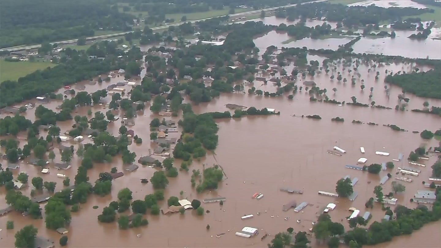
Weather, Flooding Updates: OHP Announces Latest Road Closures
City of Tulsa officials say the Evacuation Shelter at Crosstown is at capacity.
Wednesday, May 29th 2019, 12:18 pm
By:
News On 6
More rain and thunderstorms, some of them severe, are moving through eastern Oklahoma Wednesday, exacerbating flooding problems.
While the tornado risk is low, there is a risk. The National Weather Service issued a tornado watch for Choctaw, Haskell, Latimer, Le Flore, McCurtain, Pushmataha and Sequoyah counties until 8 p.m.
The Department Of Public Safety wants to remind everyone they have a great way to find all closure information at OKRoads.org. The site is maintained by DPS and updated regularly.
***
(1:48 p.m.) Highway closures from the Oklahoma Highway Patrol, Troop L:
Craig County:
None
Delaware County:
SH127 west of US59
Mayes County:
None
Nowata:
SH10 eastbound and westbound from US169 to the Craig/Nowata County line
SH28 between US169 and US60
Ottawa County:
SH125 at SH10
US69 northbound and southbound from 30RD to the Oklahoma/Kansas State line
US69 eastbound and westbound from the Neosho River to NS545RD
Washington County:
SH123 between Bartlesville and Dewey
SH11 northbound and southbound at East 186th Street North
Will Rogers Turnpike:
None
Cherokee Turnpike:
None
***
(1:42 p.m.) Highway closures from the Oklahoma Highway Patrol, Troop C:
Adair County:
None
Cherokee County:
SH80 north of Fort Gibson
SH80 west of Hulbert
Haskell County:
None
McIntosh County:
None
Muskogee County:
US62 between Muskogee and Fort Gibson
US62 at SH80 in Fort Gibson, westbound lanes only
SH10 at the US62 junction in Fort Gibson
SH10 south of Braggs at Greenleaf State Park
US69 at SH51B south of Wagoner, southbound lanes only
SH100/US64 east of Webbers Falls to near Gore
Sequoyah County:
US64 from Roland to Arkansas line
Wagoner County:
SH104 at Haskell and SH51B
SH72 south of Coweta at the Arkansas River
Muskogee Turnpike:
None
***
Updates as of 1:38 p.m.:
From the City of Coweta:
Water is rising in some areas. Please make sure you are paying attention to your surroundings throughout the day.
From the City of Wagoner:
If you are in need of sand bags, they are located in the Fred's Parking Lot at 700 E Cherokee. Many of our streets are flooded and the City and Wagoner Public Works Authority are working diligently to get barricades out. Please DO NOT drive around barricades, this puts you and our Emergency Management Teams at risk.
From Oklahoma Department of Transportation:
Westbound I-40 is narrowed to one lane at the Arkansas River Bridge between SH-100 to Webbers Falls (mm 287) and the Muskogee Turnpike (mm 286) in Muskogee County due to a crash. Motorists can expect significant delays and congestion in this area.
***
(12:42 p.m.) Highway closures from the Oklahoma Highway Patrol, Troop C:
Tulsa County:
SH51 from 145th W Ave to Avery Dr.
Rogers County:
US169 approximately two miles north of Talala.
SH88 approximately five miles north of Claremore
Related Story:
Creek County:
None
Okmulgee County:
None
Creek Turnpike:
None
***
City of Tulsa officials say the Evacuation Shelter at Crosstown is at capacity.
The shelter at Faith Church at 1901 W 171st Street is still open.
Officials ask if you need shelter from flooding, go to Faith Church at 1901 W 171st Street.

Get The Daily Update!
Be among the first to get breaking news, weather, and general news updates from News on 6 delivered right to your inbox!
","published":"2019-05-29T17:18:25.000Z","updated":"2019-05-29T21:43:02.000Z","summary":"City of Tulsa officials say the Evacuation Shelter at Crosstown is at capacity.","affiliate":{"_id":"5c784a0c4961cb23ad330098","callSign":"kotv","origin":"https://www.newson6.com"},"contentClass":"news","createdAt":"2020-02-01T18:37:41.010Z","updatedAt":"2025-04-15T02:35:34.308Z","__v":46,"breakingNews":[],"entities":[{"_id":"624219e96880e45323a151e7","text":"Choctaw","type":"LOCATION","__v":0},{"_id":"62421bae6880e45323a4a516","text":"Haskell","type":"LOCATION","__v":0},{"_id":"62421d526880e45323a79072","text":"Latimer","type":"LOCATION","__v":0},{"_id":"624224306880e45323b3b5b1","text":"Le Flore","type":"LOCATION","__v":0},{"_id":"624221c26880e45323af69fa","text":"McCurtain","type":"LOCATION","__v":0},{"_id":"62421e216880e45323a8fbb3","text":"Pushmataha","type":"LOCATION","__v":0},{"_id":"62421d526880e45323a790b1","text":"Sequoyah","type":"LOCATION","__v":0},{"_id":"62421ce36880e45323a6c513","text":"Craig County","type":"LOCATION","__v":0},{"_id":"6239c4536880e4532356a749","text":"Delaware County","type":"LOCATION","__v":0},{"_id":"6239418e6880e453231152c5","text":"Mayes County","type":"LOCATION","__v":0},{"_id":"62421ea76880e45323a9d538","text":"Nowata","type":"LOCATION","__v":0},{"_id":"6245ffe16880e45323dd65f8","text":"SH10","type":"LOCATION","__v":0},{"_id":"62437afd6880e45323b0bead","text":"US169","type":"LOCATION","__v":0},{"_id":"6245ffe16880e45323dd6603","text":"SH28","type":"LOCATION","__v":0},{"_id":"62421a586880e45323a20dc5","text":"US60","type":"LOCATION","__v":0},{"_id":"62421ca86880e45323a6595c","text":"Ottawa County","type":"LOCATION","__v":0},{"_id":"62421a956880e45323a29647","text":"US69","type":"LOCATION","__v":0},{"_id":"6238f1556880e45323d020b5","text":"Oklahoma","type":"LOCATION","__v":0},{"_id":"6242210b6880e45323ae0e53","text":"Neosho River","type":"LOCATION","__v":0},{"_id":"6245ffe16880e45323dd6616","text":"NS545RD","type":"LOCATION","__v":0},{"_id":"6238f9d56880e45323d7a381","text":"Washington County","type":"LOCATION","__v":0},{"_id":"623fcd0c6880e453233d1dfa","text":"Bartlesville","type":"LOCATION","__v":0},{"_id":"62421aa66880e45323a2b78d","text":"Dewey","type":"LOCATION","__v":0},{"_id":"624219ee6880e45323a15a30","text":"Cherokee","type":"LOCATION","__v":0},{"_id":"62421a646880e45323a22666","text":"Adair County","type":"LOCATION","__v":0},{"_id":"62421c5e6880e45323a5d67a","text":"Cherokee County","type":"LOCATION","__v":0},{"_id":"6245ffe26880e45323dd667c","text":"SH80","type":"LOCATION","__v":0},{"_id":"62421ef06880e45323aa5042","text":"Fort Gibson","type":"LOCATION","__v":0},{"_id":"62421a8d6880e45323a289fb","text":"Hulbert","type":"LOCATION","__v":0},{"_id":"62421da06880e45323a81df3","text":"Haskell County","type":"LOCATION","__v":0},{"_id":"6240f6116880e45323ec2cde","text":"McIntosh County","type":"LOCATION","__v":0},{"_id":"62421cc86880e45323a697b4","text":"Muskogee County","type":"LOCATION","__v":0},{"_id":"6245ffe26880e45323dd66d3","text":"US62","type":"LOCATION","__v":0},{"_id":"62421d556880e45323a796ef","text":"Braggs","type":"LOCATION","__v":0},{"_id":"6242255d6880e45323b5c4bc","text":"Greenleaf State Park","type":"LOCATION","__v":0},{"_id":"62421b4a6880e45323a3edb6","text":"Wagoner","type":"LOCATION","__v":0},{"_id":"62391cbb6880e45323f567a7","text":"Webbers Falls","type":"LOCATION","__v":0},{"_id":"62421d5d6880e45323a7a6ab","text":"Sequoyah County","type":"LOCATION","__v":0},{"_id":"624222526880e45323b06b0c","text":"Roland","type":"LOCATION","__v":0},{"_id":"62391cbb6880e45323f567b2","text":"Arkansas","type":"LOCATION","__v":0},{"_id":"62421b516880e45323a3f684","text":"Wagoner County","type":"LOCATION","__v":0},{"_id":"6245ffe26880e45323dd6737","text":"SH51B","type":"LOCATION","__v":0},{"_id":"62421b276880e45323a3a580","text":"Coweta","type":"LOCATION","__v":0},{"_id":"62411a786880e4532303c875","text":"Arkansas River","type":"LOCATION","__v":0},{"_id":"624220516880e45323acc161","text":"Department Of Public Safety","type":"ORGANIZATION","__v":0},{"_id":"623911076880e45323ebbbbf","text":"Oklahoma Highway Patrol","type":"ORGANIZATION","__v":0}],"hasBeenCheckedForEntities":true,"openInNewWindow":false,"rendered":65,"peerReviewer":"5c7850eac1778925af4208da","peerReviewedOn":"2025-04-05T20:12:26.524Z","show":true,"link":"/story/5e35c5752f69d76f62012a3d/weather-flooding-updates:-ohp-announces-latest-road-closures","hasSchedule":false,"id":"5e35c5752f69d76f62012a3d"};


