Windy And Warm Across Oklahoma With Rain On Easter
<p>Warm and windy weather continues to kick off our Easter weekend, but rain chances are looming as we head into the big holiday on Sunday.</p>Saturday, April 15th 2017, 8:55 am
Warm and windy weather continues to kick off our Easter weekend, but rain chances are looming as we head into the big holiday on Sunday.
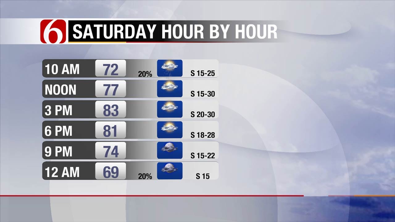
A small area of low pressure will shift quickly across northeastern Oklahoma and southern Kansas this morning, and as this happens a few isolated showers could develop with potentially a few rumbles of thunder as well. The chance for any one location to see rain is low, but that possibility will exist through late morning.
After a brief window for isolated showers, expect another day of warm and windy conditions for our Saturday with a mix of clouds and sunshine. Highs look to climb back to the low 80s this afternoon with south winds gusting over 30 miles per hour.
Scattered strong to severe storms will begin to develop across northwestern Oklahoma and into Kansas by this evening, but our main storm chances will start to arrive after midnight Sunday. Storms are expected to gradually shift south into northeastern Oklahoma by Sunday morning, and Easter sunrise services could be impacted particularly for our counties north of I-40. Fortunately, the severe weather risk appears low here in Green Country.
Temperatures should be mild for Easter with 60s in the morning and 70s in the afternoon. Scattered showers and storms will continue to shift a bit further south during the day Easter Sunday, with chances starting to increase a bit more for southeastern Oklahoma by that time. It shouldn’t be an all-day washout for our Easter here in Green Country, but there will be a chance for a scattered storm or two in just about any location through the day Sunday.
The chance for widely scattered storms will continue into Monday as a weak frontal boundary hangs near the area. Like Sunday, multiple areas of scattered storms are expected to develop across eastern Oklahoma on Monday. Again, the severe weather threat appears low though a few strong storms could occur.
A brief lull in storm chances could return by Tuesday, but additional rounds of storms are expected to impact at least parts of Green Country once again by mid to late next week as we remain in an unsettled and active weather pattern. Severe weather chances may ramp up more noticeably by the end of next week, so we’ll be watching!
More Like This
April 15th, 2017
January 2nd, 2025
September 29th, 2024
September 17th, 2024
Top Headlines
January 21st, 2025
January 21st, 2025
January 21st, 2025
January 21st, 2025


