Fall Cold Front Arrives Tuesday Bringing Rain, Storm Chances
The big blue norther is moving in Tuesday!Tuesday, September 8th 2020, 6:51 am
The big blue norther is moving in Tuesday!
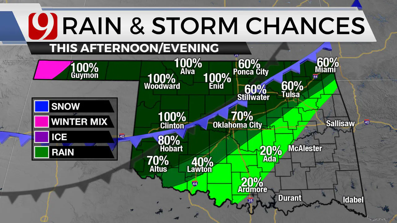
Look for rain and storm chances to go up as the front arrives.
There will be heavy rain at times, intense lightning, and localized flash flooding.


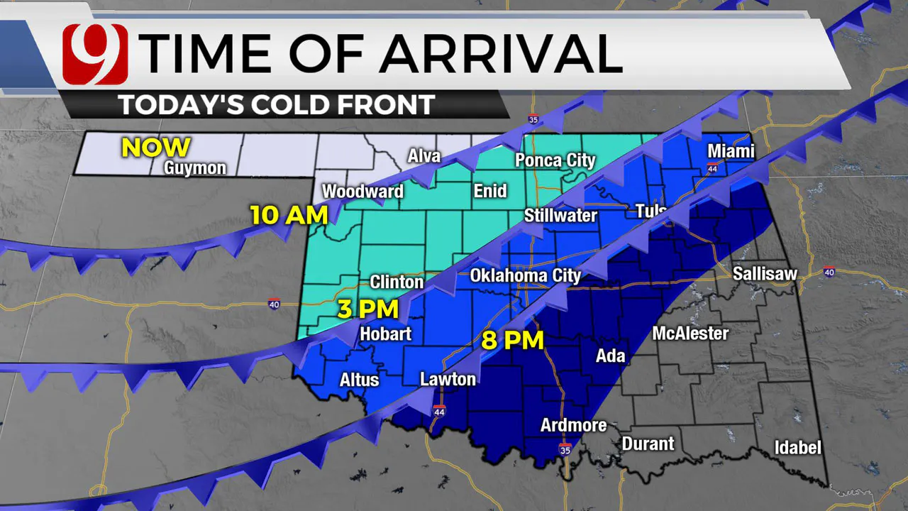
As the front moves into your hometown, look for strong north winds up to 40 mph, falling temps, and increasing rain chances.
For the Oklahoma City metro, the front arrives between 6 and 8 p.m. The cold front will have very little impact on the eastern sides of the state.
Tuesday night there will be lows in the 40s, 50s, and 60s.

Wind chill will be a factor Wednesday morning.
Rounds of rain will likely mean record cool temperatures for some both Wednesday and Thursday. With several rounds of rain on the way for western Oklahoma, we could see some localized flash flooding in the southwest.

More Like This
September 8th, 2020
March 12th, 2025
March 12th, 2025
March 12th, 2025
Top Headlines
March 12th, 2025
March 12th, 2025


