Severe Storm Chances Return To Green Country
A warm and windy day is ahead, but the chance for severe storms returns Friday evening.Friday, April 15th 2022, 6:22 am
TULSA, Oklahoma -
A warm and windy day is ahead, but the chance for severe storms returns Friday evening.
Here are the details from News On 6 Meteorologist Alan Crone:
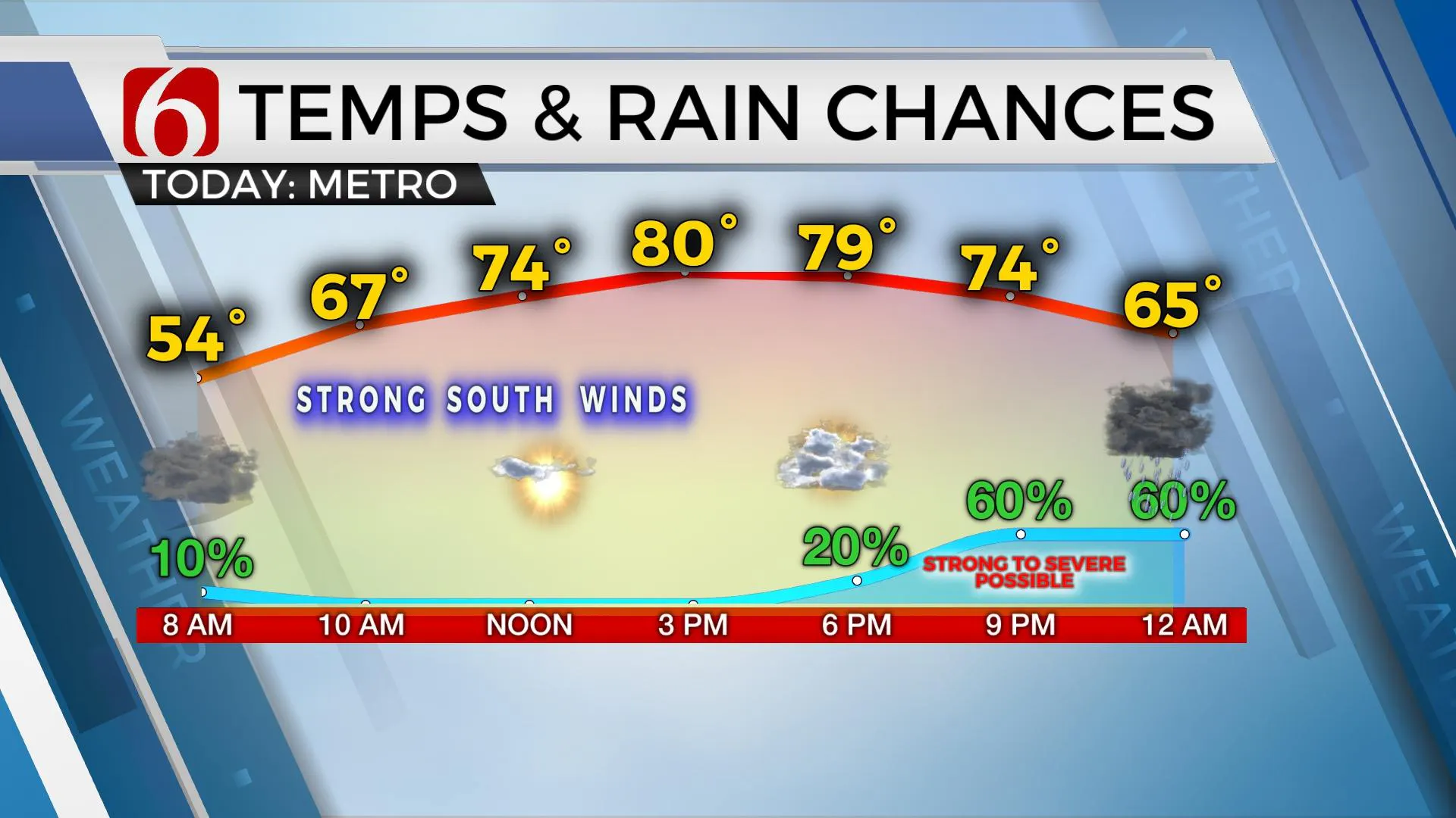
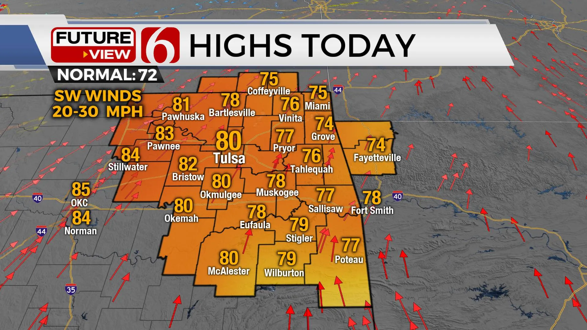
A few showers and storms will be possible during the next few hours across extreme northern OK and southern Kansas as relatively warm and moist air returns from the south as our next storm system approaches the state. Gusty south to southwest winds from 20 to 35 mph will be likely again with afternoon highs in the upper 70s and lower 80s. While the main stronger belt of westerlies remains well north of the state, a small and potent vort max is likely to arrive later tonight and exit the area early Saturday morning. A surface cold front is scheduled to develop across southern Kansas this afternoon with a surface area of low pressure deepening along the Red River. Moisture will feed into the frontal zone tonight as the vort nears and storms will attempt to develop. If any storm can develop ahead of the front, or with the updraft on the warm side of the boundary, all modes of severe weather would be possible, including large hail, damaging winds, a tornado warning or two, and extremely heavy rainfall.

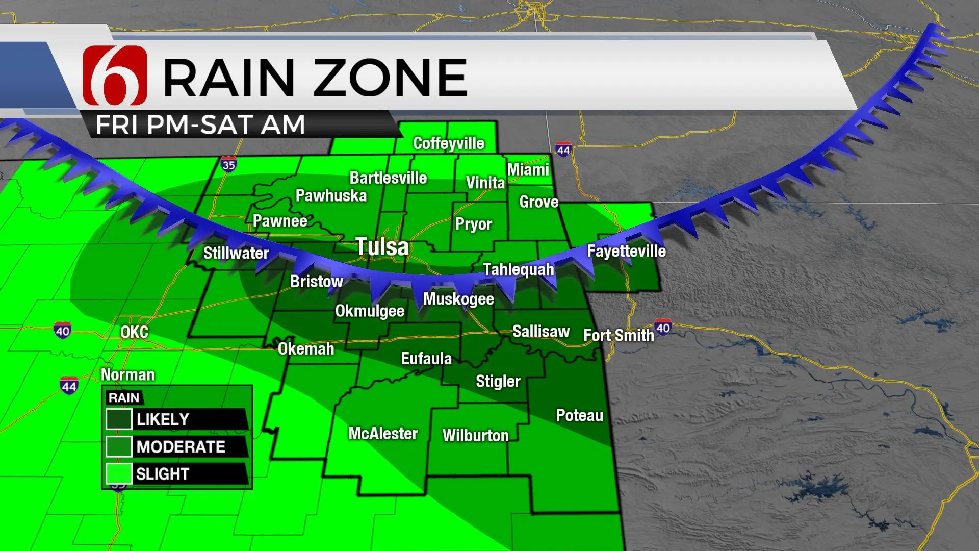
This window for any surface-based storm activity seems small, mostly for a few hours Friday evening. Later into the overnight hours, most storms should become more elevated as the front surges southward. A swath of 1 to 2-inch rainfall is possible in some locations. Higher likelihood of any flood issues will remain across extreme eastern OK and western AR late Friday night and overnight where a flood watch has been posted. Leftover showers seem plausible early Saturday morning in a few spots as the front moves into the Texoma region with northeast winds and upper 40s likely across northeastern OK. Daytime temps Saturday may be cooler than our current advertisement, but we continue to keep highs much cooler than most model guides with readings in the upper 50s north and lower 60s south. After a few lingering showers across northern OK early Saturday morning, most of the precip will be focused into southeastern OK by Saturday afternoon and evening.

Sunday another wave nears the state from the west to east and should bring a few scattered showers into part of the area. Easter Sunday morning temps will be in the upper 40s and lower 50s with highs in the upper 50s and lower 60s in eastern OK with warmer weather to the west. Another front moves across the area Sunday afternoon bringing cool and pleasant conditions Monday. Storm chances will return Tuesday night into Wednesday as our progressive weather pattern remains.

Thanks for reading the Friday morning weather discussion and blog.
Have a super great day!
Alan Crone
KOTV
If you’re into podcasts, check out my daily weather update. Search for NewsOn6 and ‘Weather Out The Door’ on most podcast providers, including Spotify, Stitcher and Tune-In, or Click Here to listen on Apple Podcasts.
More Like This
April 15th, 2022
June 21st, 2023
June 19th, 2023
June 13th, 2023
Top Headlines
December 15th, 2024
December 15th, 2024
December 14th, 2024


