Severe Weather Moves Out Of Green Country Overnight
A day of warm and windy weather is ahead before a storm system nears the area, bringing shower chances back to Green CouThursday, April 20th 2023, 12:56 am
Severe weather has slowly moved out of Green Country overnight, after several severe thunderstorm warnings were issued Wednesday night.
Several warnings were issued across Oklahoma, as well as tornado watches.
Southern Oklahoma was hit the hardest by storms, with some areas experiencing tornado warnings and serious storm damage.
Weather Update 12:25 a.m.: Severe Thunderstorm Warning for Muskogee and Okmulgee County in OK until 1:00am.
If you’re into podcasts or in a rush, check out my daily weather update. Search for NewsOn6 and ‘Weather Out The Door’ on most podcast providers, including Spotify, Stitcher and Tune-In, or Click Here to listen on Apple Podcasts.
TULSA, Okla. - A day of warm and windy weather is ahead before a storm system nears the area, bringing shower chances back to Green Country.
Here are the details from News On 6 Meteorologist Alan Crone:

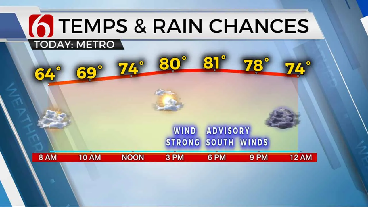
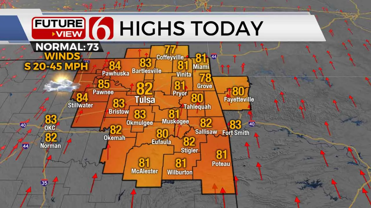
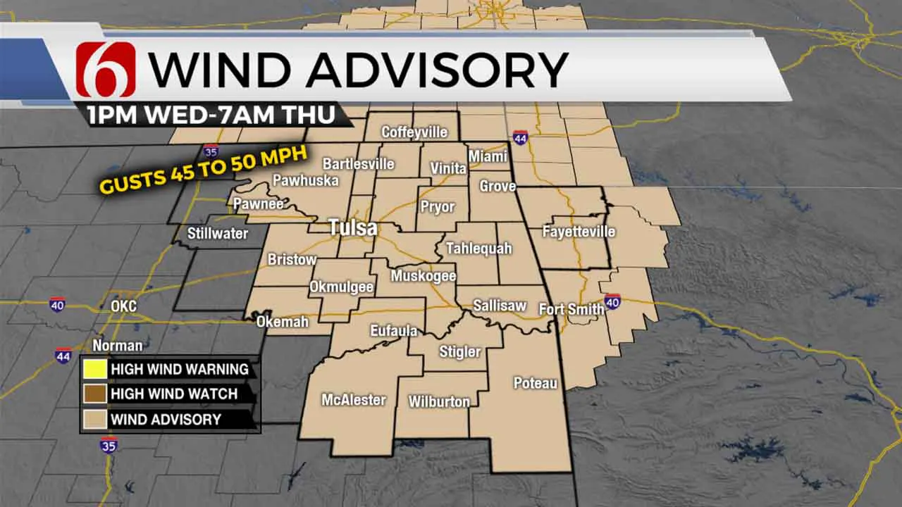
Very windy weather remains on Wednesday with highs in the upper 70s and lower 80s. A small shower is possible in a few locations on Wednesday morning as low-level moisture streams north, but the chance remains below 20%. A storm system nears the area soon bringing a chance for some rain and storms followed by cooler weather this weekend. A wind advisory will be in effect this afternoon through early Thursday morning with south winds from 20 to near 50 mph.

A dry line will sharpen up across the west-central part of the state on Wednesday afternoon as the main upper-level system remains well north of the area. Southwest flow aloft will bring upward motion across the dry line this afternoon, but a layer of warm air aloft (the capping inversion) is expected across most of central to eastern OK. This capping inversion will more than likely not allow storm development across eastern OK, but a few storms are possible along the dry line later this afternoon. A few of these will move eastward later tonight but should weaken with time and movement east. I'll keep a low chance for a storm to survive the trip, but the probability remains low. Late tonight, a surface cold front across southern Kansas will move southeast. Showers and storms are likely to develop near and behind this boundary across Kansas. A few of these may still be strong to severe overnight and pre-dawn as the front nears northern OK. By early Thursday morning the front will be near the Tulsa metro with at least the chance for a line of showers and thunder nearing the region. This front will quickly advance into southeastern Oklahoma Thursday afternoon before slowing its pace into the Red River Valley where a few strong to severe storms will again be possible. Most of this threat will be southeast of our immediate area of concern Thursday evening. The main upper-level low will be positioned across the upper Midwest Friday with a second wave rounding the base and moving across part of the area. This may trigger a few showers on Friday, but the coverage looks low at this point.

Temperatures should still reach the lower 70s around midday Thursday but will drop into the 60s by early evening with gusty northwest winds. Cooler weather will arrive Thursday night bringing Friday morning lows into the lower and mid-40s. Gusty north winds Friday at 15 to 30 mph combined with a mostly cloudy sky and the chance for showers will yield highs in the 60s. A surface ridge of high pressure will be nearing northeastern OK this weekend. This brings even cooler weather. Saturday morning lows will be in the upper 30s and lower 40s. Afternoon highs should stay in the mid to upper 50s Saturday with another brisk northwest wind for most of the afternoon. By evening, even colder weather is possible with Sunday morning nearing freezing northeast of the metro. Sunday afternoon highs will reach the upper 50s to lower 60s. A mid-level disturbance may bring a few showers Sunday across the western to southwestern OK region. Another system is likely to arrive early next week but there remain big and significant differences in the data regarding the upper air flow. Stay tuned.
Thanks for reading the Wednesday morning weather discussion and blog.
Have a super great day!
Alan Crone
KOTV
More Like This
April 20th, 2023
July 3rd, 2023
June 8th, 2023
June 6th, 2023
Top Headlines
April 25th, 2025
April 25th, 2025
April 25th, 2025
April 25th, 2025


