Another Pleasant Day With Cooler Temps; Warm Up Returns By Weekend
The cooler weather Tuesday morning is expected to stick around through Wednesday, before high heat returns later this week.Tuesday, August 15th 2023, 8:36 am
TULSA, Okla. -
Tuesday will be cool, or at least cooler than we have seen lately. The nice weather will remain through Wednesday before heat and humidity return for the latter half of the week into the weekend.
What Will The Weather Be Like On Tuesday
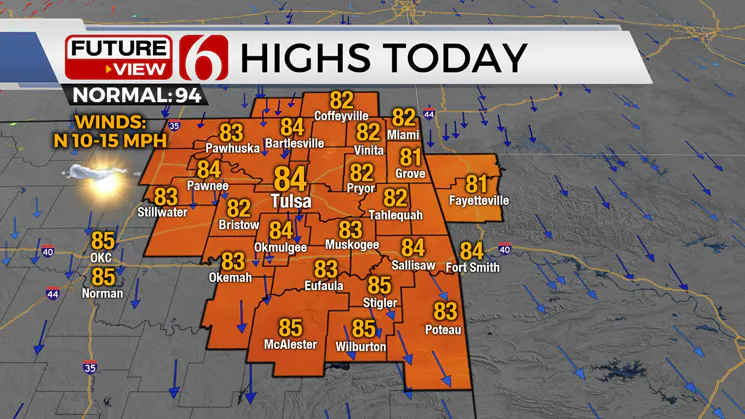
Pleasant weather is underway Tuesday morning as a surface ridge of high pressure builds northeast of Oklahoma keeping a light north wind under a mostly clear sky this morning. Drier air has moved into the region allowing overnight and morning lows dropping into the upper 50s and lower 60s. Afternoon highs will stay like yesterday with highs in the lower 80s east and mid 80s west.
 Image Provided By: News On 6
A few mid-level cumulus street clouds will be likely later this afternoon with the blue sky and sunshine mix. Wednesday morning maybe even cooler, especially in the valleys, where some lower to mid-50s may occur. Locations that received significant rainfall Sunday night may also see some early morning fog.
What's The Forecast For The Week
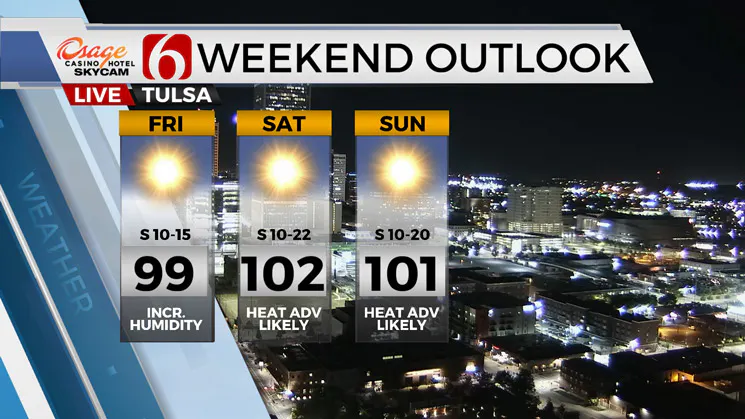
We'll reach the mid to upper 90s Thursday and Friday with triple-digit highs expected this weekend. Increasing southerly flow combined with local evapotranspiration will bring heat index values near heat advisory criteria, mostly Friday through the weekend for the northern part of the state. Some heat index issues return Thursday for southeastern Oklahoma.
The mid-level ridge is west of the state and will allow a northerly flow through Thursday morning. A weak, back-door-type wind shift may arrive late Thursday evening into Friday morning with little impact.
By Friday the ridge rapidly begins expanding eastward bringing the center over the state Friday and Saturday while continuing to expand into the upper Missouri Valley Sunday and Monday.
 Image Provided By: News On 6
This will keep the major storm systems away from the state through the foreseeable future. Some data suggest a weakness in the southern periphery of the ridge may allow an easterly wave from the Gulf coast region to reach the southern or central Texas region by the middle of next week.
This would spread some clouds nearby and take the edge off daytime highs a few degrees by the middle of next week. We should be dry, statewide, through the foreseeable future.
Thanks for reading the Tuesday morning weather update.
Enjoy the cooler weather Tuesday and Wednesday morning.
Have a super great day!
More Like This
August 15th, 2023
August 14th, 2023
August 4th, 2023
August 2nd, 2023
Top Headlines
May 3rd, 2025
May 3rd, 2025


