Mostly Pleasant Wednesday, Heat Returns Later This Week
The pattern will finally be more summerlike later this week into the weekend and for most of next week as a mid-level ridge of high pressure strengthens and expands across the central plains.Wednesday, July 21st 2021, 7:35 am
TULSA, Oklahoma -
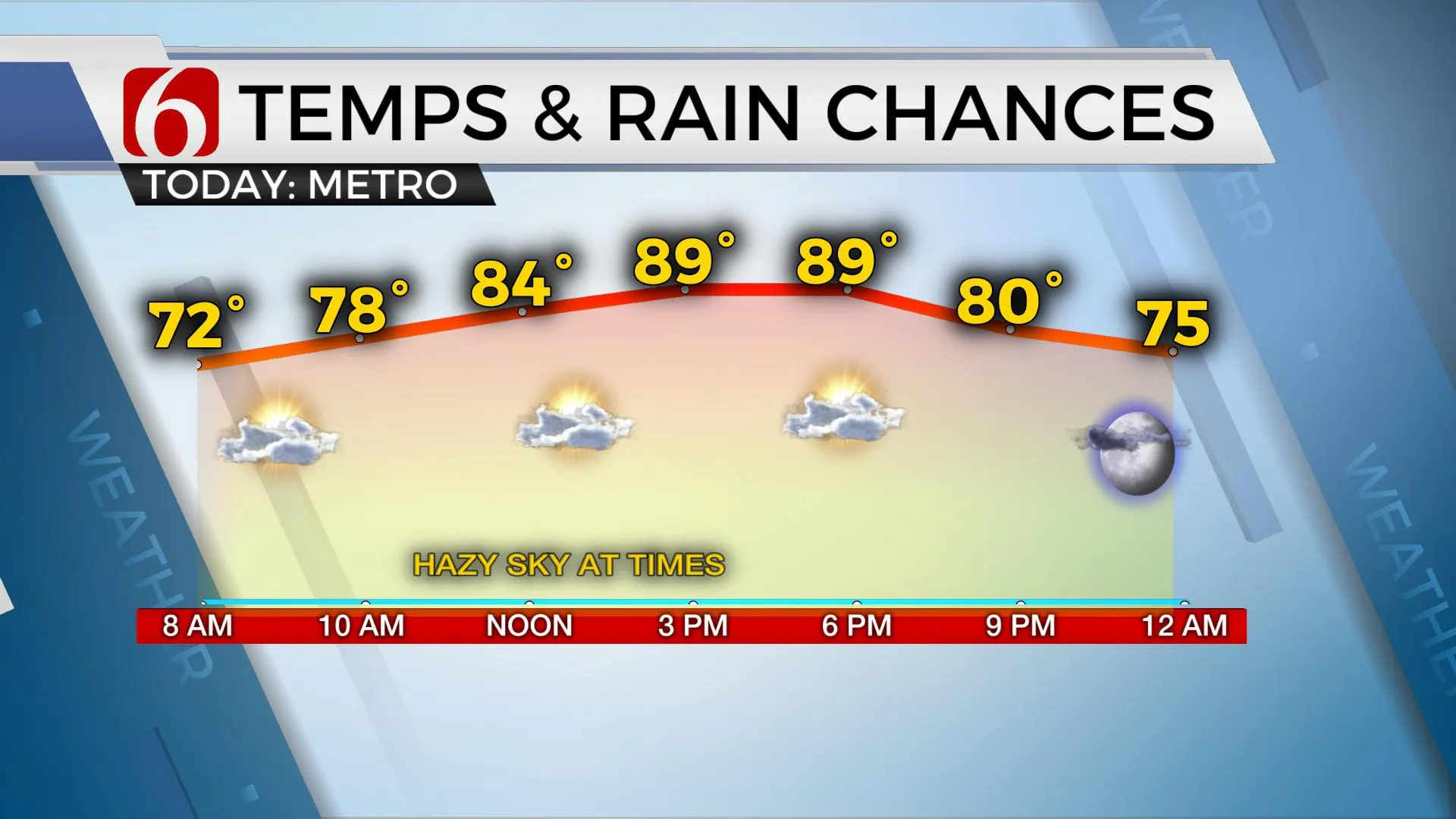
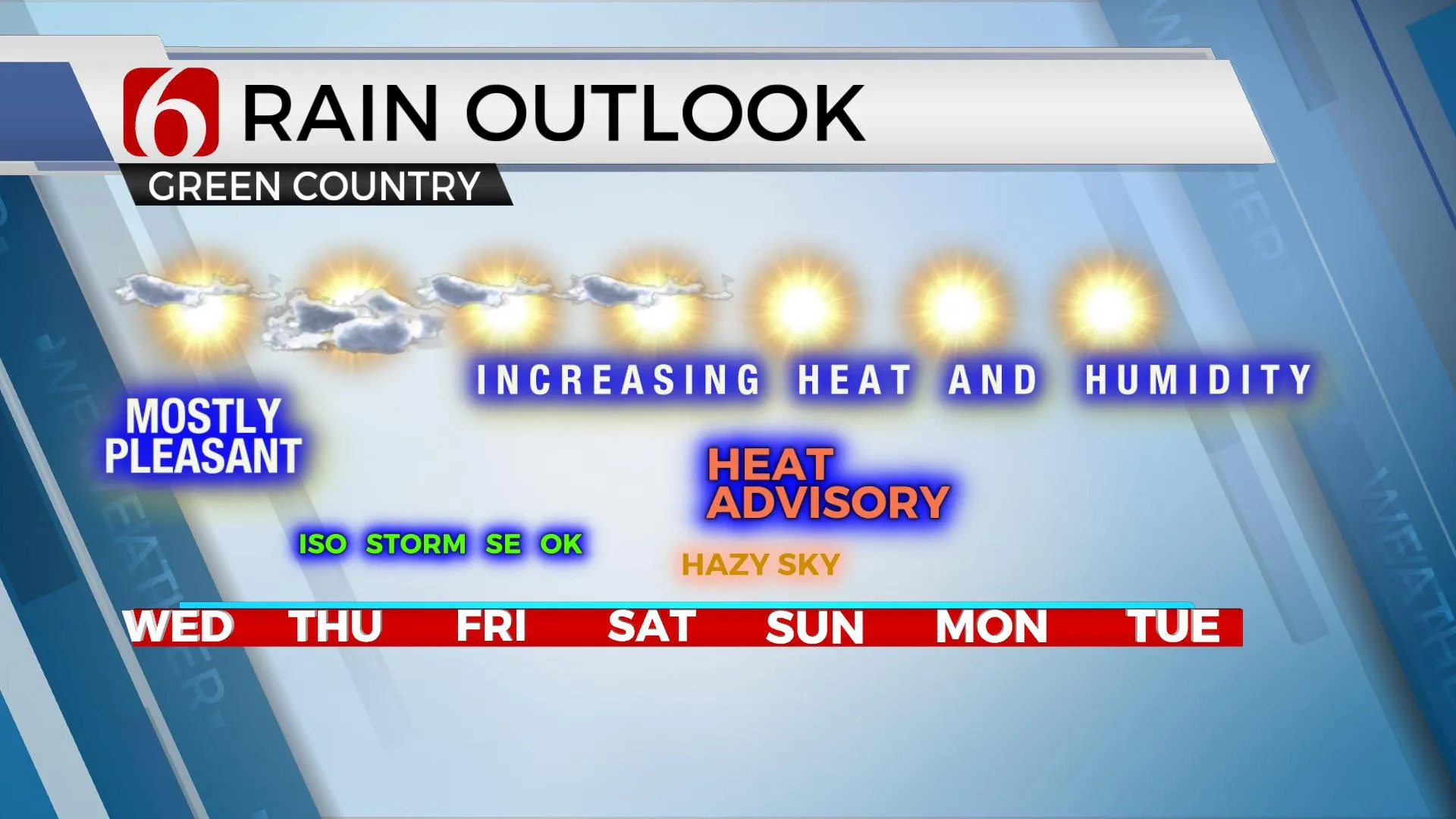
The pattern will finally be more summerlike later this week into the weekend and for most of next week as a mid-level ridge of high pressure strengthens and expands across the central plains. This eventually brings the heat and humidity back to the region, but we’ll continue with mostly pleasant weather today with morning lows in the 60s and highs nearing 90. Surface winds will remain from the east this morning as a weak trough is located across Arkansas into part of Texas. Winds will back from the southeast later today around 10 to 15 mph. This occurs in response to the change in the mid and upper levels as a weak and broad area of low pressure develops well to our northwest. A slow transport of low-level moisture will return from southeast Texas into the state by this weekend as the mid-level ridge centers up across the state. Before the ridge amplifies too much, a few isolated showers and storms will attempt to develop daily across extreme southeastern OK and western Arkansas, but the probabilities will remain highly isolated. The chance, even in these locations will remain near or less than 10%. Some data suggest Thursday may offer the best chance of one or two highly isolated showers across far eastern OK and western Arkansas. Some data suggests we may also have a few isolated showers or storms Monday on the northeastern periphery of the ridge.
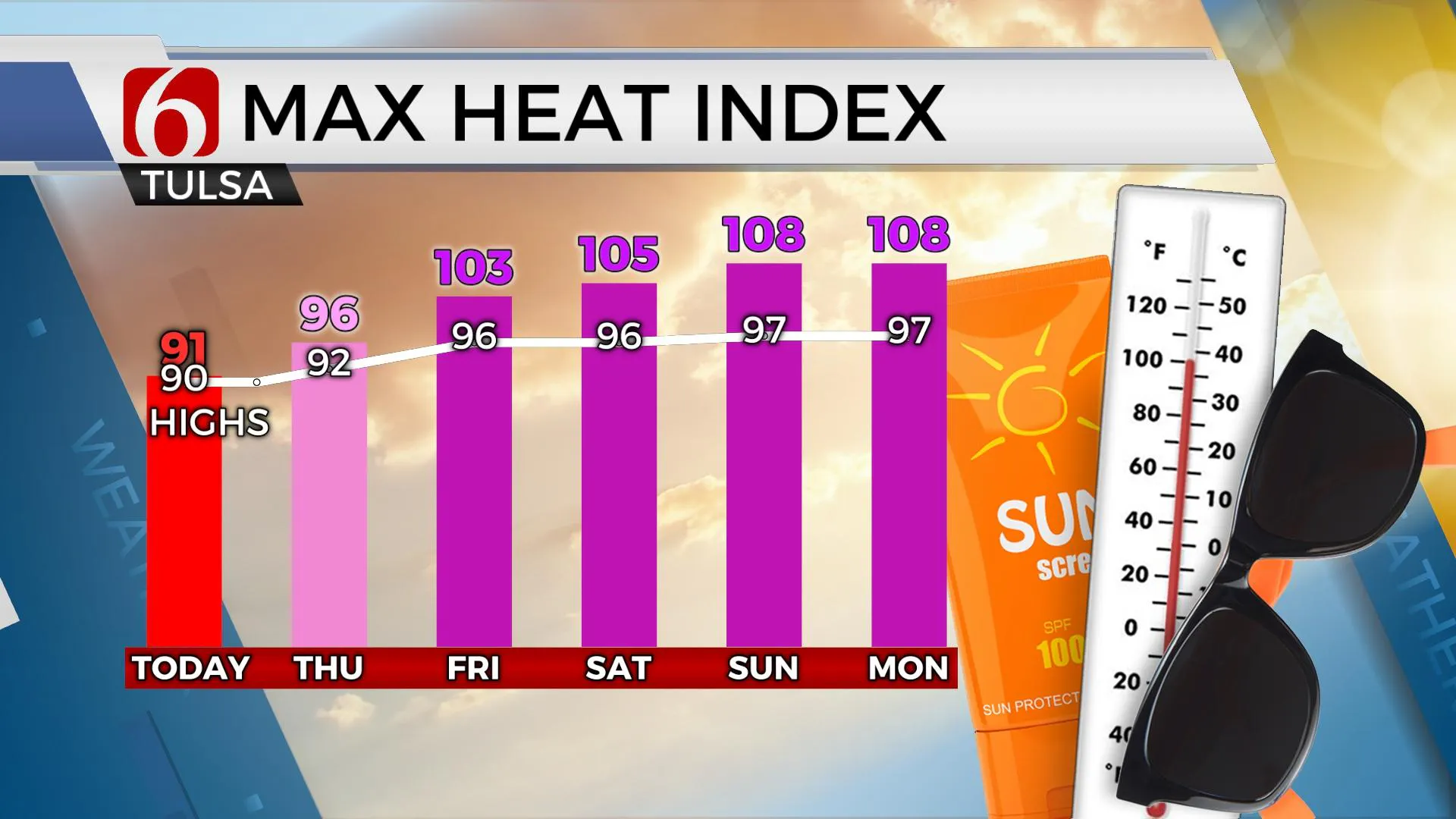
As the ridge grows, this brings sinking and compressing air into the region allowing daytime highs to climb into the mid-90s this weekend and into the upper 90s early next week. The green vegetation, combined with recent rainfall will keep the afternoon highs below 100 early next week, but the heat index values are expected from 105 to 110 beginning this weekend and continuing for a few days next week. These values should trigger heat advisories for a large portion of Eastern OK this weekend and for a few days next week before our atmosphere slowly dries out. As this occurs, daytime highs could reach slightly higher, nearing 100 by the 2nd half of next week. The mid-level ridge is expected to remain centered over the state for most of next week and this should keep organized storm chances void of the forecast. Again, locations on the periphery of the ridge will not be exempt from a few storms.
The upper air flow this weekend may also allow smoke in the mid and upper levels to the atmosphere currently across the northern high plains to drift southward, including a little hazy sky today due to the easterly component of the wind. Additionally, a plume of Saharan dust across the Atlantic and Caribbean may have a chance of sneaking up from the southeast this weekend.
Thanks for reading the Wednesday morning weather discussion and blog.
Have a super great day!
Alan Crone
KOTV
If you’re into podcasts, check out my daily weather update below. Search for NewsOn6 and ‘Weather Out The Door’ on most podcast providers, including Apple, Stitcher, Tune-In and down below on Spotify.


Alan Crone
An integral part of the News On 6 Weather Team since 2006, Alan Crone keeps Oklahomans safe and informed about morning weather each weekday on Six in the Morning. He’s always keeping an eye on the sky for both severe weather and just weather that’s going to make your day a bit more interesting.
More Like This
July 21st, 2021
November 30th, 2022
November 1st, 2022
August 26th, 2022
Top Headlines
May 15th, 2025
May 15th, 2025


