Another Chilly Day Ahead
The shallow arctic air mass will remain across Eastern OK for most of the day but will gradually begin moving northeast as another surface area low pressure develops to our northwest.Friday, January 7th 2022, 7:05 am
TULSA, Oklahoma -
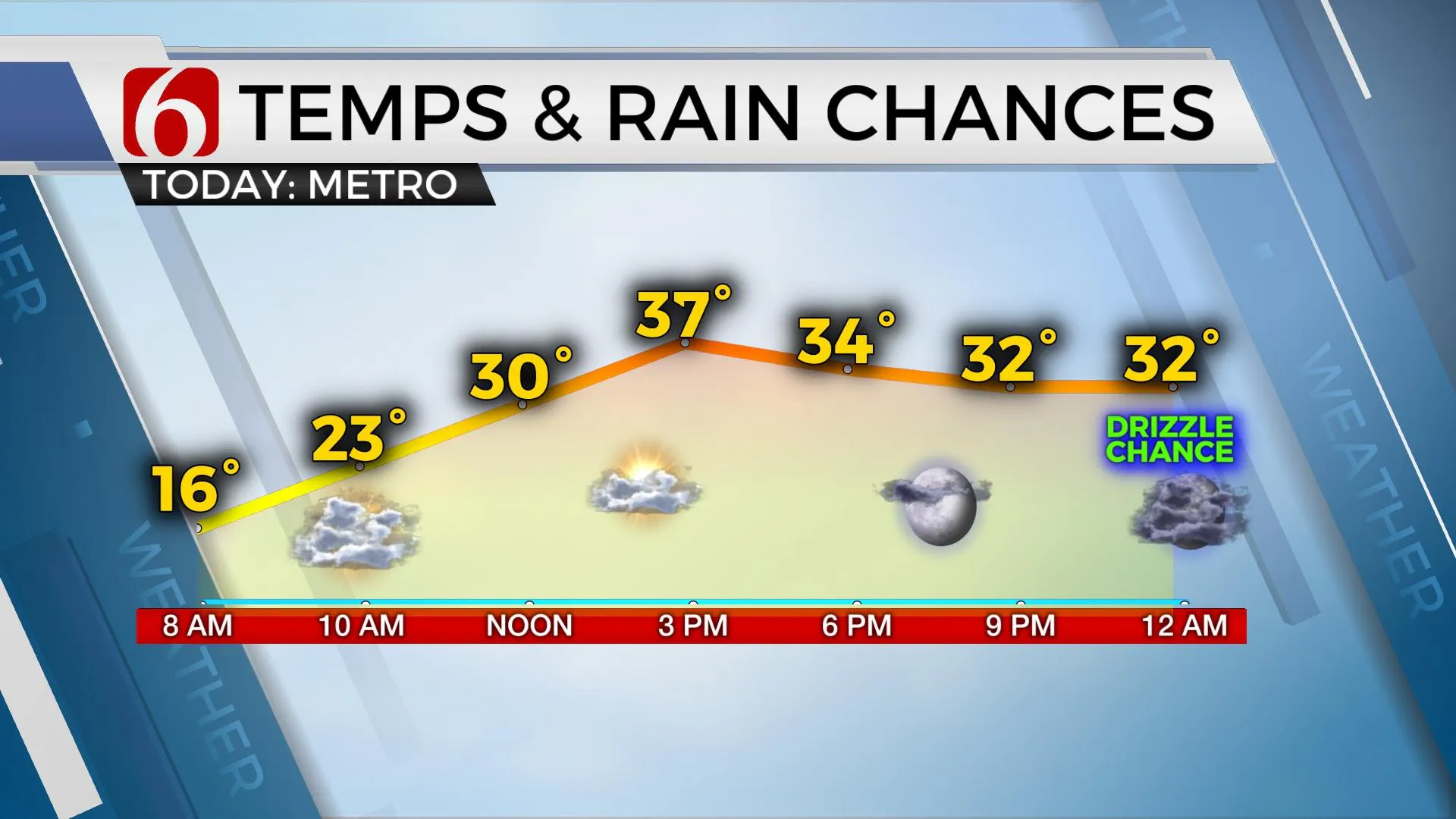
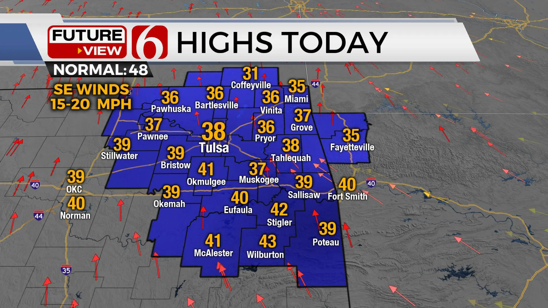
The shallow arctic air mass will remain across Eastern OK for most of the day but will gradually begin moving northeast as another surface area low pressure develops to our northwest. The falling pressure will bring southeast winds across the state today and Saturday with increasing temperatures Saturday. Highs today will reach the upper 30s and lower 40s north and mid 40s south. A sun-cloud mix is likely along with gusty southeast winds from 10 to 25 mph. Temps overnight will drop into the lower 30s, near freezing for a few hours before rising early Saturday morning.

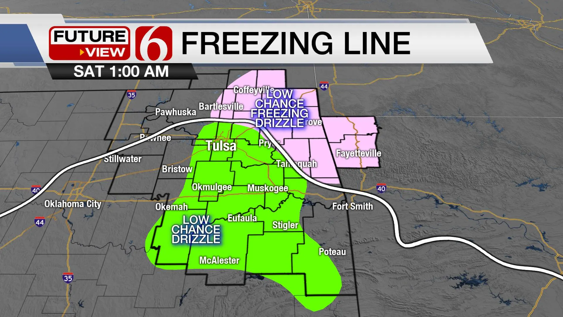
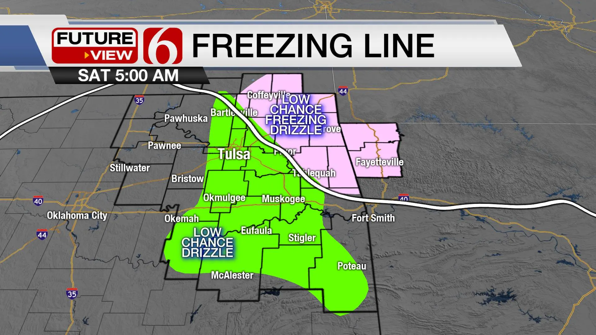
The next upper-level trough already positioned across the western U.S. will move eastward bringing yet another cold front across the state late Saturday night or early Sunday morning. The gusty south winds Saturday will advance low-level moisture from Texas into far southeastern OK bringing some spotty showers or thunder to extreme southeastern OK. We’ll have a chance of some spotty showers or pockets of drizzle Saturday morning to midday near the metro as low-level moisture attempts to surge northeast. Locations east of the metro may also see drizzle developing for a small period Saturday morning as temps remain near freezing. While this remains a low possibility, remain aware of this potential for slick spots on elevated surfaces early Saturday across far NE OK.

The max temp forecast for Saturday will remain tricky due to the different scenarios regarding cloud coverage. More clouds will keep the highs lower than currently advertised and more sun will bring us over the mark. I'll continue with a compromise approach with highs near 50 to 55. While these values will be much warmer than our current stretch of weather, the influence of clouds and gusty south winds will keep most of the region in the blustery category. Our friends across central to western OK will be warmer.

The next front moves across the region early Sunday with a few showers or pockets of drizzle across far southeastern OK followed by north winds and another chilly afternoon with temps remaining in the lower 40s north and mid-40s south. Clear sky and light winds start Monday into the lower 20s with near-normal readings Monday afternoon.

The southern stream is likely to bring a disturbance across Texas Thursday while providing rain chances across the southern two-thirds of the state during this period. The thermal profile would support the liquid variety for this system.
Thanks for reading the Friday morning weather discussion and blog.
Have a super great day!
Alan Crone
KOTV
If you’re into podcasts, check out my daily weather update below. Search for NewsOn6 and ‘Weather Out The Door’ on most podcast providers, including Apple, Stitcher, Tune-In and down below on Spotify.
More Like This
January 7th, 2022
February 14th, 2022
January 26th, 2022
January 25th, 2022
Top Headlines
May 11th, 2025
May 11th, 2025
May 11th, 2025


