Light Snow Possible For Parts Of Green Country
The mid-week cold continues for Green Country, as we track a storm system that brings some light snow into our area this evening and tonight.Wednesday, January 26th 2022, 10:44 am
TULSA, Oklahoma -
The mid-week cold continues for Green Country, as we track a storm system that brings some light snow into our area this evening and tonight.
Lighter winds return today as high pressure slides off to our east. We'll start off with some morning sun breaks before skies turn mostly cloudy again this afternoon. It'll be another chilly one with highs ranging from the mid-upper 30s in northeast Oklahoma the mid-40s in southeast Oklahoma.

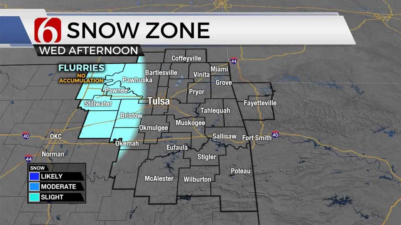
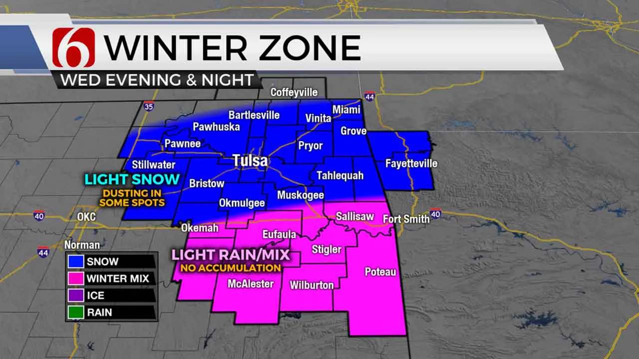
Snow will be spreading across western Oklahoma this afternoon and we could see a few flurries west of Tulsa this afternoon as well, but some very dry air at the surface will initially prevent most snow from reaching the ground during the daylight hours. Light snow will become a bit more common after sunset through the evening hours across northeastern Oklahoma, with a rain/snow mix in southeastern Oklahoma where temperatures will be a little warmer.
The system will continue to fight off dry air at the surface this evening, which will limit any sort of notable accumulation. But some spots in northeastern Oklahoma could see a dusting of snow accumulation tonight before the system departs the area early Thursday morning.

Seasonably chilly weather will stick with us through late week, with highs in the upper 40s Thursday into Friday. But right on cue, a big warming trend kicks in this weekend! Get ready for highs back in the lower 60s on Saturday!
I hope you have a great Wednesday, Green Country!
You can follow me on Twitter @StephenNehrenz as well as my Facebook page Meteorologist Stephen Nehrenz to stay up to date with the very latest.
More Like This
January 26th, 2022
February 14th, 2022
January 25th, 2022
January 7th, 2022
Top Headlines
April 20th, 2025
April 20th, 2025
April 20th, 2025


