Tracking More Rain & Storms Soon
Parts of Green Country could see showers on Wednesday.Wednesday, March 8th 2023, 6:11 am
If you’re into podcasts or in a rush, check out my daily weather update. Search for NewsOn6 and ‘Weather Out The Door’ on most podcast providers, including Spotify, Stitcher and Tune-In, or Click Here to listen on Apple Podcasts.
TULSA, Okla. - Parts of Green Country could see showers on Wednesday.
Here are the details from News On 6 Meteorologist Alan Crone:

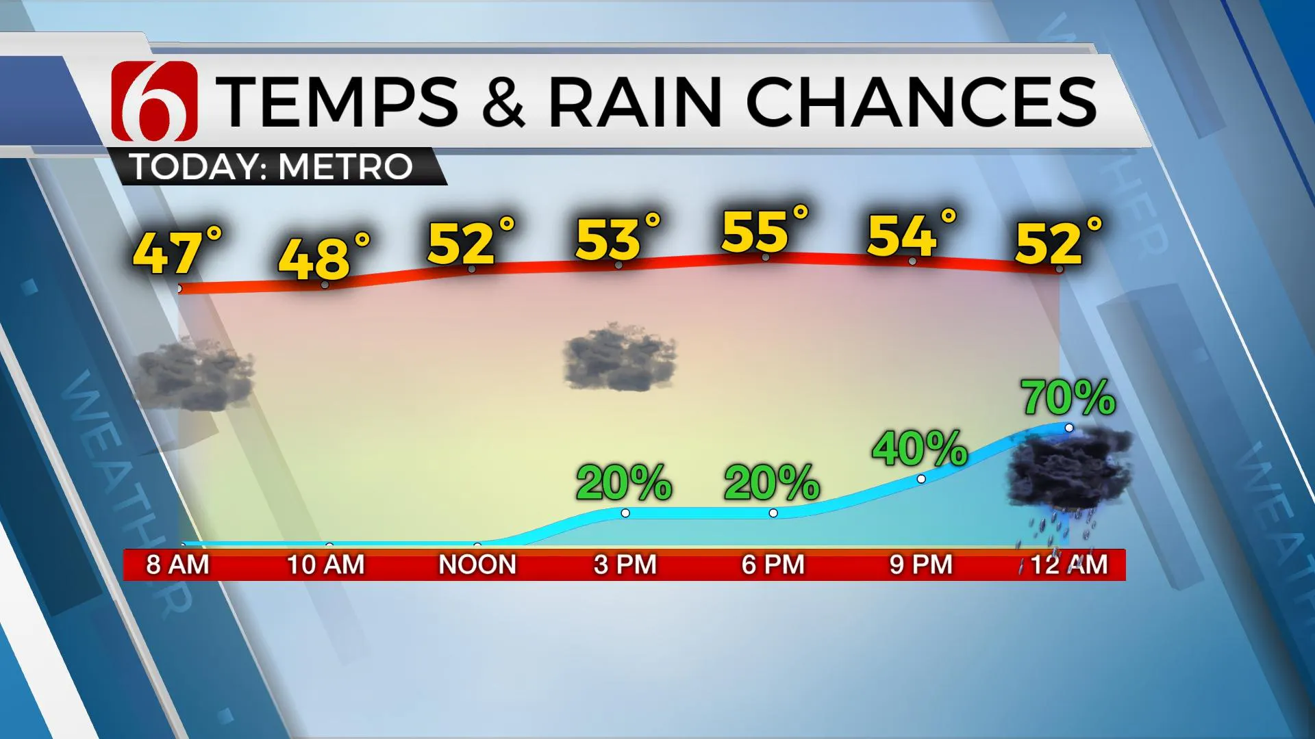
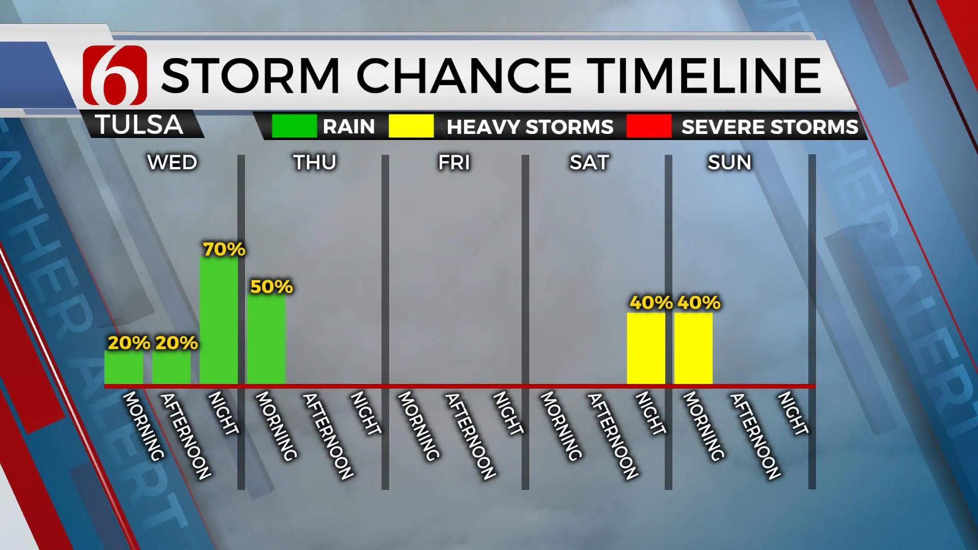
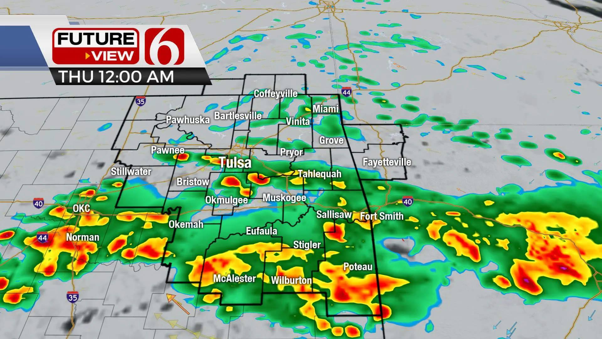
A weak boundary is located well south of the Tulsa metro with mostly upper 40s reported across the area on Wednesday morning along with north winds near 10 mph. Showers and storms that developed overnight will continue to quickly exit the Red River Valley on Wednesday morning. We’ll expect cloudy, cool, and damp weather on Wednesday with highs only in the mid-50s. A few spotty showers can’t be ruled out during the afternoon, but higher chances arriver later Wednesday night as the 2nd round of this current system brings additional scattered storms across part of the area. The main threat with any strong or severe storm activity Wednesday night and pre-dawn Thursday will be some hail located along those areas generally north of the highway 270 corridor to slightly southeast of the I-44 area. Once again, some locally heavy rainfall will be possible with some locations receiving between one to two inches of additional precipitation. As the main upper-level trough lifts away from the area early Thursday morning, clouds will begin clearing from the northwest to southeast. This will bring sunshine by Thursday midday to afternoon with highs rebounding into the lower 60s from the metro west and staying in the upper 50s along and east of highway 69. A second surge of cooler air will drive the front more south Thursday night with lows Friday morning dropping into the mid and upper 30s. Friday afternoon highs should also stay in the 50s with north winds at 10 to 20 mph.

The weekend features near normal temps Saturday before a minor cool-down Sunday, but also the return of more storm chances for a small window of time. A stronger upper-level system will be near the northern plains with a surface low developing Saturday across southeastern Colorado or the high plains of Texas and moving east across Oklahoma late Saturday evening into early Sunday morning. As this feature moves east, showers and storms will develop, some that could be strong and severe. We'll have more on this scenario on Thursday. Following the passage of the weekend system, we’ll experience a few days next week of cooler weather and north winds. Morning lows in the 30s will be followed by afternoon highs in the 50s. A stronger looking system should near the state by the latter half of next week.

Thanks for reading the Wednesday morning weather discussion and blog.
Have a super great day!
Alan Crone
KOTV
More Like This
March 8th, 2023
July 3rd, 2023
June 8th, 2023
June 6th, 2023
Top Headlines
April 22nd, 2025
April 22nd, 2025


