Winter Returns With A Cold, Blustery Tuesday And Even Some Light Wintry Precipitation
We’re in for some weather shell-shock as winter is abruptly returning to Green Country with a drastic drop in temperatures, some light wintry precipitation, and then a light freeze all on the way. A strong cold front will continue to surge south across eastern Oklahoma during the morning hours. You’ll want the big coat as you head out the door with temperatures falling into the 30s and stiff north winds dropping those wind chills down into the 20s! We’ll warm up very little from morning throughTuesday, April 20th 2021, 7:11 am
We’re in for some weather shell-shock as winter is abruptly returning to Green Country with a drastic drop in temperatures, some light wintry precipitation, and then a light freeze all on the way.
A strong cold front will continue to surge south across eastern Oklahoma during the morning hours. You’ll want the big coat as you head out the door with temperatures falling into the 30s and stiff north winds dropping those wind chills down into the 20s! We’ll warm up very little from morning through lunchtime – in fact, if anything, temperatures in some spots will continue to drop through the midday hours.

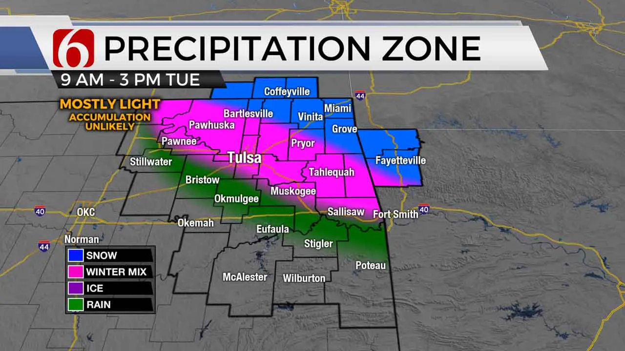
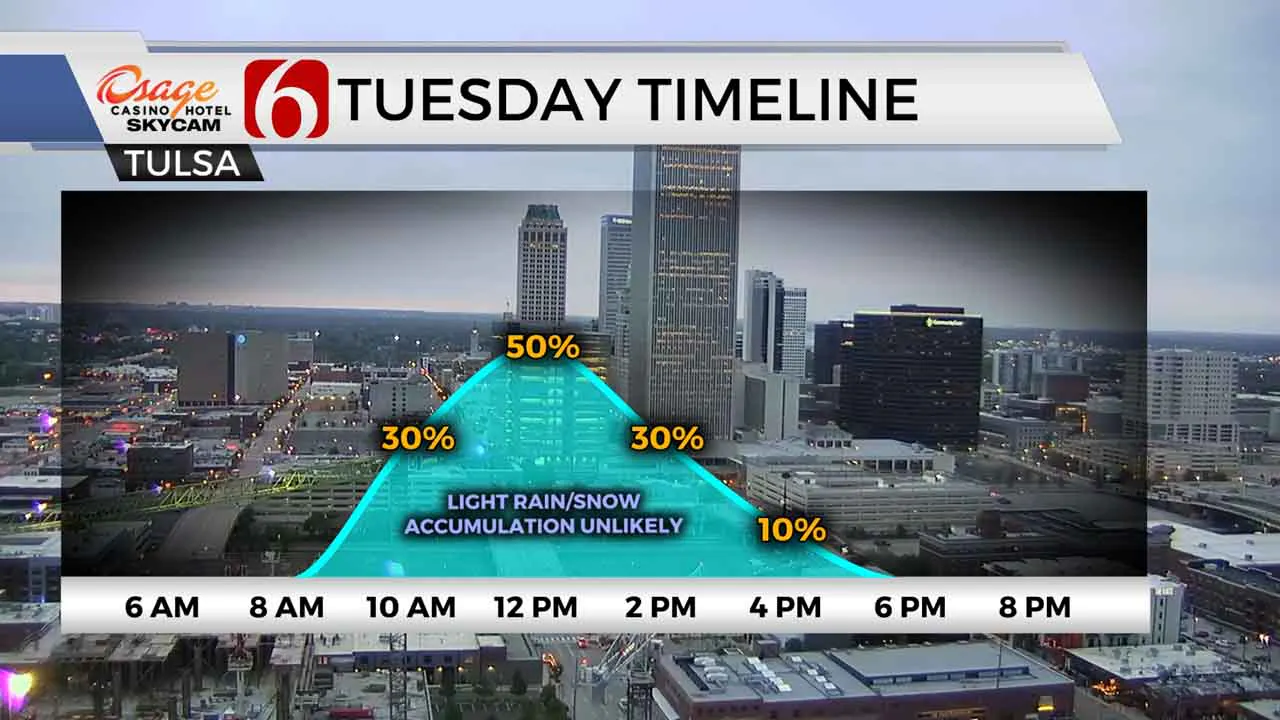
On top of that, a wave of mostly light precipitation will sweep across northeast Oklahoma and southeast Kansas from mid-morning through early afternoon. And yes, a changeover from light rain to a light wintry mix and even some light snow is expected, particularly north and east/northeast of Tulsa. Even the Tulsa metro could see a brief mix or brief snowflakes during the late morning and lunchtime hours. In most spots, this will be a brief 1-to-3-hour window for precipitation.

Ground temperatures remain warm so any snow accumulation on most surfaces is still unlikely, but a few areas north of Highway 412 and east of Highway 69 could see a very brief, minor dusting on grassy surfaces from late morning into early afternoon. If that occurred (and it’s a big if), it would melt quickly. Areas that are still seeing light precip during the afternoon will have temperatures holding in the 30s, while areas near and west of Tulsa will have afternoon temperatures bounce back into the 40s. Talk about a massive change from the t-shirt weather we had Monday!
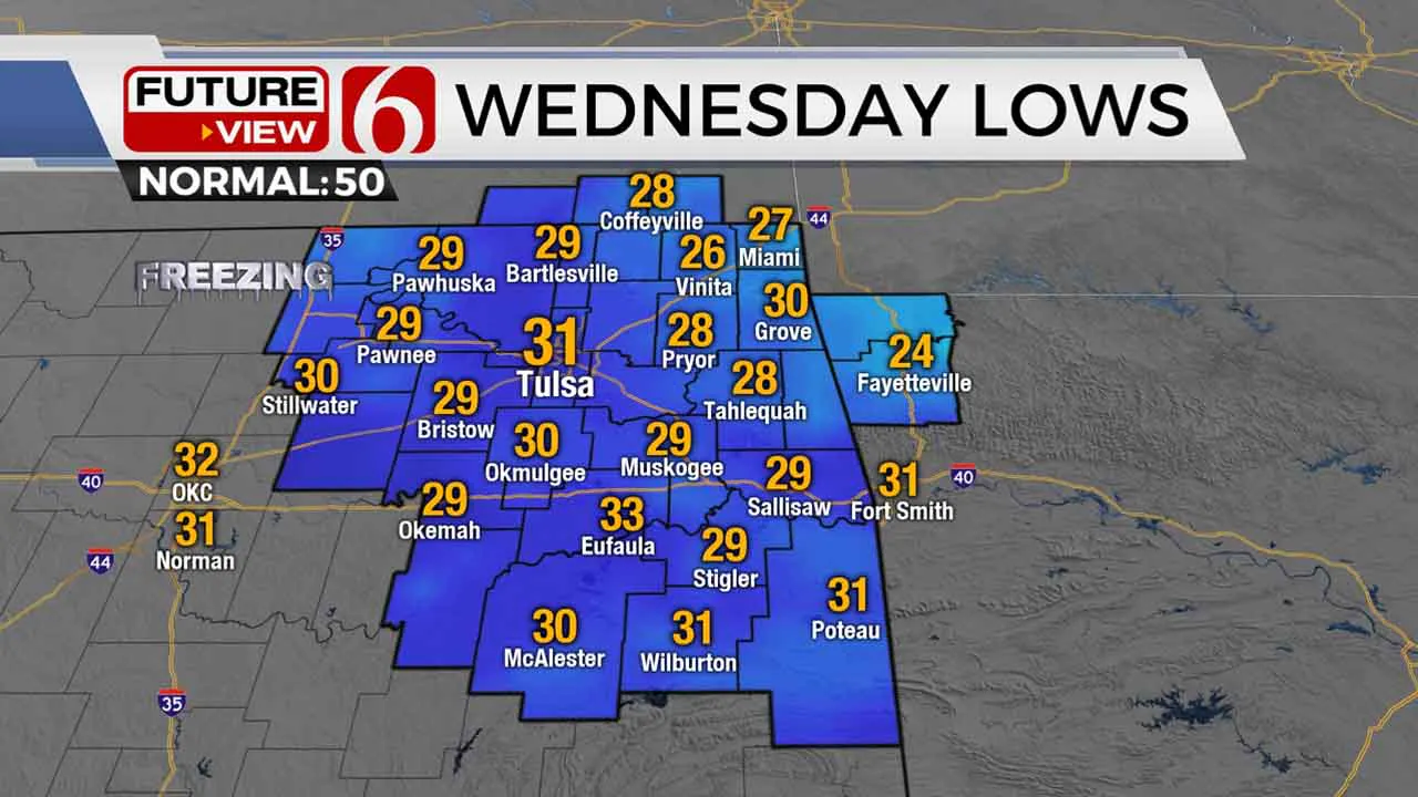
Conditions are still primed for a freeze areawide late tonight into Wednesday morning, so prepare now to cover up your tender plants or to bring inside the ones you can. Lows anywhere from 27-31 degrees are expected across Green Country by early Wednesday morning. Areas north and east of Tulsa could spend several hours below freezing, which would obviously be harmful to that tender vegetation. Plan ahead!

Wednesday will be a cool but calmer day with much lighter winds. Temperatures will remain well below normal with highs in the upper 50s to around 60. Cooler than normal conditions will persist into Thursday and Friday as well, with additional chances for showers and perhaps a few storms returning at the end of the week.
I hope you have a great Tuesday, Green Country! Stay safe! You can also follow me on Twitter @StephenNehrenz as well as my Facebook page Meteorologist Stephen Nehrenz to stay up to date with the very latest.
More Like This
April 20th, 2021
February 14th, 2022
January 26th, 2022
January 25th, 2022
Top Headlines
December 11th, 2024
December 11th, 2024
December 11th, 2024
December 11th, 2024


